Ljubljanica - Kugelč (Šentjošt above Horjul) (longer path)
Starting point: Ljubljanica (521 m)
| Latitude/Longitude: | 46,03170°N 14,24080°E |
| |
Route name: longer path
Walking time: 45 min
Difficulty: easy marked way, easy pathless terrain
Elevation gain: 145 m
Elevation difference along the route: 175 m
Map: Škofjeloško in Cerkljansko hribovje 1:50.000
Recommended equipment (summer):
Recommended equipment (winter):
Views: 4.777
 | 1 person like this post |
Access to starting point:
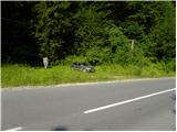
First, we drive to Horjul (from Dobrova near Ljubljana or Vrhnika to here), then we continue driving towards Vrzdenec, Šentjošt and Gorenja vas. At Vrzdenec the road starts to ascend more steeply, then a little further it brings us to a hairpin bend, in the middle of which a road branches off to the left towards Šentjošt and Smrečje. We continue right on the main road, and it soon brings us to a small saddle, at the end of which a road branches off to the right towards the village Samotorica. Because there are no appropriate parking spots on the saddle, we descend along the road another good 100 m, then on the left we notice the NOB monument, by which we park.
We can also reach the starting point from the direction of Gorenja vas and Polhov Gradec. In this case, at the hamlet Ljubljanica we continue in the direction of Horjul. We park at the previously mentioned monument, which is located approximately 200 m above the crossroad in Ljubljanica.
Route description:
From the monument we continue on the ascending road, which quickly brings us to a crossroad, where an asphalt road branches off to the left towards the village Samotorica.
On the right side of the crossroad, we notice mountain signposts for Šentjošt, Smrečje, Kožljek, Koreno, Butajnova and Setnik. We head slightly right onto the path in the direction of Šentjošt and Smrečje and continue on a gentle cart track which leads to the nearby log cabin. Approximately 50 m before the mentioned log cabin, we leave the cart track and continue left, then ascend further over a grassy meadow. Higher the "path" brings us to a grassy cart track, which, while crossing grassy meadows, after a few minutes brings us into the forest. In the forest the blazes are more frequent, and the path is entirely overgrown in some places. We follow this path, which mostly ascends gently, all the way to the chapel, where we step onto the asphalt road. The road ahead moderately ascends over a grassy slope, then we come to a smaller crossroad, where we continue left. A short descent follows and from the right a slightly shorter path joins us (option of a circular path).
Just a few meters further we leave the road, and we continue on a gentle marked cart track, which gradually transitions to panoramic grassy meadows. During the ascent over the grassy meadows the path starts to disappear, and we continue slightly right towards the houses which we see on our right. To the mentioned houses only a short descent follows, then we continue on the asphalt road which past the kindergarten brings us to the center of the village Šentjošt nad Horjulom.
We continue in the direction of Smrečje, and we follow the road to the chapels of St. Jošt and St. Janez. Behind both chapels we come to the foot of the grassy peak Kugelč, where we also notice the start of the ski lift on the mentioned hill. At the ski lift we leave the road and ascend to the mentioned peak in a few minutes over easier pathless terrain.

Along the route: Šentjošt nad Horjulom (623m)
Photos:
 1
1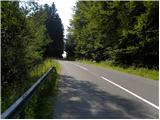 2
2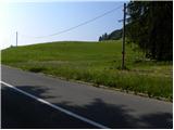 3
3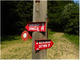 4
4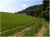 5
5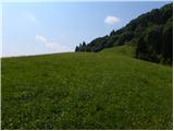 6
6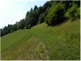 7
7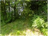 8
8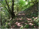 9
9 10
10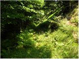 11
11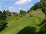 12
12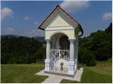 13
13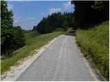 14
14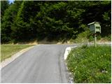 15
15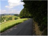 16
16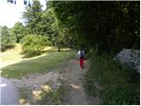 17
17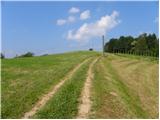 18
18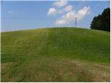 19
19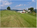 20
20 21
21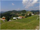 22
22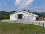 23
23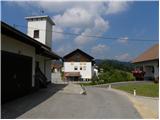 24
24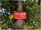 25
25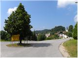 26
26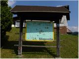 27
27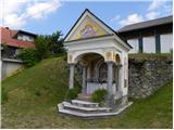 28
28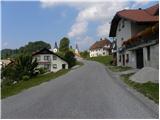 29
29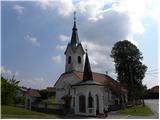 30
30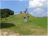 31
31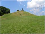 32
32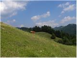 33
33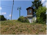 34
34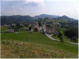 35
35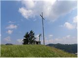 36
36 37
37
Discussion about the trip Ljubljanica - Kugelč (Šentjošt above Horjul) (longer path)
To post a comment you must log in:
If you do not yet have a username, you must first
register.