Log pri Brezovici - Strmca
Starting point: Log pri Brezovici (298 m)
Walking time: 1 h
Difficulty: easy marked way
Elevation gain: 174 m
Elevation difference along the route: 215 m
Map: Ljubljana - okolica 1:50.000
Recommended equipment (summer):
Recommended equipment (winter):
Views: 5.400
 | 1 person like this post |
Access to starting point:
A) From the highway Ljubljana - Koper, we take the exit Brezovica, then continue driving on the parallel old road towards Vrhnika. After 6.5 km of driving, from the spot when we got on the old road, we turn right onto a local road. Already after a few meters, we arrive at a crossroads, where we continue left on the road, which continues along the edge of the forest. Here we will soon notice a smaller space on the right side, where we can leave the car.
B) From the highway Koper - Ljubljana, we take the exit Vrhnika, then continue driving on the parallel old road towards Ljubljana. After 6.5 km of driving, from the spot when we got on the old road, we turn left onto a local road. Already after a few meters, we arrive at a crossroads, where we continue left on the road, which continues along the edge of the forest. Here we will soon notice a smaller space on the right side, where we can leave the car.
Route description:
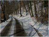
From the road where we have parked, a marked cart track branches off to the right, which first ascends parallel to the road, then turns right and after a few meters of further walking brings us to the spot where the blazes direct us right onto a steep footpath. Further, we ascend in the opposite direction to the Cankarjeva pot - CP (Cankarjeva pot starts on Cankarjev vrh - Rožnik and ends in Vrhnika).
The initially steep path quickly flattens, then joins one of the numerous cart tracks. Since the path ahead is crisscrossed with numerous small paths and cart tracks, we carefully follow the blazes, which higher up bring us to a macadam road, along which we quickly ascend below the meadows of the Ferjanka homestead. Here the road turns left and gradually turns into a wide cart track. When the path descends for a few meters, the path from Dragomer joins from the right, and we continue straight ahead along the occasionally again somewhat steeper path. Higher up, the path to Debeli hrib also branches off to the right, but we continue straight and after a minute of further walking arrive at the forested summit of Strmca.

Along the route: Ferjanka (400m)
Photos:
 1
1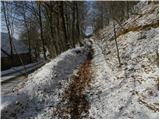 2
2 3
3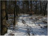 4
4 5
5 6
6 7
7 8
8 9
9 10
10 11
11 12
12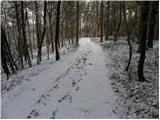 13
13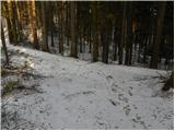 14
14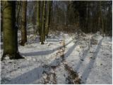 15
15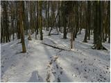 16
16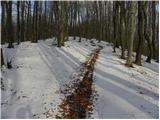 17
17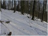 18
18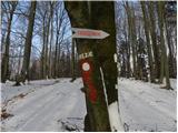 19
19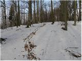 20
20 21
21 22
22
Discussion about the trip Log pri Brezovici - Strmca
To post a comment you must log in:
If you do not yet have a username, you must first
register.