Lokavec - Koča Antona Bavčerja na Čavnu
Starting point: Lokavec (170 m)
| Latitude/Longitude: | 45,90200°N 13,88130°E |
| |
Walking time: 2 h 30 min
Difficulty: easy marked way
Elevation gain: 1072 m
Elevation difference along the route: 1072 m
Map: Goriška 1:50.000
Recommended equipment (summer):
Recommended equipment (winter): ice axe, crampons
Views: 29.408
 | 5 people like this post |
Access to starting point:
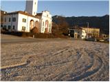
We drive on the highway from Razdrto towards Nova Gorica or vice versa and go to the exit Ajdovščina. Then at the crossroad, we turn left in the direction of Nova Gorica and drive to the village Cesta, where a sign for Lokavec points us to the right. We follow this road to a larger parking lot at the church in the village Lokavec, where there are also signposts for Čaven.
Route description:
From the parking lot, we continue on the road in the direction of Čaven. The road, which gently ascends among houses, soon brings us to the smaller crossroad near the small stream. Here we continue on the left road and left side of the stream, which at the end of the village brings us to a cart track on which we then ascend. Further, we follow the cart track which slowly turns into a footpath. The path after a time crosses a rough forest road and soon after that, it brings us to the path junction, where we continue straight in the direction of Čaven. The path then brings us to a spring and then for a few dozen steps steeply ascends. The path ahead brings us on unvegetated slopes from which a nice view opens up on Nanos, Vipava valley and surrounding hills. A little further, the path again crosses a rough forest road and for a short time ascends parallel with it. Just a little ahead we come on a wider road which we follow to the right but only a few steps, and then blazes point us to the left upwards. The path ahead starts ascending steeper and a little higher crosses the marked path. Here we continue straight upwards on the path which is becoming very steep. A little further, the path which was most of the time running through the forest again crosses some panoramic slopes. A little further, the path brings us to a ridge, where we have two options to continue. The left one runs a little below the ridge and has less view than the one that runs on a ridge but it is better in case of a strong bora. After 10 minutes both paths join and they bring us on grassy slopes east from Mala gora.
Here the steepness decreases and the path ahead continues on nice meadows, where in spring and summer time we notice a lot of mountain flowers. A little further the path from Stomaž joins from the left. Here we continue straight on the path which in a few minutes brings us to the mountain hut Koča na Čavnu.

Photos:
 1
1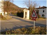 2
2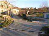 3
3 4
4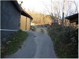 5
5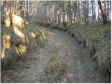 6
6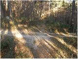 7
7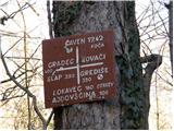 8
8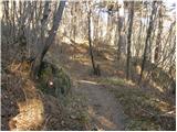 9
9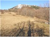 10
10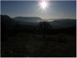 11
11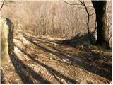 12
12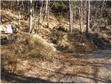 13
13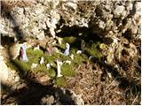 14
14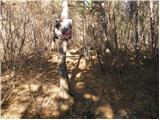 15
15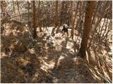 16
16 17
17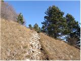 18
18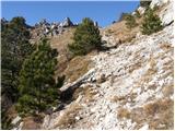 19
19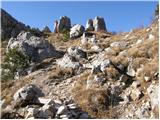 20
20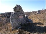 21
21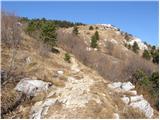 22
22 23
23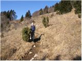 24
24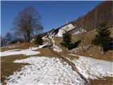 25
25
Discussion about the trip Lokavec - Koča Antona Bavčerja na Čavnu
|
| Gost2. 01. 2008 |
Super trip, worth extending to the nearby Kucelj, which offers excellent views. However, the tour is quite demanding as over 1000m of elevation gain is required.
|
|
|
|
| Gost2. 01. 2008 |
Excellent trip, with a beautiful view of Vipavska dolina and Tržaški zaliv right at hand.
|
|
|
|
| Gost21. 01. 2008 |
Yesterday went to Čaven - following the above recommendation we extended it to Kucelj. Up top the sun was shining brightly. It was really hot. The view was phenomenal. We didn't see the sea (shame), but we saw a sea of fog and Nanos, Vremščica..., which were peeking out nicely. From Kuclj the view was fantastic. Can someone tell me which mountains are visible over there... Are they really the Dolomites?
In short... Highly recommend.
Greetings.
|
|
|
|
| Gost5. 02. 2008 |
I too like to visit warm Primorska in these winter days. But it has happened to me that I went up in spring gear (mid-March), when it was already summer-like 20 degrees in the valley, but up top I was wading through a 1m thick snow blanket.
|
|
|
|
| klavdipo12. 04. 2009 |
I'd like info if there's still any snow on Čavn at all?
|
|
|
|
| tom66613. 04. 2009 |
I think there's no more, only in some gully might find some. On Javornik above Črni vrh yesterday no snow.
|
|
|
|
| klavdipo13. 04. 2009 |
Thanks! Checked today, there is no more snow on the entire path from Kamenje and Predmeja.
|
|
|
|
| Damy2513. 12. 2009 |
today I was at the hut great weather just a bit windy
|
|
|
|
| pelican23. 10. 2010 |
What's the situation up there?
Is the hut open?
|
|
|
|
| VanSims23. 10. 2010 |
It was open last Saturday.
|
|
|
To post a comment you must log in:
If you do not yet have a username, you must first
register.