Starting point: Loke (380 m)
| Latitude/Longitude: | 46,21390°N 15,00770°E |
| |
Walking time: 2 h 25 min
Difficulty: easy unmarked way
Elevation gain: 752 m
Elevation difference along the route: 830 m
Map: Posavsko hribovje - zahodni del 1:50.000
Recommended equipment (summer):
Recommended equipment (winter): ice axe, crampons
Views: 3.464
 | 1 person like this post |
Access to starting point:
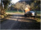
A) From the Ljubljana - Maribor highway we take the Vransko exit and continue driving on the parallel old road towards Celje. We drive a few kilometers on the main road, then signs for Tabor and Ojstriška vas direct us to the right. Further, we drive through Ojstriška vas to the settlement Tabor, and from there we continue in the direction of the village Loke. In Loke we come to a crossroad, where we continue left in the direction of the cottage Zajčeva koča (straight Krvavica) on the road which soon brings us to the next crossroad. Here we continue right in the direction of "Zajčeva koča - peš pot" (footpath) (straight - Zajčeva koča on the road) on the road which crosses a bridge and then on the other side of the meadow brings us to a smaller parking lot by the road.
B) From the Maribor - Ljubljana highway we take the Šentrupert exit, then we continue driving on the parallel old road towards Trojane. We drive a few kilometers on the main road, then signs for Tabor and Ojstriška vas direct us to the left. Further, we drive through Ojstriška vas to the settlement Tabor, and from there we continue in the direction of the village Loke. In Loke we come to a crossroad, where we continue left in the direction of the cottage Zajčeva koča (straight Krvavica) on the road which soon brings us to the next crossroad. Here we continue right in the direction of "Zajčeva koča - peš pot" (footpath) (straight - Zajčeva koča on the road) on the road which crosses a bridge and then on the other side of the meadow brings us to a smaller parking lot by the road.
Route description:
Near the parking lot, we leave the road and continue the ascent on a cart track which branches off to the left from the road. The cart track after a few meters of walking descends to a stream, crosses it and on the other side changes into a steep footpath which higher ascends parallel with another cart track. The path which runs through the forest brings us higher to a partly overgrown clearing, behind which it turns slightly to the right and brings us to a decaying house.
Here we continue on the right side of the house on a cart track which is diagonally ascending (this part of the path is poorly marked) and a little higher makes a left turn. A moderately steep cart track then slowly turns right and higher brings us to meadows above which we cross a bad forest road.
We continue on a poorly marked cart track which eventually starts descending and then joins the macadam road, which we follow to the right to the next crossroad. At the crossroad which is situated in the middle of the turn, we continue and the road after approximately 100 meters of additional walking brings us to the spot where right downwards a worse forest road branches off towards the cottage Zajčeva koča.
Here we continue straight in the direction of "Vrhe" and still continue the ascent on the road. A little higher the path brings us to the chapel, where we go straight, and we continue on the road which further leads past the farm Krvavičnik. A little above the farm we arrive at the next crossroad, where we continue sharply left. The path ahead leads us across a panoramic grassy slope, then the road brings us to the next crossroad, where we step onto an asphalt road. We follow the road to the right, and it gradually passes to the other side of the peak Kisovec. Further, we ascend diagonally through the forest for a short time, then past a few houses and with a view of the nearby Javor we walk to the mountain hut Planinski dom Vrhe.
From the mountain hut we first walk to the nearby church of St. Lenart and a little further to the crossroad at the NOB monument. Here we continue on the right road in the direction of Sveta planina / Partizanski vrh, and we walk on the road only about 10 steps, then on the left side we notice an unmarked cart track which first ascends parallel with the road, then turns to the left and after a few minutes of additional walking brings us out of the forest. The cart track then ascends diagonally across the former ski slope, and we immediately leave it and continue the ascent to the right along the edge of the forest relatively steeply upwards. Higher we reach another cart track, which we follow to the right into the forest. The cart track soon turns to the left and quickly returns to the area where there used to be a ski slope. Through bushes we ascend to the top of the old ski lift, from where the last view opens up, and the path then enters the forest, through which we ascend on a steep footpath to the top.

Photos:
 1
1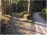 2
2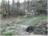 3
3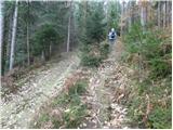 4
4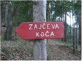 5
5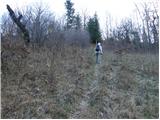 6
6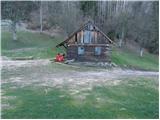 7
7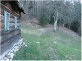 8
8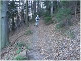 9
9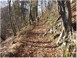 10
10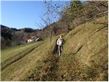 11
11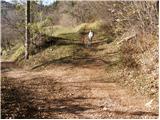 12
12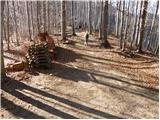 13
13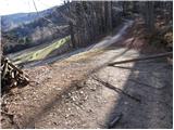 14
14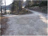 15
15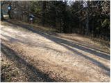 16
16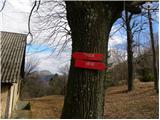 17
17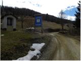 18
18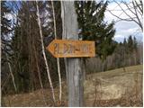 19
19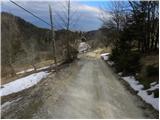 20
20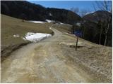 21
21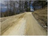 22
22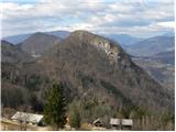 23
23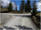 24
24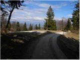 25
25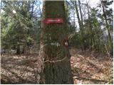 26
26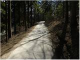 27
27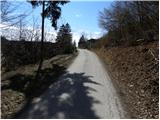 28
28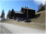 29
29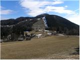 30
30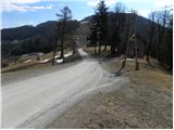 31
31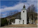 32
32 33
33 34
34 35
35 36
36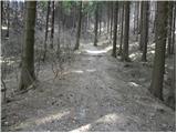 37
37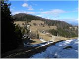 38
38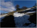 39
39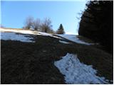 40
40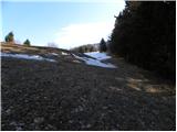 41
41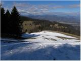 42
42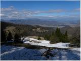 43
43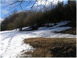 44
44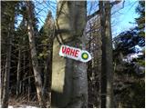 45
45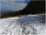 46
46 47
47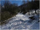 48
48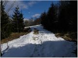 49
49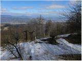 50
50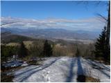 51
51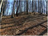 52
52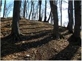 53
53 54
54
Discussion about the trip Loke - Javor
|
| Klemen Zorenč22. 03. 2012 |
"The path through the forest leads us higher to a partially overgrown clearing, behind which it turns slightly right and brings us to a collapsing house.
Here we continue on the right side of the house along the cart track, which ascends transversely (this part of the path is poorly marked) and a bit higher makes a left turn" This part of the description is no longer quite accurate as the path has been slightly relocated at the request of the landowner. The path runs across the meadow under the newly built house and auxiliary buildings, under which it turns back into the forest along the "new" forest road
|
|
|
To post a comment you must log in:
If you do not yet have a username, you must first
register.