Loke - Sveta planina (Partizanski vrh) (via Krvavica)
Starting point: Loke (400 m)
| Latitude/Longitude: | 46,20720°N 14,99130°E |
| |
Route name: via Krvavica
Walking time: 3 h 5 min
Difficulty: partly demanding marked way
Elevation gain: 611 m
Elevation difference along the route: 725 m
Map: Posavsko hribovje - zahodni del 1:50.000
Recommended equipment (summer): helmet
Recommended equipment (winter): helmet, ice axe, crampons
Views: 3.702
 | 1 person like this post |
Access to starting point:
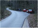
A) From the highway Ljubljana - Maribor, we take the exit Vransko and continue driving on the parallel old road towards Celje. We drive a few kilometers on the main road, and then signs for Tabor and Ojstriška vas direct us to the right. Further, we drive through Ojstriška vas to the settlement Tabor, and from there we continue in the direction of the village Loke. In Loke, we come to a crossroad, where we continue straight (left - Zajčeva koča) and follow the road to the next crossroad, which is situated after the village Loke. Here we continue straight (slightly left) in the direction of "Presedle" and follow the road to the parking lot on the right side of the road, by which we notice signposts for Krvavica.
B) From the highway Maribor - Ljubljana, we take the exit Šentrupert, and then we continue driving on the parallel old road towards Trojane. We drive a few kilometers on the main road, and then signs for Tabor and Ojstriška vas direct us to the left. Further, we drive through Ojstriška vas to the settlement Tabor, and from there we continue in the direction of the village Loke. In Loke, we come to a crossroad, where we continue straight (left - Zajčeva koča) and follow the road to the next crossroad, which is situated after the village Loke. Here we continue straight (slightly left) in the direction of "Presedle" and follow the road to the parking lot on the right side of the road, by which we notice signposts for Krvavica.
Route description:
From the parking lot, we cross the road and head onto the marked path in the direction of Krvavica. The path already at the very beginning goes into the forest and starts to ascend relatively steeply. Higher up, the steepness eases a little and the path at the notification sign (walk on the path because of the nesting of rare bird species) turns sharply left. The path further again starts to ascend steeply and after a few minutes of additional walking brings us to an indistinct side ridge, where it turns to the right. We continue ascending through the forest on the path, which higher brings us to a very steep slope. The steepness for a short time eases, as the path leads us along an exposed and often muddy ledge. Next follows a steep ascent on a grassy slope overgrown by sparse forest. At the top of this steep section, which is dangerous for slipping when wet, the path brings us to a natural window through which a secured mountain path runs. With the help of pegs and a steel cable, we ascend to the top of the window, after which follows some 10 steps of walking on a steep grassy slope. The steepness then eases and the path, which continues through the forest, soon brings us to the summit of Krvavica.
From the top of Krvavica, we start steeply descending a slightly exposed slope, then the path brings us below the cliffs, from which a beautiful view opens up. The path then enters the forest and descends to the nearby forest road, which we only cross (left - Zajčeva koča, right - Presedlje saddle and Loke village). We continue the ascent on an initially wide cart track, but further on a somewhat steeper path we arrive at the road, which we follow to the right. Further, we ascend diagonally across a panoramic slope, and the road after a few minutes brings us to a smaller crossroad, where we join the path from Čemšeniška planina.
Here we continue left in the direction of Sveta planina and then after a few meters again left to the yard of the Gunet homestead. Here, immediately behind the house, we turn left and through a short stretch of forest ascend to a panoramic grassy slope. From the path, which ascends diagonally to the right, a nice view opens up on Čemšeniška planina, Krvavica and Savinjska dolina. At the top of the ascent, the path turns right and enters the forest, through which it continues without major changes in elevation. After a few minutes, we join a wider cart track, which then starts to descend more steeply. A little lower, the cart track widens into a poorer road, and we continue along it to the nearby Planinski dom Vrhe.
From the mountain hut, we first walk to the nearby church of St. Lenart and a little further to the crossroad by the NOB monument. Here we continue on the right road in the direction of Sveta planina or Partizanski vrh. The road further on the western side crosses the slopes of the peak Javor and brings us to a crossroad, where we continue left in the direction of Sveta planina. We continue for some time through the forest, then the road brings us to grassy slopes, from which a beautiful view of the surroundings opens up. The road further leads past a few houses, then we arrive at a small saddle, where the path from Podmeja joins us. Here we continue right and after a few steps of further walking arrive at the inn on Sveta planina. From here we walk to the nearby little church, by which we turn left and then after a short ascent across the grassy slope reach the summit of Sveta planina.

Photos:
 1
1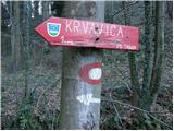 2
2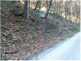 3
3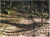 4
4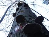 5
5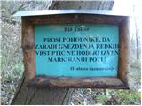 6
6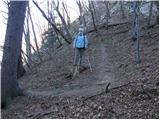 7
7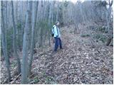 8
8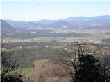 9
9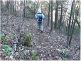 10
10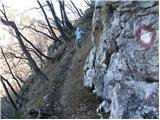 11
11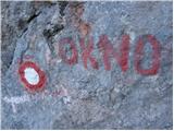 12
12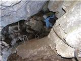 13
13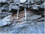 14
14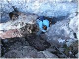 15
15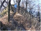 16
16 17
17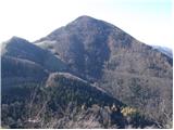 18
18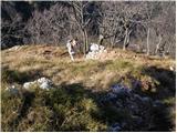 19
19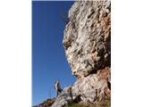 20
20 21
21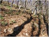 22
22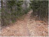 23
23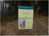 24
24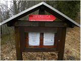 25
25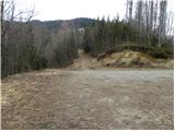 26
26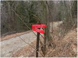 27
27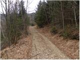 28
28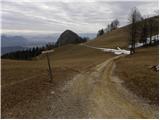 29
29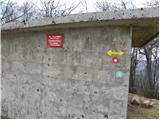 30
30 31
31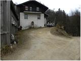 32
32 33
33 34
34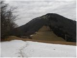 35
35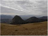 36
36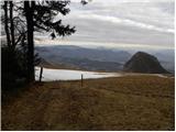 37
37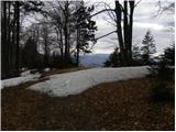 38
38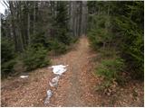 39
39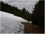 40
40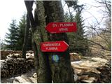 41
41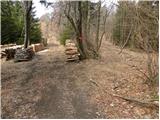 42
42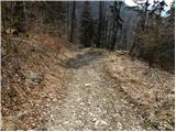 43
43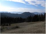 44
44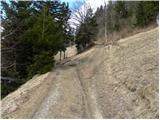 45
45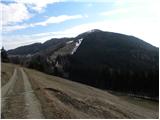 46
46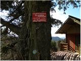 47
47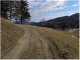 48
48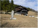 49
49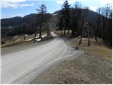 50
50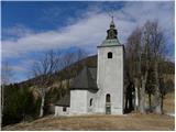 51
51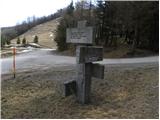 52
52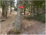 53
53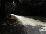 54
54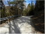 55
55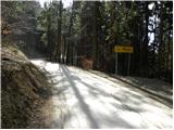 56
56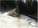 57
57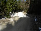 58
58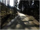 59
59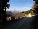 60
60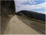 61
61 62
62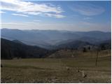 63
63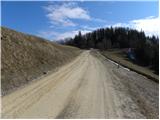 64
64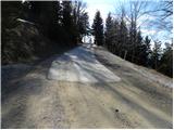 65
65 66
66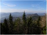 67
67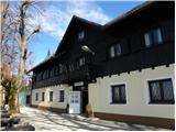 68
68 69
69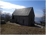 70
70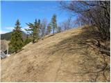 71
71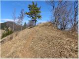 72
72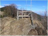 73
73 74
74
Discussion about the trip Loke - Sveta planina (Partizanski vrh) (via Krvavica)
To post a comment you must log in:
If you do not yet have a username, you must first
register.