Starting point: Loke (380 m)
| Latitude/Longitude: | 46,21390°N 15,00770°E |
| |
Walking time: 1 h 30 min
Difficulty: easy marked way
Elevation gain: 362 m
Elevation difference along the route: 450 m
Map: Posavsko hribovje - zahodni del 1:50.000
Recommended equipment (summer):
Recommended equipment (winter): ice axe, crampons
Views: 14.096
 | 2 people like this post |
Access to starting point:
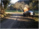
A) From the Ljubljana–Maribor highway, take the Vransko exit and continue driving on the parallel old road towards Celje. We drive a few kilometres on the main road, then the signs for Tabor and Ojstriška vas direct us to the right. Further, we drive through Ojstriška vas to the place Tabor, and from there we continue in the direction of the village Loke. In Loke we come to a crossroads, where we continue left in the direction of Zajčeva koča (straight Krvavica) on the road which soon brings us to the next crossroads. Here we continue right in the direction of "Zajčeva koča - peš pot" (straight Zajčeva koča on the road) on the road which crosses a bridge and then on the other side of the meadow brings us to a smaller parking lot by the road.
B) From the Maribor–Ljubljana highway, take the Šentrupert exit, then continue driving on the parallel old road towards Trojane. We drive a few kilometres on the main road, then the signs for Tabor and Ojstriška vas direct us to the left. Further, we drive through Ojstriška vas to the place Tabor, and from there we continue in the direction of the village Loke. In Loke we come to a crossroads, where we continue left in the direction of Zajčeva koča (straight Krvavica) on the road which soon brings us to the next crossroads. Here we continue right in the direction of "Zajčeva koča - peš pot" (straight Zajčeva koča on the road) on the road which crosses a bridge and then on the other side of the meadow brings us to a smaller parking lot by the road.
Route description:
Near the parking lot, we leave the road and continue the ascent on a cart track which branches off to the left from the road. The cart track after a few metres of walking descends to a stream, crosses it and on the other side changes into a steep footpath which higher ascends parallel with another cart track. The path, which runs through the forest, brings us higher to a partly overgrown clearing behind which it turns slightly to the right and brings us to a decaying house.
Here we continue on the right side of the house on a cart track which ascends diagonally (this part of the path is poorly marked) and a little higher makes a left turn. The moderately steep cart track then slowly turns right and brings us higher to the grassy hay meadows above which we cross a poor forest road.
We continue on a poorly marked cart track which after a while starts to descend and then joins a macadam road which we follow to the right to the next crossroads. At the crossroads, which is situated in the middle of a bend, we continue right and follow it for approximately 100 m to the place where the sign for Zajčeva koča directs us right onto a wide cart track (poorer road), which starts to descend slightly. We follow this cart track, which runs through the forest, to Zajčeva koča.

Photos:
 1
1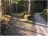 2
2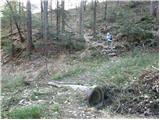 3
3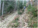 4
4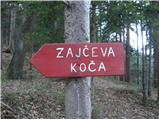 5
5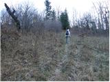 6
6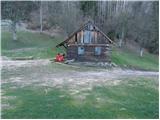 7
7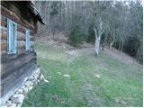 8
8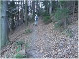 9
9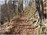 10
10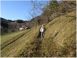 11
11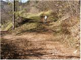 12
12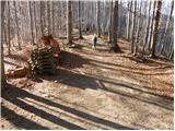 13
13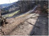 14
14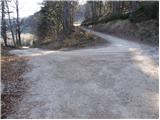 15
15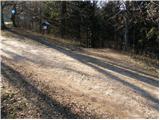 16
16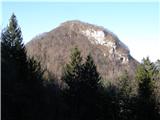 17
17 18
18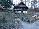 19
19
Discussion about the trip Loke - Zajčeva koča
To post a comment you must log in:
If you do not yet have a username, you must first
register.