Starting point: Lokev (439 m)
| Latitude/Longitude: | 45,66500°N 13,92160°E |
| |
Walking time: 45 min
Difficulty: easy marked way
Elevation gain: 164 m
Elevation difference along the route: 164 m
Map: Slovenska Istra - Čičarija, Brkini in Kras 1:50.000
Recommended equipment (summer):
Recommended equipment (winter):
Views: 7.305
 | 1 person like this post |
Access to starting point:
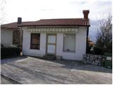
From the highway Ljubljana - Koper, we go to the Divača exit and follow the road ahead in the direction of the villages Lokev and Lipica. The road then quickly brings us to the village Lokev, where at the end of it we will come to a crossroads, where a road towards the Vilenica cave branches off to the right. We turn onto this road along which we will soon notice the blazes, which point us to the right into the upper part of the village, which is the starting point for our tour. At the spot where the marked path leaves the road, there are no appropriate parking spots (we park above or below the village).
Route description:
The marked path leaves the road at flower shop Cvetličarna Lenka or at the candle shop. The marked path goes first past the candle shop, and then continues on a cart track surrounded by bushes. The gently sloping cart track brings us after a good 10 minutes of walking to a well-marked junction, where we continue right in the direction of Stari tabor and village Povir (straight cave Vilenica and Lipica) on a cart track which goes into the forest and further slightly ascends. A well-marked cart track which has a few smaller junctions changes higher into a pleasant footpath. The mentioned path, which becomes a little steeper, is joined a few meters below the summit by the path from the village Povir. We continue right and past the cribs (when they are there) in a few steps ascend to the panoramic summit.
The trip can be extended to the following destinations: Stari tabor
Photos:
 1
1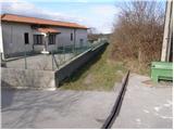 2
2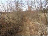 3
3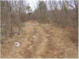 4
4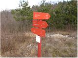 5
5 6
6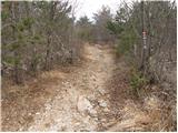 7
7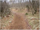 8
8 9
9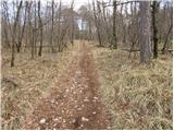 10
10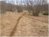 11
11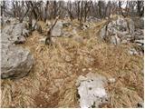 12
12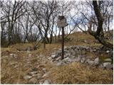 13
13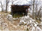 14
14 15
15
Discussion about the trip Lokev - Stari tabor
To post a comment you must log in:
If you do not yet have a username, you must first
register.