Starting point: Lokve (1060 m)
| Latitude/Longitude: | 46,01600°N 13,80500°E |
| |
Walking time: 35 min
Difficulty: easy unmarked way
Elevation gain: 131 m
Elevation difference along the route: 131 m
Map: Goriška 1:50.000
Recommended equipment (summer):
Recommended equipment (winter): ice axe, crampons
Views: 8.973
 | 2 people like this post |
Access to starting point:
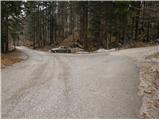
First, we drive to Lokve (from Nova Gorica, Most na Soči or Predmeja), and then we continue driving in the direction of the village Lazna. After a short ascent, the road brings us to a crossroad, where a road branches off to the right, which leads towards Poldanovec. We park on a parking lot right next to the crossroad.
Route description:
From the parking lot, we go on a macadam road in the direction of Poldanovec. The road, which starts ascending, already after a few steps crosses the gate and only a few steps further brings us to a crossroad.
We go sharply left (straight Poldanovec) and we continue the ascent on an unmarked road which moderately ascends on the western slopes of Veliki Češevik. The road higher slightly descends, and then turns right, where it starts ascending a little steeper.
When we already reach the northern side of the previously mentioned summit, from the left side a marked path from Lazna joins us. We still continue on the road, which only slightly higher, on a smaller clearing, ends.
Here we will notice on the left side at first a wide unmarked footpath which higher brings us to the ridge and gradually narrows. Only a few steps of ascent follow on the footpath which ascends on a partly exposed ridge to the summit of Stanov rob.
Photos:
 1
1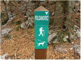 2
2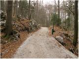 3
3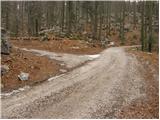 4
4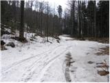 5
5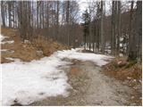 6
6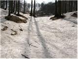 7
7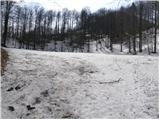 8
8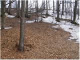 9
9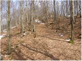 10
10 11
11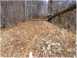 12
12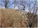 13
13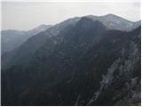 14
14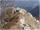 15
15
Discussion about the trip Lokve - Stanov rob
|
| volkci19. 04. 2009 |
Nice outing for families, especially those with small children. We enjoyed the nice, warm and sunny weather. Caution at the very top, where it's steep and a precipitous slope with nice views.
|
|
|
|
| vican6. 12. 2011 |
Does anyone know if it's possible to connect into a loop the path Lokve-Stanov Rob-Poldanovec. Thanks
|
|
|
|
| wolphgang6. 12. 2011 |
There is a variant. It's marked but slippery with a large amount of fallen leaves. If we are at that circular clearing before Stanov rob (end of the road) we climb to the saddle and instead of left to Stanov rob, go left on the side path. The whole path is side, gentle, but the terrain is steep in places. Recommend in spring when snow melts. If you need more explanation, just ask, happy to answer
|
|
|
|
| anka 6. 12. 2011 |
How to get from Stanov rob to Poldanovec has already been described by @wolphgang. To the starting point, use the description of the Lokve - Poldanovec path. The hike takes about three hours.
|
|
|
|
| otiv6. 12. 2011 |
@vican go when visibility is good, namely from the top of Poldanovec there is a wonderful view of the Julijce, something unforgettable, especially now when they are white again.
Good luck with the view.
|
|
|
|
| Zvonček6. 04. 2017 |
This month we plan to hike Lokve-Stanov rob-Poldanovec-Lokve. We're also interested in the path from Stanov rob to Poldanovec. I don't fully understand @wolphgang's explanation. First we'd climb to Stanov rob, then per the description return to the saddle and continue to Poldanovec. Well, if the path is marked, there shouldn't be a problem. Any comment welcome. Thanks in advance.
|
|
|
|
| 11122. 04. 2025 12:31:21 |
From Poldanovec to Stanov rob (or vice versa) there is an old (unmarked) hunters' trail across the precipitous slope of Veliki Češevik. Hunters once secured it at tricky spots (over gullies) with thin steel cables, which are mostly torn by avalanches; the trail is destroyed there and otherwise, as it is obviously no longer used, it gets buried and disappears. Therefore I advise against it, especially when wet, after rain. In snow it is downright suicidal. To Stanov rob it is safer to go around if you value your life.
|
|
|
|
| mirank22. 04. 2025 17:59:01 |
Everything is described on the forum under current conditions in the topics Poldanovec and Poldanovec and Stanov rob. We took the hunters' path that crosses the slope of Govc one level lower and that's probably what 111 means. If it's this one, I have to say it's quite demanding; check the pictures. Otherwise, I think the ascent to Stanov rob is no big deal.
|
|
|
|
| 11126. 04. 2025 14:52:57 |
I warned about the old (abandoned) hunters' trail, which is the shortest (direct) connection between Poldanovec and Stanov rob and crosses the steep slope of Veliki Češevik at constant altitude approx. 1150m. This path, which is also marked on the map, is nicely laid out, but it goes over avalanche-prone areas and gullies where avalanches fly in winter, otherwise falling rocks, so it gets buried and is no longer secured. The other approaches to Stanov rob are fairly easy.
|
|
|
To post a comment you must log in:
If you do not yet have a username, you must first
register.