Lom - Koča na Kamnem griču
Starting point: Lom (817 m)
| Latitude/Longitude: | 45,71450°N 14,60900°E |
| |
Walking time: 45 min
Difficulty: easy marked way
Elevation gain: 199 m
Elevation difference along the route: 215 m
Map:
Recommended equipment (summer):
Recommended equipment (winter):
Views: 1.850
 | 1 person like this post |
Access to starting point:
A) First, we drive to Sodražica, and then we continue driving in the direction of the settlement Hrib-Loški Potok. A few hundred meters after the road sign 8.5 km, at the beginning of a longer left turn, a side road branches off to the left, onto which we turn, and we drive along it for approximately 1 km, or to the spot where a marked cart track branches off to the left. A little before the cart track there are signposts for the mountain hut Koča na Kamnem griču. We park at a suitable place by the junction.
B) First, we drive to the settlement Hrib-Loški Potok, and then we continue driving in the direction of Sodražica. Soon after the road sign 9 km, in the last part of the right turn, we turn right onto a side road, along which we drive for approximately another 1 km to the spot where, slightly to the left from the road, a marked cart track branches off in the direction of the mountain hut Koča na Kamnem griču. We park at a suitable place by the junction.
Route description:
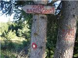
From the starting point, we continue in the direction of the mountain hut Koča na Kamnem griču, and we notice the sign on a tree by the road a few dozen steps before the beginning of the cart track. The cart track first gently ascends into a strip of forest, then continues without major changes in altitude, partly through the forest, partly across mowed meadows. Further on, the cart track begins to ascend moderately, and higher up it brings us to a meadow where the footpath disappears. Here we continue straight uphill, and when we step into the forest again, the footpath also reappears. Before stepping into the forest, it is worth turning back, as a nice view opens up that reaches all the way to Snežnik. In the forest, besides the blazes, we also notice the inscription KG (Kamni grič), which confirms that we are on the right path. When we step out of the forest again, we arrive at the next hayfield, where a poorly visible little path turns left again. A moderate ascent follows, then the path returns to the forest, where it leads us through a shorter stretch where the footpath is somewhat more overgrown but nicely followable. After that section, a short descent follows, then we reach a wider cart track and a marked junction.
From the junction, we continue straight in the direction of the mountain hut Koča na Kamnem griču, to which we have another 5 minutes of moderate ascent mostly on a grassy slope.
From the hut, we can in a few steps also ascend to the nearby peak, from which a nice view opens up that reaches all the way to the Alps.
The description and pictures refer to the condition in 2016 (August).

Photos:
 1
1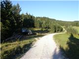 2
2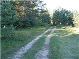 3
3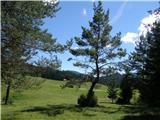 4
4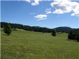 5
5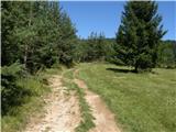 6
6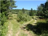 7
7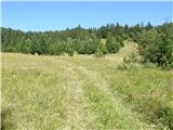 8
8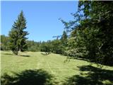 9
9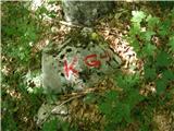 10
10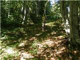 11
11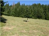 12
12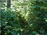 13
13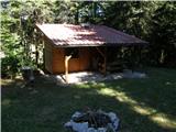 14
14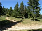 15
15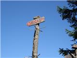 16
16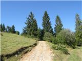 17
17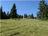 18
18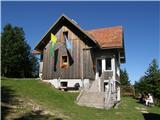 19
19 20
20
Discussion about the trip Lom - Koča na Kamnem griču
To post a comment you must log in:
If you do not yet have a username, you must first
register.