Loška Koritnica - Zavetišče pod Špičkom
Starting point: Loška Koritnica (727 m)
| Latitude/Longitude: | 46,41470°N 13,62950°E |
| |
Walking time: 4 h 55 min
Difficulty: very difficult marked way
Elevation gain: 1337 m
Elevation difference along the route: 1525 m
Map: Julijske Alpe - zahodni del 1:50.000
Recommended equipment (summer): helmet, self belay set
Recommended equipment (winter): helmet, self belay set, ice axe, crampons
Views: 7.290
 | 2 people like this post |
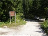
Access to starting point:
From Bovec we drive towards the Predel border crossing. In the village of Log pod Mangartom, immediately after the bridge over the Predilnica, we turn right in the direction of Koritnica. The road, initially asphalted and then gravel, quickly takes us to the parking lot at the beginning of the entrance to the central part of TNP.
Route description:
From the parking lot we head to the right onto the road that is closed with a barrier. The road runs all the time near the stream and crosses it several times. Towards the end the road becomes narrower and leads us past a few houses to a crossroads. We head slightly to the right onto the hiking path following the signs for Jalovec, Pod Špičkom, Mangrt (left Planina Brdo). The path then goes into the forest and soon brings us to a marked crossroads.
We continue to the right following the signs for Zavetišče pod Špičkom, to the left the path leads towards Kotovo sedlo and Mangart.
The path soon brings us to a stream that we have to cross, then we climb for a short time through sparse forest. This is followed by an ascent along a grassy slope and a short ascent over scree to the entry into the climbing section of the path.
When we enter the wall, we first climb up to the left along the steel cable. The path soon becomes even steeper and climbs almost vertically several times along the steel cable with the help of numerous pitons. In the continuation we continue to climb the steep slope with the help of steel cables, then the path turns somewhat to the right and soon brings us into the forest, where the steepness eases somewhat. From the forest the path brings us onto a slope covered with bushes and tall grass. The bushes then end and an ascent follows along an ever nicer valley. Beautiful views also open from the path towards Mangart, Jalovec and the precipitous walls of Plešivec under which we are climbing. In the last part the valley turns slightly to the right and an ascent over scree to the saddle Čez Brežice follows.
At the saddle we continue left as directed by the inscription on the rock “Špička”. First we climb up to the left along the steel cable, then the path brings us to a grassy slope along which we climb for some time. When we arrive under the cliffs of Mali Ozebnik we continue to the right and along the steel cable in a slight ascent we cross the precipitous slopes. In some places there is also a lot of gravel on the path, so additional caution is required. The path then brings us to a short very demanding section of the path. With the help of the steel cable and a few pitons we climb vertically, then we traverse a few more meters vertically to the right across the slope. In the continuation the path climbs on a somewhat less steep but unprotected slope and there follows yet an ascent on a very scree-covered slope to Škrbina za Gradom.
From the notch we descend on scree under the walls of the peak Pelc nad Klonicami (2442 m). The path then leads us through broken terrain past numerous rocks and boulders. In the last part the path turns to the left and after a short descent brings us to Zavetišče pod Špičkom.
Starting point - Mlaka 0:45, Mlaka - Čez Brežiče 2:35, Čez Brežiče - Škrbina Za gradom 0:55, Škrbina Za gradom - Zavetišče pod Špičkom 0:40.

Along the route: Šujč (895m), Mlaka (959m), Čez Brežiče (1980m), Škrbina Za gradom (2277m)
Photos:
 1
1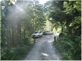 2
2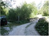 3
3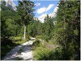 4
4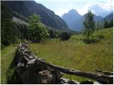 5
5 6
6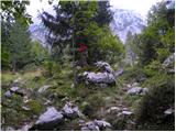 7
7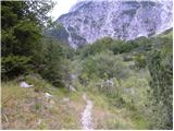 8
8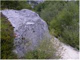 9
9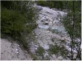 10
10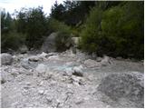 11
11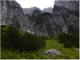 12
12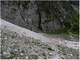 13
13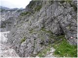 14
14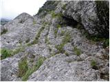 15
15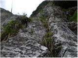 16
16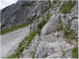 17
17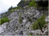 18
18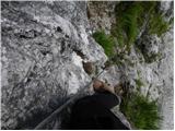 19
19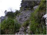 20
20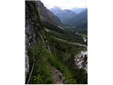 21
21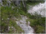 22
22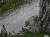 23
23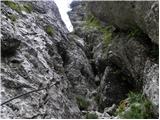 24
24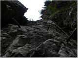 25
25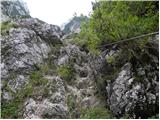 26
26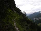 27
27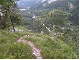 28
28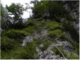 29
29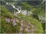 30
30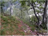 31
31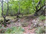 32
32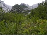 33
33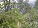 34
34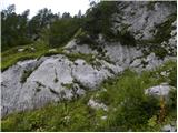 35
35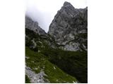 36
36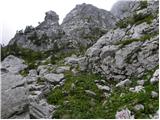 37
37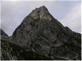 38
38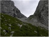 39
39 40
40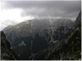 41
41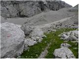 42
42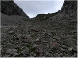 43
43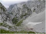 44
44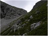 45
45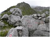 46
46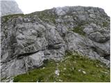 47
47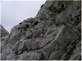 48
48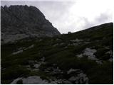 49
49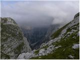 50
50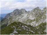 51
51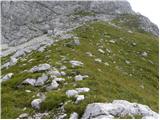 52
52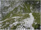 53
53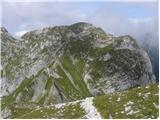 54
54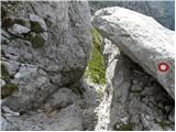 55
55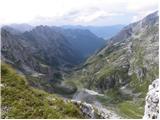 56
56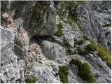 57
57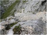 58
58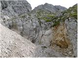 59
59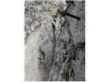 60
60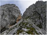 61
61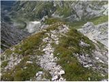 62
62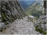 63
63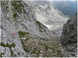 64
64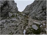 65
65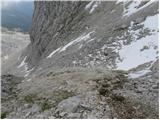 66
66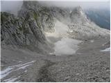 67
67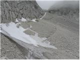 68
68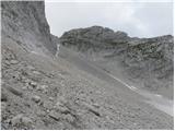 69
69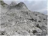 70
70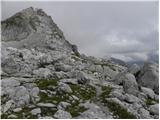 71
71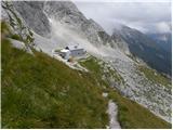 72
72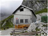 73
73
Discussion about the trip Loška Koritnica - Zavetišče pod Špičkom
To post a comment you must log in:
If you do not yet have a username, you must first
register.