Lovnik - Sveti Mihael on Pečica
Starting point: Lovnik (348 m)
| Latitude/Longitude: | 46,27710°N 15,55810°E |
| |
Walking time: 30 min
Difficulty: easy marked way
Elevation gain: 152 m
Elevation difference along the route: 152 m
Map: Posavsko hribovje (Boč-Bohor) 1:50 000
Recommended equipment (summer):
Recommended equipment (winter):
Views: 2.802
 | 2 people like this post |
Access to starting point:
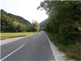
A) From Poljčane through the valley of the stream Bela to the settlement Lovnik, where we park by the road.
B) From Podplat over saddle Pečica to the settlement Lovnik, where we park by the road.
Route description:
In the settlement Lovnik we go along the vineyard farm Zorin following the municipal road and blazes of Mary's pilgrimage route and cross the stream for the first time. At the second crossing of the stream, we go left on the forest road and follow it all the way to the exit on the asphalt road over Pečica. We continue right and after about two hundred meters we reach the church of St. Michael on Pečica.
Photos:
 1
1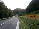 2
2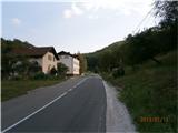 3
3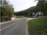 4
4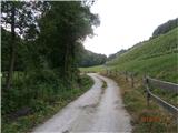 5
5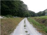 6
6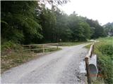 7
7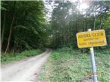 8
8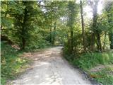 9
9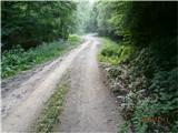 10
10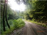 11
11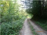 12
12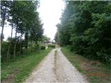 13
13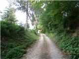 14
14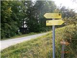 15
15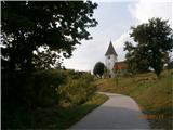 16
16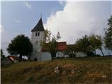 17
17
Discussion about the trip Lovnik - Sveti Mihael on Pečica
|
| bruny28. 12. 2013 |
Today with a mountain bike short activity directly from Poljčane. Pleasant for a late December date and the bike is ideal for this terrain. This is the first path I officially described on this forum, added it among the paths and indirectly entered it into the world wide web. They say  'you never forget the first ones' and maybe it's true. Some snapshots from the path Lp 'you never forget the first ones' and maybe it's true. Some snapshots from the path Lp
|
|
|
|
| bruny15. 07. 2014 |
Today on the described path. Also this time from Poljčane in the valley of the Bela stream easy activity with a mountain bike. The entire path practically uphill. Towards the end a bit steeper. Still caught the last sun somewhere on the sunny side of Pečice. Also passed the junction with the path Dolga gora - Boč/first. By the water near the gurgling stream definitely pleasant. Path partially muddy in the final ascent, temperature pleasant. On the return from Lovnik/panzeršpera still a bit to Boč. To the pass above Zg. Kostrivnica or junction with the path Dolga gora - Boč again.
Track:Sv. Mihael na Pečici,15.07.2014.Lp
|
|
|
|
| bruny4. 08. 2024 13:29:20 |
After six years and two months...back to Pečica. To the subsidiary church of St. Michael, Sladka Gora parish. From Poljčane by bike. There and back. It was a pleasant  easy Sunday... easy Sunday...
Strava/Sv. Mihael na Pečici,04.08.2024
|
|
|
To post a comment you must log in:
If you do not yet have a username, you must first
register.