Lovrenc na Pohorju - Lovrenška jezera
Starting point: Lovrenc na Pohorju (493 m)
| Latitude/Longitude: | 46,53480°N 15,37920°E |
| |
Walking time: 3 h 35 min
Difficulty: easy marked way
Elevation gain: 1027 m
Elevation difference along the route: 1050 m
Map: Pohorje 1:50.000
Recommended equipment (summer):
Recommended equipment (winter): ice axe, crampons
Views: 20.868
 | 5 people like this post |
Access to starting point:
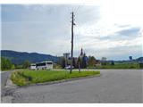
A) By car, we drive from Maribor towards Dravograd. Approximately 20 km from Maribor, we turn left onto the bridge over the Drava River. Under the railway bridge in the hamlet Ruta, we continue driving straight. At the next crossroad, we turn right, then we drive through the hamlet Puščava. Then the road brings us to the settlement Kurja vas, where at the crossroad we keep straight. On the lower side we see the very well-known factory of scythes and sickles, after approx. 2 km we arrive in the center of the place Lovrenc na Pohorju, where we can already park at a suitable place or continue to the church of St. Lovrenc, where there is also plenty of space for parking.
B) First, we drive to Dravograd, then we continue driving towards Maribor. A few kilometers after the place Ožbalt we turn right onto the bridge over the Drava River. Further, we follow the above description.
Route description:
We start near the church of St. Lovrenc. We go along the road in the direction of Pesek past the cemetery, which is on the left side. Higher up, at the crossroad by Hojnik chapel the signpost directs us straight. Above the settlement, at the bend we turn left onto a footpath that goes into the bushes. After a few steps, we step onto the road, only a few meters ahead, at the edge of the forest, we turn right onto a side ridge, which stretches all the way to the vicinity of the Lovren Lakes. We walk past farms Dešnik, Bednik and Kasjak, the path several times crosses a forest road, higher it turns below the left edge of Kasjakov breg 1014 m and Fakov kogel 1188 m on Recenjak. After a while we step onto the clearing Vrelenk 1165 m, where there is a nice view. An old Kasjakova koča hut used to stand here, of which only the foundations remain.
The path ahead again leads us into the forest and soon we cross the forest road Pesek-Pesnik, where we are already near the summit plateau Planinka on the northern edge of the Lovren Lakes. Further on, the path brings us out of the forest, where views already open towards the north to Jezerski vrh and northwest all the way to the Kamnik Alps. Soon we reach the junction of mountain paths, where the path from the direction of Ribniška koča joins us. We turn left and after approx. 30 minutes of further walking we reach the next junction. Here is again a junction, where the path from the direction of Rogla joins. The signpost directs us to the left again, from here to the lakes it is no longer far. Over wooden duckboards and up the slope and in a further 5 minutes, the path brings us to the Lovren Lakes.

Photos:
 1
1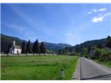 2
2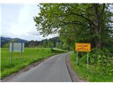 3
3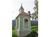 4
4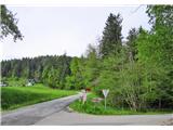 5
5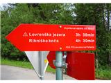 6
6 7
7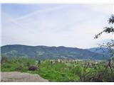 8
8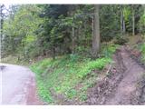 9
9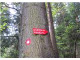 10
10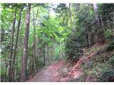 11
11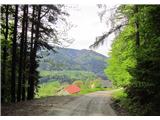 12
12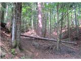 13
13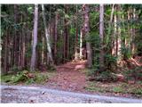 14
14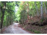 15
15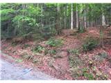 16
16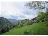 17
17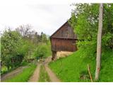 18
18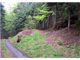 19
19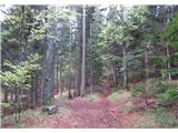 20
20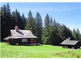 21
21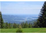 22
22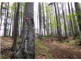 23
23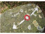 24
24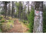 25
25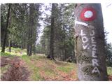 26
26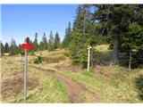 27
27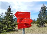 28
28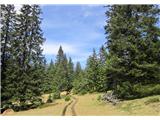 29
29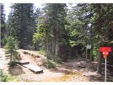 30
30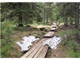 31
31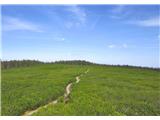 32
32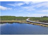 33
33
Discussion about the trip Lovrenc na Pohorju - Lovrenška jezera
|
| cenc21. 02. 2016 |
Today I chose this trail for recreation before Sunday lunch. Unfortunately, I had to give up above the beautiful
meadow Vrelenk, as it was sinking up to my knees. But I'll continue another time.....
|
|
|
|
| dprapr21. 02. 2016 |
You didn't want to miss a good lunch, did you?
|
|
|
|
| Megas10. 05. 2020 |
The route is well marked and doesn't require any difficult techniques usage.
The actual route length is 10.37 km (one way) and 1146 m of climbing.
It took me 3h 50m to reach the lakes and then 2h 40m to return to starting point.
The route is not very interesting cause it lies along same forest path without view changing. The lakes were also disappointing. Small pools of dirty water and a lot of people around it.
GPX file of the route: http://ext.qmegas.info/uploads/hiking/74.gpx
|
|
|
To post a comment you must log in:
If you do not yet have a username, you must first
register.