Lozice - Furlanovo zavetišče pri Abramu
Starting point: Lozice (300 m)
| Latitude/Longitude: | 45,78500°N 14,00300°E |
| |
Walking time: 2 h 30 min
Difficulty: easy marked way
Elevation gain: 600 m
Elevation difference along the route: 700 m
Map: Nanos 1:50.000
Recommended equipment (summer):
Recommended equipment (winter): ice axe, crampons
Views: 10.500
 | 1 person like this post |
Access to starting point:
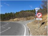
A) From the highway Ljubljana - Koper, take the Razdrto exit, then continue driving on the old road towards Nova Gorica. After Razdrto, the road starts steeply descending, and we follow it to a crossroad, where a left downwards for public traffic closed road towards Lozice branches off, and to the right the road towards the former building site of the highway branches off (the mentioned crossroad is located near the road sign 7 km, by the crossroad there are also signs for Nanos). Because in the mentioned crossroad we are not allowed to turn left or right, it is better to leave the car already a few 100 meters higher, on one of the many parking lots by the road.
B) From the highway Nova Gorica - Razdrto, take the Vipava exit, then continue driving on the old road towards Razdrto. Further, we drive through Podnanos and past the turn-off of the road which leads to Nanos. From the mentioned crossroad, we follow the main road only 2 km, then we arrive at a crossroad, where sharply right and steeply downwards a for public traffic closed road towards Lozice branches off, and to the left the road towards the former building site of the highway (the mentioned crossroad is located near the road sign 7 km, by the crossroad there are also signs for Nanos). Because in the mentioned crossroad we are not allowed to turn left or right, it is better to leave the car already a few 100 meters lower, on one of the many parking lots by the road.
Route description:
From the starting point, we first walk to the crossroad mentioned in the description of the starting point, and from there we continue on the ascending road, along which there are also signs for Nanos. The road first steeply ascends, then temporarily flattens and leads us under the viaducts of the nearby highway. Some 10 m ahead, we arrive at an unmarked crossroad, where we continue sharply right onto the road, which gets very close to the highway.
When on the right side we notice the transmitters (we won't see the transmitters in the fog), then on the left side of the road we notice signs for Nanos, which direct us left. Further, we ascend through a belt of bushes to the nearby meadow, where the path quickly brings us to the nearby "spring". Above the spring, the path turns left into the low forest, through which it starts first gently, then moderately ascending. Higher, we reach a somewhat wider path, which we immediately leave, as the blazes direct us left onto a gradually steeper footpath. Some 10 m higher, we cross another cart track, and the path, which gradually turns left, already becomes somewhat steeper. A traverse ascent towards the left follows, and the path brings us to the "Loziško počivalo", where from the left the path from Podnanos joins (starting point Hrašče).
Here we continue right in the direction of the hunting cottage, and the relatively wide path, in numerous zigzags, leads over increasingly steep slopes. The relatively steep path occasionally leads us over quite panoramic slopes, from which a nice view opens towards the Vipavska brda. Higher, we arrive at a somewhat more demanding section, where the otherwise wide path ascends transversely over a short exposed slope (mainly in snow and ice there is a risk of slipping). Above the exposed traverse, we arrive at a marked junction, where we continue straight onto the wide path (left downwards Podnanos and Vipava, right Vojkova koča past Strmec). Further, we moderately ascend on the wide path, on which in good 10 minutes of further walking we arrive at the hunting cottage Vojkovo.
From the hunting cottage, we continue to the nearby asphalt road and follow it to the right to the nearby Vrata, behind which we step onto the southwestern part of the Nanos plateau. On the other side of Vrata, the road starts descending, and we follow it only briefly, as then the blazes direct us left onto the marked footpath, which descends through a pine thicket. After a short descent, we return to the road and follow it to the left. Along the road, we walk to the nearby right bend, at the end of which a marked path branches off to the left. We continue on the cart track, which starts gently ascending; we walk on it only some 10 m, then on the right side we notice the poorly visible start of the footpath, which gradually starts descending transversely towards the Šembijska bajta.
At the mentioned bajta, we return to the road, on which we continue. Somewhat higher, we arrive at a triangular crossroad, where to the left the road towards Vipava branches off, and we continue slightly right on the gradually somewhat steeper road. The road, which continues through the forest, then rises almost 150 altitude meters and brings us to a crossroad, where we reach the marked path Abram - Vojkova koča. Here we continue left on the road, which starts gently descending. After a few minutes, we step out of the forest, where at the crossroad we continue right towards the nearby hunting lodge.
From the hunting lodge, near which there is a large parking lot, we continue a few meters further on the road, then the signs for farm tourism Abram direct us left onto a narrower road, along which we only walk to the nearby shelter.

Photos:
 1
1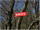 2
2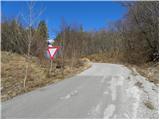 3
3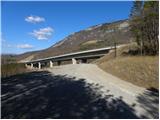 4
4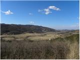 5
5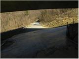 6
6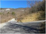 7
7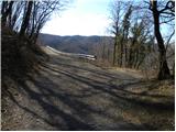 8
8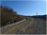 9
9 10
10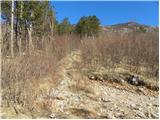 11
11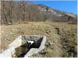 12
12 13
13 14
14 15
15 16
16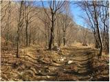 17
17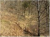 18
18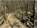 19
19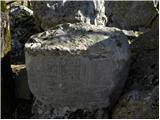 20
20 21
21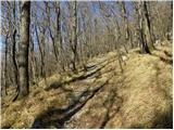 22
22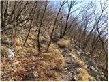 23
23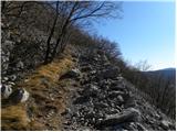 24
24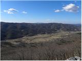 25
25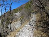 26
26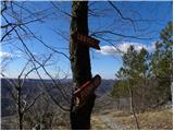 27
27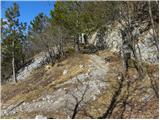 28
28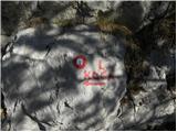 29
29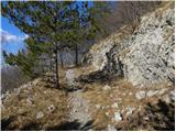 30
30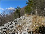 31
31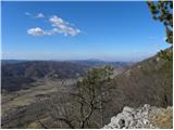 32
32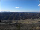 33
33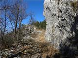 34
34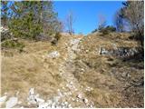 35
35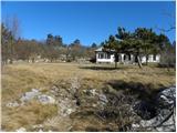 36
36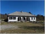 37
37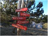 38
38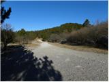 39
39 40
40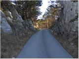 41
41 42
42 43
43 44
44 45
45 46
46 47
47 48
48 49
49 50
50 51
51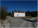 52
52 53
53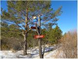 54
54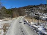 55
55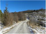 56
56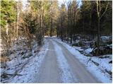 57
57 58
58 59
59 60
60 61
61 62
62 63
63 64
64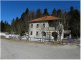 65
65 66
66 67
67 68
68
Discussion about the trip Lozice - Furlanovo zavetišče pri Abramu
|
| marinka6730. 10. 2014 |
So you can drive to Vojkova koča by car, then it's another 1 hour on foot to Furlanovo zavetišče. Is that right? Not that we're lazy, just sometimes on the way from the sea.
|
|
|
|
| B230. 10. 2014 |
Yes, you can drive to Vojkova koča by car and from there it's two and a half hours to Abram (Jež or also Furlanovo zavetišče) - and another two and a half hours back to the car... But you can also drive to Abram by car (the road is half asphalt, the second half good gravel). We'd go sometimes on the way from the sea - for stamps for SPP. And to Sinji vrh, Čaven and Pirnatova koča you can also drive by car, except to Golake... There it's really one hour to the stamp at the top...
|
|
|
|
| marinka6730. 10. 2014 |
This doesn't make sense to me. From the starting point Lozice it's 2.5 hours to Abram, and from Vojkova hunters' hut also 2.5 hours to Abram.
So the sign on picture no.38 doesn't hold (Abram- 1h)?
|
|
|
|
| mirjam6730. 10. 2014 |
Marinka67 - there's something misunderstood here. Namely, there are two objects, one is Vojkova koča on Nanos (that's where the TV transmitters are) and from there it's two hours to Furlanovo zavetišče. The other is Lovska koča Vojkovo, from there it's one hour to the shelter. You can reach both by car. If you go to Razdrtem via Rebernices towards Podnanos, just before Podnanos there's a right turn to Nanos. The road is fully asphalted and takes you to Lovska koča Vojkovo. If you continue, you reach gravel and there's a fork - straight goes the path to Furlanovo zavetišče (or to Abram, as it's better known in our parts), right leads to Vojkova koča. All turnoffs are well marked.
|
|
|
|
| marinka6730. 10. 2014 |
Eh, yes, of course, I think one thing, write another. Thanks mirjam67, now I understand. So:
We drive to hunters' hut Vojkovo and from there to Abram it's 1 hour walk.
We were at Vojkova koča on Nanos two years ago, also on the way from the sea. It doesn't seem fair to us to drive for SPP stamps, at least an hour's walk is needed for it to count.
|
|
|
|
| mirjam6730. 10. 2014 |
Yes Marinka67, now you've understood correctly. And about the stamps, I completely agree with you. Have you noticed that we have something in common?
|
|
|
|
| mirjam6731. 10. 2014 |
Apparently we both entered the year in the password. But let me tell you, that's a very good year, they don't make them anymore!
|
|
|
|
| eppy3. 11. 2014 |
Nice autumn hike Still, I think a more realistic estimate is that it takes three hours to walk. You have to cover quite a long distance, first you climb from the Vipava Valley to the plateau, from there it's still almost an hour of walking (flat or only slight gradual ascents) to the hut. My boyfriend and I are not sprinters, but yesterday we walked relatively quickly, without breaks. So, count on it taking longer than stated
And a few notes on the route description. The "junction at the transmitter" is a bit poorly visible. When walking on the path that is practically parallel to the highway, it takes about 10 minutes to spot the mentioned transmitter. The transmitter is on the highway itself. Then you need to look carefully to your left. The "Nanos" sign is on a stone on the ground, which is also a bit overgrown, so you have to watch out. The path is narrow and easy to miss. When passing "Vrat", it's best to stay on the road (wide gravel). Cars do pass by, but shortening via the path to Šembiška bajta doesn't make much sense, as the path is a bit overgrown (as said by passing locals).
Otherwise, a nice hike. It starts among brambles with views of the Vipava Valley, great views of the Nanos barren landscape, the path to Abram winds already among spruces.
|
|
|
|
| marinka6728. 04. 2015 |
Thanks for the tips, the tour was fully successful! Fog hindered us, but no problem, you can't have everything
|
|
|
|
| Matej17. 04. 2016 |
Greetings to all!
I accidentally learned about this mountain station and indignantly noticed the photo of a bear in a cage. This is probably the past, isn't it? Does anyone know anything about it? Locking such an animal in such a small cage is namely as inhumane as locking the caretaker of this shelter in the pantry.
Best, Matej
|
|
|
|
| natalia237. 04. 2016 |
Hello, it's not the past, the bear is still in this cage on a few square meters, somehow it's considered an attraction of this inn...
|
|
|
|
| Matej17. 04. 2016 |
Unbelievable that no one is doing anything ... Well, someone will 
|
|
|
|
| ajax8. 04. 2016 |
they won't, it's been quite a few years already, come see it live, but if you want to eat or drink something, I think you have to reserve beforehand, at least in summer it's like that, full of pasta eaters.
|
|
|
To post a comment you must log in:
If you do not yet have a username, you must first
register.