Starting point: Luče (522 m)
| Latitude/Longitude: | 46,35530°N 14,74820°E |
| |
Walking time: 4 h 5 min
Difficulty: easy unmarked way
Elevation gain: 1286 m
Elevation difference along the route: 1315 m
Map: Kamniške in Savinjske Alpe 1:50.000
Recommended equipment (summer):
Recommended equipment (winter): ice axe, crampons
Views: 2.940
 | 2 people like this post |
Access to starting point:
A) From the highway Ljubljana - Maribor, take the exit Šentrupert, then continue driving in the direction of Logarska dolina. At the beginning of the settlement Luče, only a few meters before the road crosses the river Savinja, we will notice on the left side of the road a bigger macadam parking lot, where we park.
B) To the starting point, we can also come via the mountain pass Volovljek (Kranjski Rak). In this case, in Luče we turn right in the direction towards Mozirje and then only a few 10 meters after the bridge over the river Savinja we park on the parking lot mentioned in the description a.
Route description:
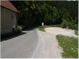
Between the parking lot and the bridge over the river Savinja, we will notice by the road the sign for Koča na Loki, which directs us to the path that first steeply ascends on stairs. The path soon flattens, then continues along the ridge that steeply descends towards the river Savinja. Ahead we enter a dense forest, and the path quickly brings us to a chapel, behind which there is a smaller junction.
We continue on the right path, which starts to ascend steeper and steeper, then flattens and turns right. A short crossing to the right follows, then we step out of the forest onto an extensive meadow. Further, the poorly visible path ascends diagonally across the mentioned meadow, then brings us to a smaller hamlet, where we again notice the blazes. The path ahead leads us past a few houses and above them into a belt of bushes, through which we ascend to the nearby road. We only cross the mentioned road, as the signposts located by a smaller shrine direct us to the footpath, which further moderately ascends through the forest. A little higher, a nice view of Raduha opens up, and we continue on the marked path, which a little higher brings us to the road, which after a few meters reaches a marked junction. We continue slightly left and continue the ascent along the road in the direction of Raduha. Further, we ascend along the road for quite some time, which has some marked shortcuts (blazes on this section are very rare), then we reach a newer road, where in the middle of the left bend a wide marked cart track branches off to the right. We continue the ascent on the mentioned cart track, which higher again brings us to the mentioned road, and we walk along it only a few 10 steps, then on the left side we notice a marked path leading towards the pastures Loka and Arta (the branch-off from the newer road is not marked). Further, we ascend diagonally parallel to the road, and the path a little further brings us to a large bench by which there is a marked junction.
We continue on the right path (left to pasture Arta), which for some time ascends diagonally, then brings us to the road leading towards Snežna jama. We reach the mentioned road right at the junction, where to the right a forest road closed to public traffic branches off, leading towards pasture Loka. We head onto the mentioned road, along which with 15 minutes of moderate ascent we climb to Koča na Loki pod Raduho.
From the hut, we continue slightly right on the marked path in the direction of saddle Durce (slightly left Raduha, right Smrekovec and Travnik). Further, we first gently ascend along the right side of the gully (along the left side of the gully runs the path to Raduha) on the path that starts to ascend gradually steeper. After approximately 10 minutes of walking from the hut, the path brings us to a less noticeable junction, where we continue sharply right on the poorly visible path (straight to Durce). After a few steps of further walking, we will notice on the tree hiking signposts with markings Lanež and Durce via Lanež, which direct us left upwards onto a steep but marked pathless terrain (in fog, orientation is quite difficult). After a few minutes of ascent over the steep grassy slope, the "path" brings us to a grazing fence, where we continue left. Just a few steps further, the marked path crosses the mentioned fence and then turns somewhat to the left (here the track is already better visible).
We continue the ascent on the scenic path, which past the watering place for animals brings us into a smaller valley between Lanež and Jelovec. The moderately steep path, which further runs through the pleasant valley, soon brings us to an indistinct saddle between the previously mentioned peaks.
Here we turn right and continue along the grassy slope to a smaller saddle on the south side of Jelovec. From here we continue left and cross the slopes along the right (eastern) side of the ridge. The narrow track further runs through dwarf pines and slightly descends in a few places. Soon we will see the summit Kup ahead of us, on which a cross stands. The path still runs through dwarf pines and soon brings us to the scenic summit.
Luče - Koča na Loki 3:00, Koča na Loki - Kup 1:05.

Photos:
 1
1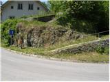 2
2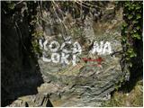 3
3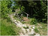 4
4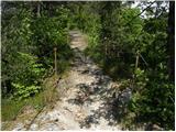 5
5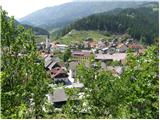 6
6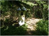 7
7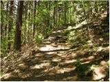 8
8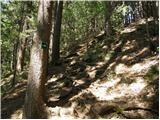 9
9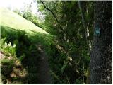 10
10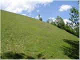 11
11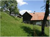 12
12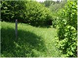 13
13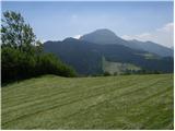 14
14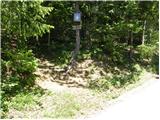 15
15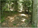 16
16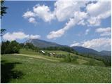 17
17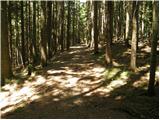 18
18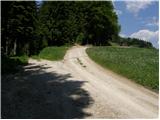 19
19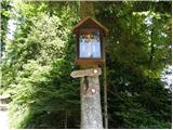 20
20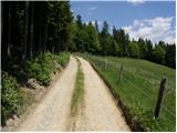 21
21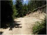 22
22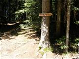 23
23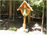 24
24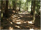 25
25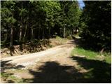 26
26 27
27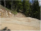 28
28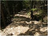 29
29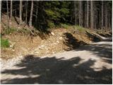 30
30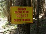 31
31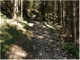 32
32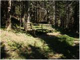 33
33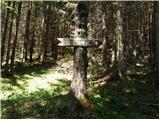 34
34 35
35 36
36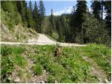 37
37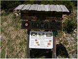 38
38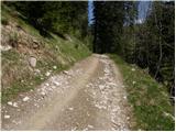 39
39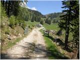 40
40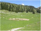 41
41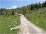 42
42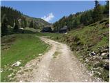 43
43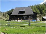 44
44 45
45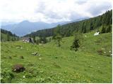 46
46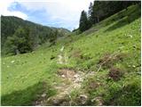 47
47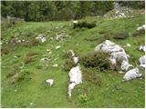 48
48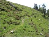 49
49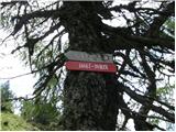 50
50 51
51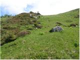 52
52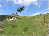 53
53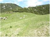 54
54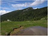 55
55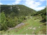 56
56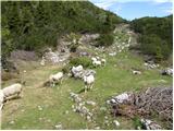 57
57 58
58 59
59 60
60 61
61 62
62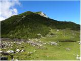 63
63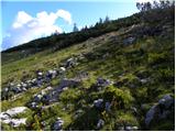 64
64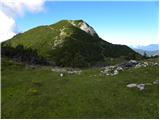 65
65 66
66 67
67 68
68 69
69 70
70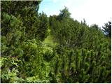 71
71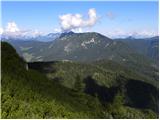 72
72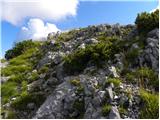 73
73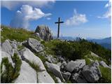 74
74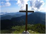 75
75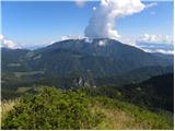 76
76
Discussion about the trip Luče - Kup (on Raduha)
|
| povhica9. 01. 2017 |
Thanks for the new tip. Beautiful photos. The path from the alpine pasture onwards seems particularly nice to me. But how much walking is there on the macadam road from Luče?
|
|
|
|
| ziki11. 01. 2017 |
I think the summit in pictures 74 and 75 is not called Jelovc, but Kup "na Kupu". Jelovc is the slope towards planina Jevorje.
|
|
|
|
| geppo12. 01. 2017 |
When I first climbed Jelovec (1808m asl), I was looking on maps for the name of this summit with the cross. Wherever I looked, I came across the name Jelovec. Also Planina Javorje was described as Javorje and not Jevorje.
Maybe now you're using field names?
Regards
|
|
|
|
| Janez Seliškar19. 02. 2023 10:18:03 |
Yesterday they taught me that the peak in photos 74 and 75 is called Kup.
|
|
|
|
| Tadej18. 11. 2024 08:59:06 |
Thanks for the notice. I have corrected it in the description to Kup.
|
|
|
To post a comment you must log in:
If you do not yet have a username, you must first
register.