Mače - Dom na Kališču (via Sveti Miklavž)
Starting point: Mače (586 m)
| Latitude/Longitude: | 46,31310°N 14,41870°E |
| |
Route name: via Sveti Miklavž
Walking time: 2 h 45 min
Difficulty: easy unmarked way
Elevation gain: 948 m
Elevation difference along the route: 980 m
Map: Karavanke - osrednji del 1:50.000
Recommended equipment (summer):
Recommended equipment (winter): ice axe, crampons
Views: 3.557
 | 1 person like this post |
Access to starting point:
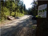
a) From the Ljubljana - Jesenice motorway take the Kranj - east exit, then continue driving towards Jezersko. When arriving in Preddvor leave the main road and continue left towards the centre of the mentioned place, from there follow the signs for Mače. When arriving in Mače, at the marked junction continue right (left Bašelj, straight church of sv. Miklavž (the church is not accessible by car)) and drive up the narrow road above the village, where there is a larger marked parking lot.
b) From the Jesenice - Ljubljana motorway take the Kranj - west exit and at the first junction continue left. Continue driving through the underpass under the motorway, then arrive at a roundabout, from which continue driving towards Golnik. The route ahead leads through the settlement Mlaka pri Kranju, we, at the end of the settlement, continue right towards the settlement Srakovlje. This is followed by driving through Srakovlje, Spodnja Bela, Srednja Bela to Zgornja Bela, where we continue right towards Preddvor. In Preddvor notice the signs for Mače, which direct us left past the primary school to the road that climbs to Mače. When arriving in Mače, at the marked junction continue right (left Bašelj, straight church of sv. Miklavž (the church is not accessible by car)) and drive up the narrow road above the village, where there is a larger marked parking lot.
Route description:
From the parking lot above Mače return along the asphalt road back to the village centre, from there continue towards sv. Miklavž (the junction from the village centre towards sv. Miklavž is well marked). From the village centre continue along the dead-end street and begin a moderate ascent along it. The road soon levels out and brings us to a point where we see the next sign for sv. Miklavž, which this time directs us left onto a road that leads past a few courtyards to the nearby stream. Before descending to the stream, the next sign directs us right, where we continue past a garage and along a concrete embankment. When the already deteriorating road descends completely to the Suha stream, we cross it over a small wooden bridge. On the other side of the bridge, we climb to the edge of the courtyard of a nearby residential house, then continue right, beginning to ascend along a chain-link fence. After a short ascent, we reach the edge of a larger hay meadow, from where a nice view opens up to Tolsti vrh and Storžič. Continue along the edge of the forest or right along the meadow to the point where the path returns to the forest. Once in the forest, the path widens into a cart track, along which we continue for just a dozen steps, then go right onto a well-trodden path. A bit further, we reach the next cart track, which we cross diagonally to the left.
From the cart track onwards, we ascend a moderately steep path that quickly takes us out of the forest onto a larger meadow below the church of sv. Miklavž. From there follows only a short ascent and we are at the little church, from which a nice view opens up to the Upper Carniola settlements, Polhograjsko and Škofjeloško hills, and on clear days also to Triglav.
We notice the continuation of the path on the eastern side of the church, where we ascend through a short stretch of forest to a pleasant bench and a nice vantage point. Continue along the right side of the bench on a path that gently ascends crossing the slopes to the right. After a few minutes, we reach a cart track, which we just cross and continue the ascent on a well-trodden and still unmarked path that ascends somewhat more steeply. When the path levels out, we reach a kind of ridge, where we step onto another, relatively new cart track, along which we ascend northwards. With occasional nice views of Triglav, Mali Grintavec and more, we ascend along an indistinct forest edge, where we leave the cart track and continue slightly right onto a nicely traceable little path (since the cart track is relatively new (April 2014), the start of the path is somewhat less noticeable), which gradually enters the forest and a bit further joins the usual marked path from Mače to Kališče.
The marked path soon brings us to the next cart track, along which we walk to the point where the markers lead us right upwards onto a steeper path, along which in a few minutes we ascend to a nicely arranged vantage point with a bench. Behind the vantage point, we return to the forest, where we ascend gently. A bit further, we again reach one of the numerous cart tracks in this area, the marked path runs parallel to it for a while, and later, when the dense forest belt ends, returns to it. With a view of Tolsti vrh and Storžič, we then walk in a minute of further walking to the junction north of Gora, the summit which we have bypassed on the left side.
From the junction continue along the marked path towards Kališče. For a few minutes we ascend through dense spruce forest, then join a poorer road, along which we continue the ascent for a few minutes. We leave the road when on the right side we notice the continuation of the mountain path (the junction is well marked). The path ahead moves onto a steeper slope and ascends relatively steeply in numerous switchbacks. Higher up, the forest thins temporarily and a nice view opens to the south. In the area of sparse forest, a wooden bench also provides a pleasant rest, a little further a still functioning clock on a tree "surprises" us. Continuing, we cross more to the right, reaching the forested southern ridge of Kališče. On the mentioned ridge, the path turns sharply left, then ascends in a few switchbacks to Spodnje Kališče, from where a nice view of Storžič opens up.
When above Spodnje Kališče the path returns to the forest, the path from Laški (also the path from Bašelj past Košuta hospital) joins us from the left. A few more minutes of walking through the forest follow and we arrive at a nice vantage point, from which a nice view opens towards the nearby Dom na Kališču, Mali Grintavec, the ridge of Lanež, Krvavec... From the vantage point follows only a short ascent and we are at Dom na Kališču.
Mače - sv. Miklavž 0:20, sv. Miklavž - za Goro 1:00, za Goro - Spodnje Kališče 1:10, Spodnje Kališče - Dom na Kališču 0:15.

Photos:
 1
1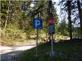 2
2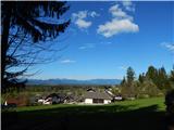 3
3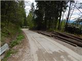 4
4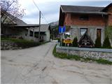 5
5 6
6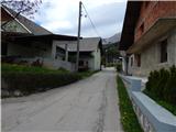 7
7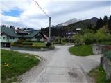 8
8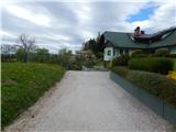 9
9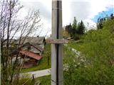 10
10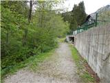 11
11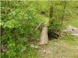 12
12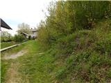 13
13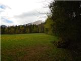 14
14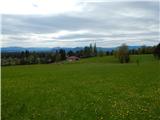 15
15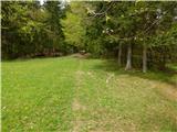 16
16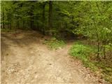 17
17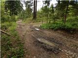 18
18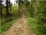 19
19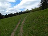 20
20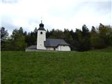 21
21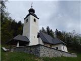 22
22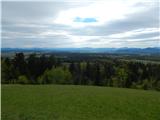 23
23 24
24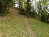 25
25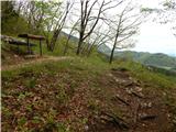 26
26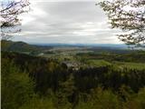 27
27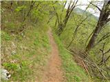 28
28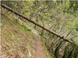 29
29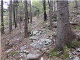 30
30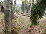 31
31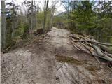 32
32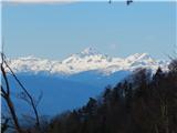 33
33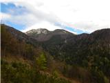 34
34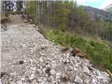 35
35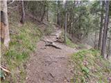 36
36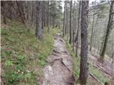 37
37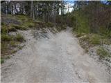 38
38 39
39 40
40 41
41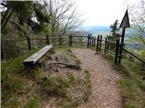 42
42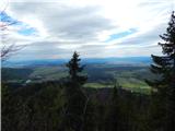 43
43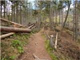 44
44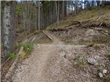 45
45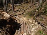 46
46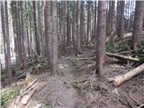 47
47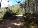 48
48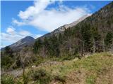 49
49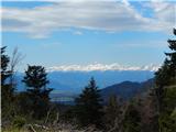 50
50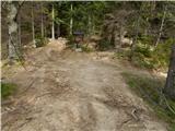 51
51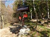 52
52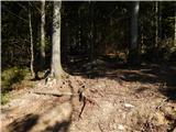 53
53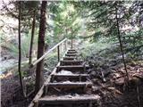 54
54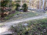 55
55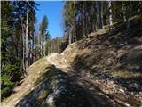 56
56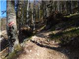 57
57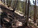 58
58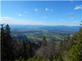 59
59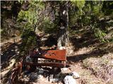 60
60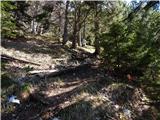 61
61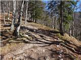 62
62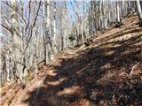 63
63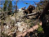 64
64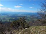 65
65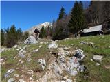 66
66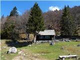 67
67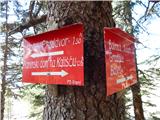 68
68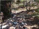 69
69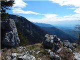 70
70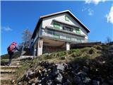 71
71 72
72 73
73
Discussion about the trip Mače - Dom na Kališču (via Sveti Miklavž)
To post a comment you must log in:
If you do not yet have a username, you must first
register.