Mače - Bašeljski vrh (through valley of Suha)
Starting point: Mače (586 m)
| Latitude/Longitude: | 46,31310°N 14,41870°E |
| |
Route name: through valley of Suha
Walking time: 3 h 15 min
Difficulty: easy pathless terrain
Elevation gain: 1158 m
Elevation difference along the route: 1160 m
Map: Karavanke - osrednji del 1:50.000
Recommended equipment (summer):
Recommended equipment (winter): ice axe, crampons
Views: 5.350
 | 1 person like this post |
Access to starting point:
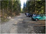
a) From the Ljubljana - Jesenice motorway take the Kranj - east exit, then continue driving towards Jezersko. When arriving in Preddvor leave the main road and continue left towards the centre of the mentioned place, from there follow the signs for Mače. When arriving in Mače, at the marked junction continue right (left Bašelj, straight church of St. Nicholas (church not accessible by car)) and drive up the narrow road above the village, where there is a larger marked parking lot.
b) From the Jesenice - Ljubljana motorway take the Kranj - west exit and at the first junction continue left. Then drive through the underpass under the motorway, then arrive at the roundabout, from which continue driving towards Golnik. The road ahead leads through the settlement Mlaka pri Kranju, we at the end of the settlement continue right towards the settlement Srakovlje. Driving continues through Srakovlje, Spodnja Bela, Srednja Bela to Zgornja Bela, where we continue right towards Preddvor. In Preddvor notice the signs for Mače, which direct us left past the elementary school to the road that climbs to Mače. When arriving in Mače, at the marked junction continue right (left Bašelj, straight church of St. Nicholas (church not accessible by car)) and drive up the narrow road above the village, where there is a larger marked parking lot.
Route description:
From the parking lot return to the road from which we turned onto the parking lot and continue the ascent along it in the direction of Kališče. Initially we walk through the forest, the road approaches the Suha stream a few minutes higher, which it also crosses twice a bit further on. After approximately 20 minutes we arrive at a marked junction, where the usual path towards Kališče continues left, we however continue right in the direction of Srednji vrh, Kališče over Kozjek and Shelter in Hudičev boršt over Kozjek. The increasingly poor road brings us a little further to a freight cableway that leads towards Dom na Kališču, the road then gradually turns into a wide cart track.
We follow the marked cart track for some more time, then, when it splits into two parts, continue on the left wider unmarked cart track (a cairn is at the junction). Continue the ascent on the mentioned cart track, which steeply ascends through a belt of unwooded slope. Higher the cart track ends, we continue on a nicely traceable but quite steep path, which higher enters dense forest. This is followed by approximately 20 minutes of ascent and we join a marked path, which we follow left towards Dom na Kališču (right Hudičev boršt).
We follow the marked path only a few dozen meters, then just before the marked path turns sharply left, we leave it and continue the ascent straight ahead on a barely visible little path. The path quickly disappears in the forest, we however continue in the same direction. The path then quickly brings us from the forest onto a scree overgrown with dwarf pines, on and beside which we ascend towards Mačensko sedlo. Although the "path" is harder to follow in some places, there are no major orientation problems, as we always continue in the same direction (i.e. towards the saddle between Bašeljski vrh and Mali Grintovec). Higher we have to push through a short belt of dwarf pines, however the passage is not particularly demanding, as through the mentioned section a nicely visible, otherwise completely overgrown little path is visible. Further the path brings us out of the dwarf pines and after a few steps of further walking we arrive at Mačensko sedlo, where we again step onto the marked path.
Continue slightly left in the direction of Bašeljski vrh (sharply left Kališče, right Mali Grintovec) on the path that starts to ascend steeply on and beside the eastern ridge of the aforementioned peak. This relatively steep and increasingly panoramic path we follow all the way to the summit, which we reach after approximately 20 minutes of walking from Mačensko sedlo.
Starting point - Studenci 0:25, Studenci - junction to Suha valley 0:35, junction to Suha valley - Suha valley 1:05, Suha valley - Mačensko sedlo 0:50, Mačensko sedlo - Bašeljski vrh 0:20.

Along the route: Studenci (737m), Spodnja postaja tovorne žičnice (800m), Odcep v dolino Suhe (916m), Dolina Suhe (1322m), Mačensko sedlo (1622m)
Photos:
 1
1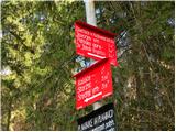 2
2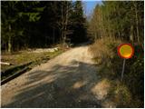 3
3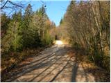 4
4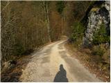 5
5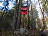 6
6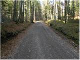 7
7 8
8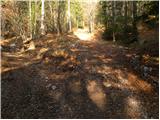 9
9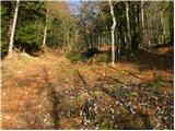 10
10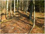 11
11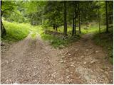 12
12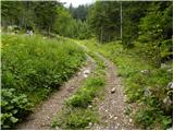 13
13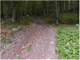 14
14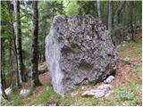 15
15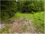 16
16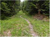 17
17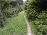 18
18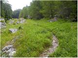 19
19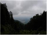 20
20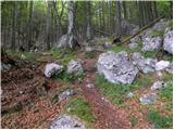 21
21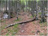 22
22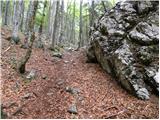 23
23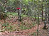 24
24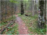 25
25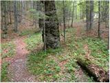 26
26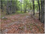 27
27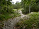 28
28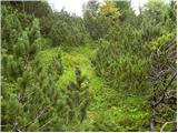 29
29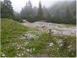 30
30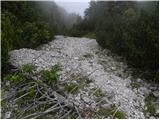 31
31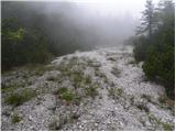 32
32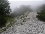 33
33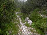 34
34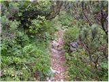 35
35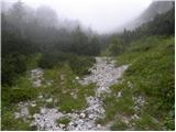 36
36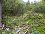 37
37 38
38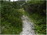 39
39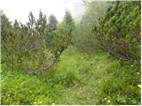 40
40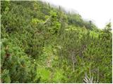 41
41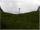 42
42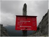 43
43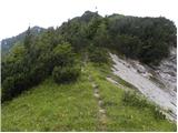 44
44 45
45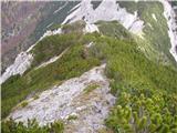 46
46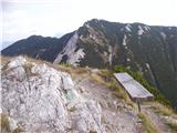 47
47
Discussion about the trip Mače - Bašeljski vrh (through valley of Suha)
To post a comment you must log in:
If you do not yet have a username, you must first
register.