Mače - Bašeljski vrh (via Kozjek)
Starting point: Mače (586 m)
| Latitude/Longitude: | 46,31310°N 14,41870°E |
| |
Route name: via Kozjek
Walking time: 3 h 30 min
Difficulty: easy marked way
Elevation gain: 1158 m
Elevation difference along the route: 1175 m
Map: Karavanke - osrednji del 1:50.000
Recommended equipment (summer):
Recommended equipment (winter): ice axe, crampons
Views: 2.828
 | 2 people like this post |
Access to starting point:
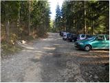
a) From the Ljubljana-Jesenice motorway, take the Kranj-east exit, then continue driving towards Jezersko. When arriving in Preddvor, leave the main road and continue left towards the centre of the mentioned town, from there follow the signs for Mače. When arriving in Mače, at the marked junction continue right (left Bašelj, straight church of St. Nicholas (the church is not accessible by car)) and drive up the narrow road above the village, where there is a larger marked parking lot.
b) From the Jesenice-Ljubljana motorway, take the Kranj-west exit and at the first junction continue left. Then drive through the underpass under the motorway, then arrive at a roundabout, from which continue driving towards Golnik. The road ahead leads through the settlement of Mlaka pri Kranju, we, at the end of the settlement, continue right towards the settlement of Srakovlje. This is followed by driving through Srakovlje, Spodnja Bela, Srednja Bela to Zgornja Bela, where we continue right towards Preddvor. In Preddvor, notice the signs for Mače, which direct us left past the primary school to the road that climbs to Mače. When arriving in Mače, at the marked junction continue right (left Bašelj, straight church of St. Nicholas (the church is not accessible by car)) and drive up the narrow road above the village, where there is a larger marked parking lot.
Route description:
From the parking lot continue towards Kališče and follow the forest road closed to public traffic. The road, which rises quite steeply, brings us after about 20 minutes of walking to a marked junction, where the usual path to Kališče branches left, we continue right and proceed along the increasingly poor forest road. A little higher we reach the lower station of the cargo cableway to Kališče, and the road gradually turns into a wide cart track. The ascent further on is somewhat orientationally more difficult due to the labyrinth of cart tracks, but if we carefully follow the markers, we cannot miss it. Higher up the cart track turns into a steep footpath, which after a while brings us to the ridge of Kozjek. Here the path levels out and turns left, bringing us after a few more minutes of walking to a marked junction.
Continue left towards Storžič and Kališče (right Srednji vrh, Hudičev boršt, Potoška gora and sv. Jakob) along the path that further crosses the slopes to the left. During the crossing we will come to a small scree, from which we get the first view towards the valley. A short crossing follows and the path brings us to the Suha valley, where a somewhat shorter unmarked path joins from the left.
Continue towards Kališče and continue the ascent along the gradually steeper path. The path ahead climbs through dense forest for a while longer, then brings us to the foot of rocky cliffs and a little higher to the ridge, where a small hut is visible just a few metres off the path. Here the path turns right and steeply ascends over a short rocky step. The path levels out here and a few metres further joins the usual path leading to Kališče.
Continue towards Kališče and ascend along a moderately steep path, along which after 5 minutes of further walking we arrive at the Planinski dom na Kališču.
Behind the Dom na Kališču we notice a mountaineering direction sign with numerous options for continuing the path. Continue along the gentle and scenic ridge path towards Storžič, Bašeljski vrh..., which continues northwards. After a few minutes of easy walking with beautiful views reaching to the Julian Alps, we arrive at a junction, where we continue right (straight Storžič) towards Bašeljski vrh. The path ahead rises more steeply through a belt of dwarf pines and brings us with nice views of the neighbouring Mali Grintovec to the dwarf pine-covered ridge of Bašeljski vrh, where in the next few minutes we arrive at the next well-marked junction. At the junction the path to Mali Grintovec and Srednji vrh branches right, we continue straight and with a view of Storžič continue the ascent. The path, which runs along and on the dwarf pine-covered ridge, joins a little below the summit the path from Jekarica and Bašeljski preval. Here we continue right and along a somewhat narrower ridge reach Bašeljski vrh in one minute of further walking, from which we get a beautiful view towards the mountains above Jezersko, with the view extending to Košuta, Obir and the Labotniške Alpe in Austria.
Starting point - Studenci 0:25, Studenci - junction into Suha valley 0:35, junction into Suha valley - junction on Kozjek 0:50, junction on Kozjek - Suha valley 0:20, Suha valley - junction below Kališče 0:30, junction below Kališče - Dom na Kališču 0:05, Dom na Kališču - junction on Kališče 0:10, junction above Kališče - junction below Bašeljski vrh 0:15, junction below Bašeljski vrh - Bašeljski vrh 0:20.

Along the route: Dom na Kališču mountain hut (737m), Spodnja postaja tovorne žičnice (800m), Odcep v dolino Suhe (916m), Greben Kozjeka (1175m), Razpotje Kozjek (1281m), Dolina Suhe (1322m), Razpotje pod Kališčem (1509m),
Dom na Kališču (1534m), Razpotje nad Kališčem (1570m), Razpotje pod Bašeljskim vrhom (1643m)
Photos:
 1
1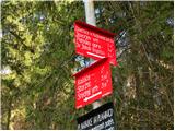 2
2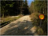 3
3 4
4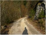 5
5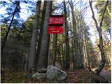 6
6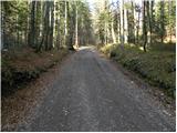 7
7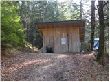 8
8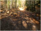 9
9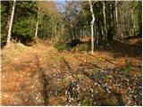 10
10 11
11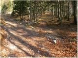 12
12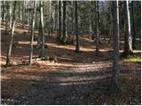 13
13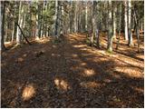 14
14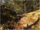 15
15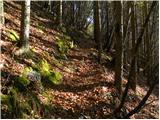 16
16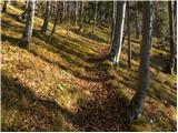 17
17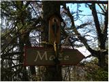 18
18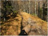 19
19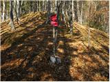 20
20 21
21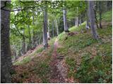 22
22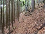 23
23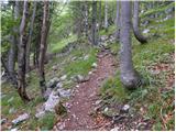 24
24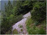 25
25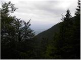 26
26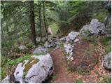 27
27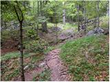 28
28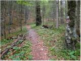 29
29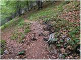 30
30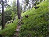 31
31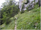 32
32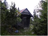 33
33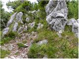 34
34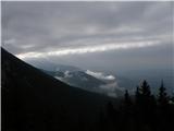 35
35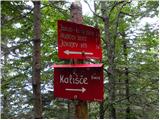 36
36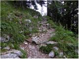 37
37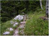 38
38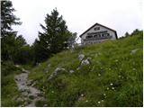 39
39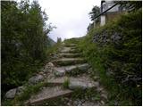 40
40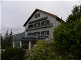 41
41 42
42 43
43 44
44 45
45 46
46 47
47 48
48 49
49 50
50 51
51 52
52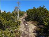 53
53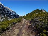 54
54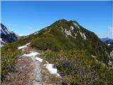 55
55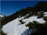 56
56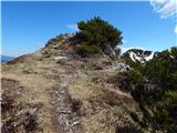 57
57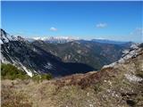 58
58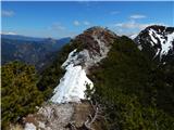 59
59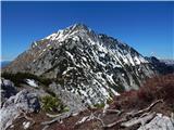 60
60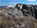 61
61 62
62
Discussion about the trip Mače - Bašeljski vrh (via Kozjek)
To post a comment you must log in:
If you do not yet have a username, you must first
register.