Mače - Cjanovca (Mačenska pot and on SE ridge)
Starting point: Mače (586 m)
| Latitude/Longitude: | 46,31310°N 14,41870°E |
| |
Route name: Mačenska pot and on SE ridge
Walking time: 3 h 40 min
Difficulty: easy marked way
Elevation gain: 1234 m
Elevation difference along the route: 1285 m
Map: Karavanke - osrednji del 1:50.000
Recommended equipment (summer):
Recommended equipment (winter): ice axe, crampons
Views: 24.167
 | 2 people like this post |
Access to starting point:
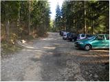
a) From the Ljubljana-Jesenice motorway take the Kranj-east exit, then continue driving towards Jezersko. When arriving in Preddvor leave the main road and continue left towards the centre of the mentioned place, from there follow the signs for Mače. When arriving in Mače, at the marked junction continue right (left Bašelj, straight church of St. Nicholas (church not accessible by car)) and drive up the narrow road above the village, where there is a larger marked parking lot.
b) From the Jesenice-Ljubljana motorway take the Kranj-west exit and at the first junction continue left. Then drive through the underpass under the motorway, then arrive at the roundabout, from which continue driving towards Golnik. The road ahead leads through the settlement Mlaka pri Kranju, we, at the end of the settlement, continue right towards the settlement Srakovlje. Driving continues through Srakovlje, Spodnja Bela, Srednja Bela to Zgornja Bela, where continue right towards Preddvor. In Preddvor notice the signs for Mače, which direct us left past the primary school to the road that ascends to Mače. When arriving in Mače, at the marked junction continue right (left Bašelj, straight church of St. Nicholas (church not accessible by car)) and drive up the narrow road above the village, where there is a larger marked parking lot.
Route description:
At the beginning of the large parking lot above Mače we notice mountaineering direction signs, we continue right across the entire parking lot in the direction of Zavetišče v Hudičevem borštu, Javorov or Javorjev vrh, Potoška gora and sv. Jakob. From the end of the parking lot a marked cart track continues, which we follow. The cart track, which has some minor junctions in the lower part where we follow the marks, first ascends gently to moderately, then for a short time a bit steeper. After crossing the torrent the cart track gradually flattens and brings us to a marked junction, where the mountaineering direction signs direct us left onto a well-trodden and nicely maintained mountain path. The marked path immediately enters quite dense forest, through which it ascends for some time along the torrent gully, then turns a bit more to the right and brings us in a few zigzags to a less noticeable junction, where the path to Dom na Kališču branches left (the junction is marked with a sign on the tree), we continue straight on the path that gradually brings us to sparser forest. Higher up the increasingly sparse forest ends and the path brings us to scenic grassy slopes, from which a nice view of Gorenjska opens up. Follows another good 10 minutes of ascent on the mentioned grassy slope and we arrive at the spring in Hudičev boršt, next to which there is a marked junction.
Again continue right (left Dom na Kališču, Dolga njiva, Srednji vrh...) and after one or two minutes of further walking arrive at Zavetišče v Hudičevem borštu.
From the shelter continue eastwards, where we quickly leave Hudičev boršt and arrive at the place where we step out of the forest. On the initial part where we step out of the forest, a wire cable assists in the moderate descent, which continues for a few meters of traversing across a relatively steep slope. The path continues along the fairly steep grassy slope of Zaplate, which is extremely avalanche-prone in winter. Traversing the grassy slope, which is especially in wet dangerous for slipping at some places, otherwise technically undemanding, ends after about 15 minutes and the path brings us into the forest. Follows another about 15 minutes of traversing through the forest, then we arrive at a marked junction, where we continue left towards Cjanvci and Srednji vrh (right Javorov vrh, Potoška gora, Spodnja Kokra, sv. Jakob...).
Continue left in the direction of Cjanovce and Srednji vrh along the path that begins to ascend more steeply along and on the eastern ridge of Cjanovce. Higher up the path brings us out of the forest onto slopes overgrown with dwarf pines, we continue along the increasingly steep and locally very scenic path. The path, from which nice views open up to Kočna, Grintovec, Kalški greben and Gorenjska, slowly turns slightly to the left. We follow this increasingly scenic and relatively steep path all the way to the summit of Cjanovce, on which there is a bench and a small cairn.
Mače - Hudičev boršt 1:55, Hudičev boršt - Skodovnjek 0:30, Skodovnjek - Cjanovca 1:15.

The trip can be extended to the following destinations: Srednji vrh
Photos:
 1
1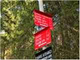 2
2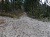 3
3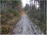 4
4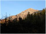 5
5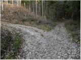 6
6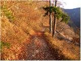 7
7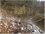 8
8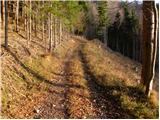 9
9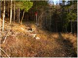 10
10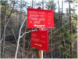 11
11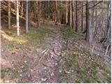 12
12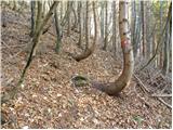 13
13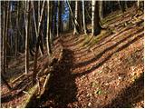 14
14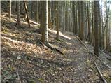 15
15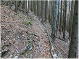 16
16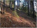 17
17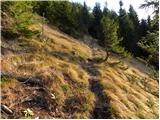 18
18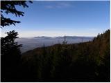 19
19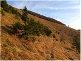 20
20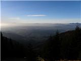 21
21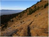 22
22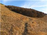 23
23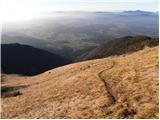 24
24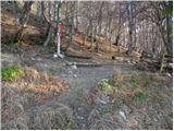 25
25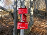 26
26 27
27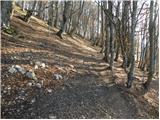 28
28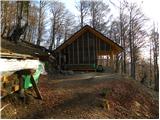 29
29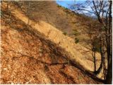 30
30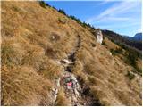 31
31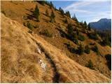 32
32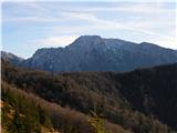 33
33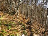 34
34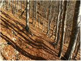 35
35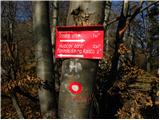 36
36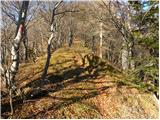 37
37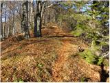 38
38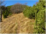 39
39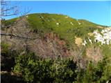 40
40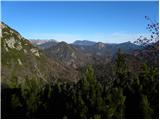 41
41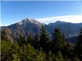 42
42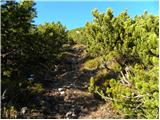 43
43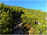 44
44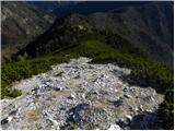 45
45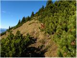 46
46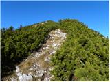 47
47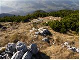 48
48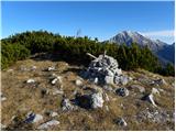 49
49 50
50
Discussion about the trip Mače - Cjanovca (Mačenska pot and on SE ridge)
|
| Parkeljc31. 12. 2010 |
Yesterday I chose this tour, admittedly started a bit late, at 11, arrival in the valley accordingly, in pitch dark at 17:20! Up to the path where it joins from Kokra direction, almost no snow, further on it can be quite annoying, although not much, as it sinks deeply between the bushes if not frozen. Just below the summit, danger of slipping in some places, so I tackle the last meters with classic crampons. Reach the summit at 15:00, wonderful view all around, no time for Srednji vrh, so I quickly head towards Hudičev boršt and down to the valley, arriving almost in pitch dark. Good to know there's high avalanche danger on this path (some were still on the way), as the slope is quite steep.
|
|
|
|
| golmat20. 02. 2011 |
MOUNTAIN LOVERS,
MOUNTAINS AND HILLS ARE QL 
9.2.2011 went to Cjanovca from Preddvor via Potoška gora, Javorjev vrh and onwards to Cjanovca - the tour is very,very nice,not too strenuous and rewards you with really beautiful views of the surrounding peaks,"Kranjska dolina",Kokra valley,Grintovec, Kočno,Kalški greben and ..... At that time nature served me views that are only for GODS. I'll definitely go to Cjanovca again as soon as spring advances a bit more into our region and there will be plenty of flowers too.
From Preddvor to the top it took me about 4 hours of moderate slow walking.
Whoever knows how to listen to the quiet speech of our mountains and hills knows what QuuuL is.
|
|
|
|
| funnyboy6. 06. 2014 |
Does anyone know if the Mačenska trail is nicely cleared or if there are still many fallen trees?
|
|
|
|
| Kobra 16. 06. 2014 |
The trail is nicely cleared ...
|
|
|
|
| Lisica29. 04. 2015 |
Today did the path from Mače gor over Dolge njive to Srednji vrh and nearby Cjanovca and descent via the path described above to Hudičev boršt. Very nice circular path for building fitness.
|
|
|
|
| mojlajf21. 04. 2019 |
Has anyone been up there these days, any snow left? Thanks for info.
|
|
|
|
| KarmenT21. 04. 2019 |
On Friday, 19.4., via Mačenska pot to Cjanovca and Srednji vrh. Wonderful views in all directions. Just below Cjanovca summit some minor softened snow, which can be crossed without issues. Similarly some minor snow further towards Srednji vrh. Descent towards planina Dolga njiva, where the path from Mali Grintovec joins. Quite some snow, only a faint track visible, but snow softened and descent without issues. We apparently missed the direct path from Srednji vrh summit and made it a bit longer. Traversed without winter gear. Very nice day.
|
|
|
|
| tango5. 05. 2022 16:55:13 |
Today via Mačenska path along the SE ridge to Cjanovca, then to Sr. vrh and instead of directly to Dolge njive, extension along the path towards M. Grintovcu. At the saddle we turned back towards Dolge njive and down to Mače. Total 13 km and a bit over 1350 m elevation gain. It was nice, especially the ridge section. From Sr. vrh towards M. Grintovcu still some snow and a few puddles up to ankle-deep, but bottom line, great tour at the right time when there was no haze and thus good views.
|
|
|
To post a comment you must log in:
If you do not yet have a username, you must first
register.