Mače - Dom na Kališču (by road)
Starting point: Mače (586 m)
| Latitude/Longitude: | 46,31310°N 14,41870°E |
| |
Route name: by road
Walking time: 2 h 30 min
Difficulty: easy marked way
Elevation gain: 948 m
Elevation difference along the route: 948 m
Map: Karavanke - osrednji del 1:50.000
Recommended equipment (summer):
Recommended equipment (winter): ice axe, crampons
Views: 5.445
 | 1 person like this post |
Access to starting point:
a) From the Ljubljana-Jesenice motorway take the Kranj-east exit, then continue driving towards Jezersko. When arriving in Preddvor leave the main road and continue left towards the centre of the mentioned place, from there follow the signs for Mače. When arriving in Mače, at the marked junction continue right (left Bašelj, straight church of St. Nicholas (church not accessible by car)) and drive up the narrow road above the village, where there is a large marked parking lot.
b) From the Jesenice-Ljubljana motorway take the Kranj-west exit and in the first junction continue left. Then drive through the underpass under the motorway, then arrive at the roundabout, from which continue driving towards Golnik. The road ahead leads through the settlement Mlaka pri Kranju, we at the end of the settlement continue right towards the settlement Srakovlje. We continue driving through Srakovlje, Spodnja Bela, Srednja Bela to Zgornja Bela, where continue right towards Preddvor. In Preddvor notice the signs for Mače, which direct us left past the primary school to the road that climbs to Mače. When arriving in Mače, at the marked junction continue right (left Bašelj, straight church of St. Nicholas (church not accessible by car)) and drive up the narrow road above the village, where there is a large marked parking lot.
Route description:
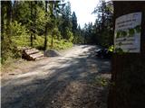
From the parking lot return to the road from which we turned onto the parking lot and continue the ascent towards Kališče. Initially we walk through the forest, the road approaches the Suha stream a few minutes higher, which it also crosses twice a bit further on. After about 20 minutes we arrive at a marked junction, where the usual path to Kališče continues left, we continue right towards Srednji vrh, Kališče via Kozjek and Zavetišče v Hudičevem borštu via Kozjek. The increasingly poor road brings us a little further to a freight cableway that leads towards Dom na Kališču, we at the first junction after the freight cableway continue along the left unmarked cart track (right Srednji vrh and Kališče via Kozjek). Continue along the cart track or wide logging trail, at junctions following the "main" cart track. In moderate ascent in a few minutes we reach a belt of wild garlic growth and a belt of sparse forest, from where some views open up. A short traverse ascent follows and we join the usual path from Mače.
We reach the marked path on a small saddle north of Gora (994 m), from there we follow it towards Kališče. For a few minutes we ascend through dense spruce forest, then join a poorer road along which we continue the ascent for a few minutes. We leave the road when we notice the continuation of the mountain path on the right side (the branch is well marked). The path ahead moves to a steeper slope and ascends relatively steeply in numerous switchbacks. Higher up the forest temporarily thins and a nice view opens to the south. In the area of sparse forest a wooden bench also provides a pleasant rest, a little further a still functioning clock on a tree "surprises" us. Continuing we traverse somewhat more to the right, so that we reach the forested southern ridge of Kališče. On the mentioned ridge the path turns sharply left, then ascends in a few switchbacks to Spodnje Kališče, from where a nice view of Storžič opens.
When above Spodnje Kališče the path returns to the forest, the path from Laškega also joins from the left (also the path from Bašelj past Košuta hospital). A few more minutes of walking through the forest follow and we arrive at a nice viewpoint, from where a nice view opens towards the nearby Dom na Kališču, Mali Grintavec, Lanež ridge, Krvavec... From the viewpoint only a short ascent remains and we are already at Dom na Kališču.
Starting point - Studenci 0:25, Studenci - za Goro 0:40, za Goro - Spodnje Kališče 1:10, Spodnje Kališče - Dom na Kališču 0:15.

Photos:
 1
1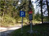 2
2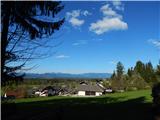 3
3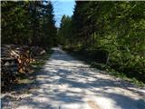 4
4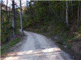 5
5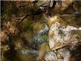 6
6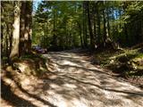 7
7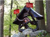 8
8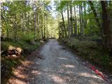 9
9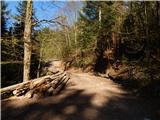 10
10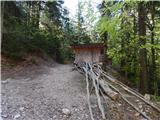 11
11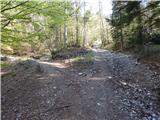 12
12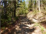 13
13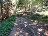 14
14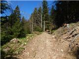 15
15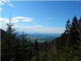 16
16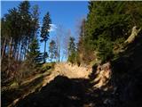 17
17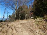 18
18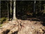 19
19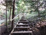 20
20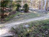 21
21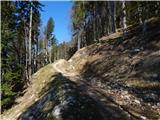 22
22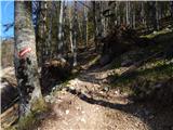 23
23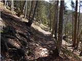 24
24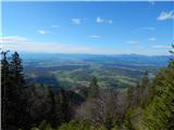 25
25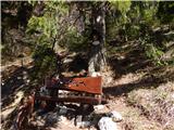 26
26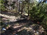 27
27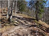 28
28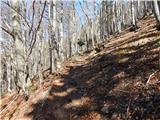 29
29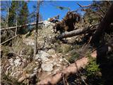 30
30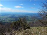 31
31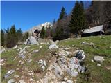 32
32 33
33 34
34 35
35 36
36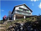 37
37 38
38 39
39
Discussion about the trip Mače - Dom na Kališču (by road)
|
| balon9. 10. 2023 08:42:32 |
Hello
can you reach photo 7 by car? We have a member recovering and the 2+ hour schedule is currently a big effort for him.
Thanks for answers.
|
|
|
|
| ppegan9. 10. 2023 09:30:45 |
In principle yes, or it depends on the condition of the road and how much you care about your car  If there are many potholes, I don't recommend it for lower cars. With a higher car you can always reach that starting point. If there are many potholes, I don't recommend it for lower cars. With a higher car you can always reach that starting point.
|
|
|
|
| balon9. 10. 2023 10:21:44 |
|
|
|
|
| michael669. 10. 2023 10:33:19 |
Sometimes we parked there 
|
|
|
To post a comment you must log in:
If you do not yet have a username, you must first
register.