Mače - Dom na Kališču (through valley of Suha)
Starting point: Mače (586 m)
| Latitude/Longitude: | 46,31310°N 14,41870°E |
| |
Route name: through valley of Suha
Walking time: 2 h 40 min
Difficulty: easy unmarked way
Elevation gain: 948 m
Elevation difference along the route: 950 m
Map: Karavanke - osrednji del 1:50.000
Recommended equipment (summer):
Recommended equipment (winter): ice axe, crampons
Views: 7.456
 | 1 person like this post |
Access to starting point:
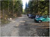
a) From the Ljubljana–Jesenice motorway, take the Kranj–east exit, then continue driving towards Jezersko. When you arrive in Preddvor, leave the main road and continue left towards the centre of the aforementioned place; from there, follow the signs for Mače. When you arrive in Mače, at the marked junction continue right (left Bašelj, straight Church of St. Nicholas (the church is not accessible by car)) and drive up the narrow road above the village, where there is a large marked parking lot.
b) From the Jesenice–Ljubljana motorway, take the Kranj–west exit and at the first junction continue left. Continue through the underpass beneath the motorway, then arrive at a roundabout from which continue driving towards Golnik. The road leads through the settlement of Mlaka pri Kranju; at the end of the settlement, continue right towards the settlement of Srakovlje. Continue driving through Srakovlje, Spodnja Bela, Srednja Bela to Zgornja Bela, where continue right towards Preddvor. In Preddvor, notice the signs for Mače, which direct left past the primary school onto the road that ascends to Mače. When you arrive in Mače, at the marked junction continue right (left Bašelj, straight Church of St. Nicholas (the church is not accessible by car)) and drive up the narrow road above the village, where there is a large marked parking lot.
Route description:
From the parking lot return to the road from which you turned onto the parking lot and continue the ascent towards Kališče. Initially walk through the forest; the road approaches the Suha stream a few minutes higher, which it also crosses twice a bit further on. After about 20 minutes arrive at a marked junction where the usual path to Kališče continues left, but continue right towards Srednji vrh, Kališče via Kozjek and Zavetišče v Hudičevem borštu via Kozjek. The increasingly poor road soon brings you to a freight cableway leading towards Dom na Kališču; behind it the road gradually turns into a wide cart track.
Follow the marked cart track a bit longer, then when it forks into two parts, continue on the left wider unmarked cart track (a cairn is at the junction). Continue the ascent on the mentioned cart track, which steeply ascends through a belt of barren slope. Higher up the cart track ends; continue on a well-followable but fairly steep path which higher enters dense forest. Another approx. 20 minutes of ascent follows and you join a marked path, which follow left (right Hudičev boršt).
Continue towards Kališče on a path that temporarily levels out, then gradually begins to ascend more steeply. The path continues ascending through dense forest for some time, then brings you to the foot of rocky cliffs and just a bit higher to the ridge, where a small hut is spotted a few metres off the path. Here the path turns right and steeply climbs over a short rocky step. The path levels here and a few metres further joins the usual path leading to Kališče.
Continue towards Kališče and continue the ascent on a moderately steep path, after which in 5 more minutes of walking you reach Planinski dom na Kališču.
Starting point - Studenci 0:25, Studenci - junction to Suha valley 0:35, junction to Suha valley - Suha valley 1:05, Suha valley - junction below Kališče 0:30, junction below Kališče - Dom na Kališču 0:05.

Along the route: Studenci (737m), Spodnja postaja tovorne žičnice (800m), Odcep v dolino Suhe (916m), Dolina Suhe (1322m), Razpotje pod Kališčem (1509m)
Photos:
 1
1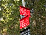 2
2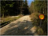 3
3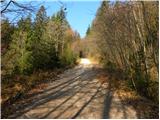 4
4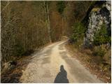 5
5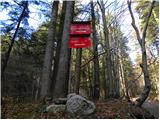 6
6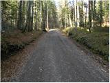 7
7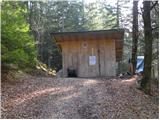 8
8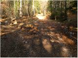 9
9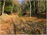 10
10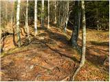 11
11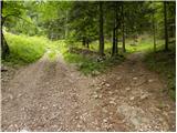 12
12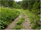 13
13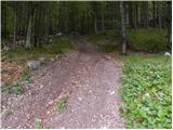 14
14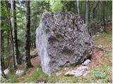 15
15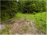 16
16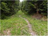 17
17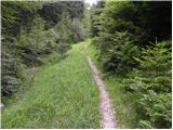 18
18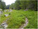 19
19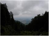 20
20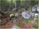 21
21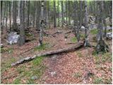 22
22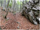 23
23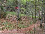 24
24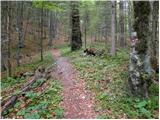 25
25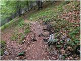 26
26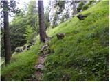 27
27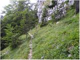 28
28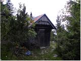 29
29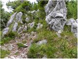 30
30 31
31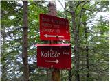 32
32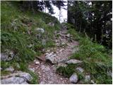 33
33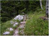 34
34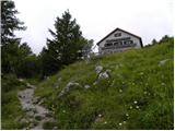 35
35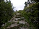 36
36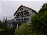 37
37
Discussion about the trip Mače - Dom na Kališču (through valley of Suha)
To post a comment you must log in:
If you do not yet have a username, you must first
register.