Starting point: Mače (586 m)
| Latitude/Longitude: | 46,3131°N 14,4187°E |
| |
Walking time: 2 h 15 min
Difficulty: easy marked way
Elevation gain: 864 m
Elevation difference along the route: 865 m
Map: Karavanke - osrednji del 1:50.000
Recommended equipment (summer):
Recommended equipment (winter): ice axe, crampons
Views: 19.163
 | 3 people like this post |
Access to starting point:
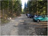
From the Ljubljana - Jesenice motorway, take the Kranj - east exit and continue following the road towards Jezersko, but only to the village of Tupaliče. Here, the sign for Preddvor directs us left, and we then follow the road to the neighbouring village of Mače. Through the village of Mače, follow the mountain trail signs for Kališče. Shortly after the village, we will notice a marked parking lot where we park (further driving is prohibited).
Route description:
From the parking lot, we return a few dozen steps back, i.e., to the road from which we turned into the parking lot, and continue uphill along it towards Dom na Kališču and Storžič. We walk along the road for just under half an hour, then at Studenci the path forks.
We choose the left path, marked for Kališče (right to Srednji vrh), cross the stream, and then immediately begin a steep ascent. A few minutes higher, we reach a forest road, which we also leave immediately and continue following the markers. We continue on the marked path, which runs between two forest roads, and higher up we ascend moderately in switchbacks for a while. Higher up we reach the forest road again, follow it uphill, but after a minute leave it and head onto the marked path, which brings us to a rest area and viewpoint with a bench in a few minutes of further ascent.
The path ahead returns to the forest and initially ascends gently, but the easy walk soon ends as after crossing the forest road we begin ascending in switchbacks through the forest again.
Here, before we start the steep ascent, a path from Bašlja joins from the left, and we then ascend in switchbacks on the steeper slope, crossing the forest road several times, always following the markers. Higher up, we occasionally get nice views towards Gorenjska, followed by a somewhat longer traverse to the right. Later, at about 1330 m altitude, the path turns left and, with the exception of a few switchbacks, ascends to the left. When we leave the forest, we have already reached the edge of Planina Kališče, and a little further on to the junction at Spodnje Kališče, where there are a few benches for rest.
Starting point - Studenci 0:25, Studenci - za Goro 0:40, za Goro - Spodnje Kališče 1:10.

Along the route: Studenci (737m), Za Goro (975m)
Photos:
 1
1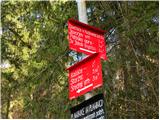 2
2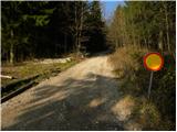 3
3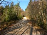 4
4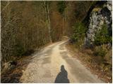 5
5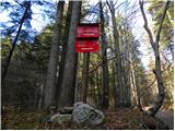 6
6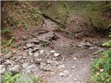 7
7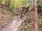 8
8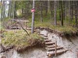 9
9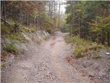 10
10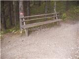 11
11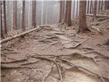 12
12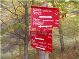 13
13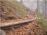 14
14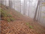 15
15 16
16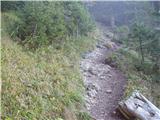 17
17 18
18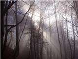 19
19 20
20
Discussion about the trip Mače - Planina Kališče
|
| Gost27. 01. 2007 |
was at the hut today, great view, it even "warmed up", the snow was ok to walk on, at the top though slush
|
|
|
To post a comment you must log in:
If you do not yet have a username, you must first
register.