Mače - Srednji vrh (via Kozjek and Dolga njiva)
Starting point: Mače (586 m)
| Latitude/Longitude: | 46,31310°N 14,41870°E |
| |
Route name: via Kozjek and Dolga njiva
Walking time: 3 h 35 min
Difficulty: easy marked way
Elevation gain: 1267 m
Elevation difference along the route: 1270 m
Map: Karavanke - osrednji del 1:50.000
Recommended equipment (summer):
Recommended equipment (winter): ice axe, crampons
Views: 39.452
 | 4 people like this post |
Access to starting point:
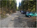
a) From the Ljubljana - Jesenice motorway take the Kranj - east exit, then continue driving towards Jezersko. When arriving in Preddvor leave the main road and continue left towards the centre of the mentioned place, from there follow the signs for Mače. When arriving in Mače, at the marked junction continue right (left Bašelj, straight church of St. Nicholas (the church is not accessible by car)) and drive up the narrow road above the village, where there is a larger marked parking lot.
b) From the Jesenice - Ljubljana motorway take the Kranj - west exit and at the first junction continue left. Continue driving through the underpass under the motorway, then arrive at the roundabout, from which continue driving towards Golnik. The route further leads through the settlement Mlaka pri Kranju, but at the end of the settlement continue right towards the settlement Srakovlje. Driving continues through Srakovlje, Spodnja Bela, Srednja Bela to Zgornja Bela, where continue right towards Preddvor. In Preddvor notice the signs for Mače, which direct left past the primary school onto the road that climbs to Mače. When arriving in Mače, at the marked junction continue right (left Bašelj, straight church of St. Nicholas (the church is not accessible by car)) and drive up the narrow road above the village, where there is a larger marked parking lot.
Route description:
From the parking lot continue towards Kališče and follow the forest road closed to public traffic. The road, which ascends quite steeply, brings us after about 20 minutes of walking to a marked junction, where the normal path to Kališče branches left, we continue right and proceed along the increasingly poor forest road. A little higher we reach the lower station of the cargo cableway to Kališče, and the road gradually turns into a wide cart track. The ascent further on is somewhat more difficult orientation-wise due to the labyrinth of cart tracks, but if we carefully follow the markers, we cannot go wrong. Higher up the cart track turns into a steep footpath, which after a while brings us to the ridge of Kozjek. Here the path levels out and turns left, bringing us after a few more minutes of walking to a marked junction.
Continue right towards Srednji vrh, Hudičev boršt, Potoška gora and sv. Jakob (left Kališče and Storžič) along the path that crosses the slopes to the right, and after a few minutes we arrive at the next junction.
This time continue left towards Cjanovce, Srednji vrh and Mali Grintovec along the path (straight Zavetišče v Hudičevem borštu and Mačenska pot to Mače), which begins to ascend more steeply through the forest. The quite steep path higher up brings us to a small valley, where the forest thins out and the path levels. After a few minutes walking along this valley the path turns right, ascends more steeply and after a short ascent brings us to the shepherd hut on Planina Dolga njiva.
From the hut on Dolga njiva continue straight towards Cjanovce and Srednji vrh (left Mali Grintovec, right pathless to Hudičev boršt) along the path that first ascends over the grassy slope, then enters a belt of dwarf pines, continuing along a wide clearing. The path, ascending transversely towards the east, brings us higher to a less noticeable junction, where the path from the summit of Cjanovce joins from the right. Here continue left and after a few more steps we step onto the main ridge of Srednji vrh, which we follow left. Continue the ascent along the scenic path, which after a few more minutes of walking brings us to Srednji vrh.
Starting point - Studenci 0:25, Studenci - junction to Suha valley 0:35, junction to Suha valley - junction on Kozjek 0:50, junction on Kozjek - junction below Dolga njiva 0:05, junction below Dolga njiva - Planina Dolga njiva 0:55, Planina Dolga njiva - Cjanovca saddle 0:35, Cjanovca saddle - Srednji vrh 0:10.

Along the route: Studenci (737m), Spodnja postaja tovorne žičnice (800m), Odcep v dolino Suhe (916m), Greben Kozjeka (1175m), Razpotje Kozjek (1281m), Razpotje pod Dolgo njivo (1282m),
Planina Dolga njiva (1600m), Sedlo Cjanovca (1802m)
Photos:
 1
1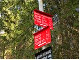 2
2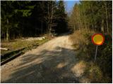 3
3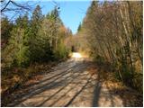 4
4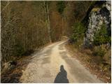 5
5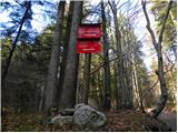 6
6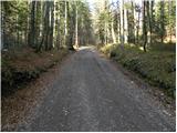 7
7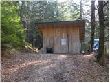 8
8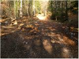 9
9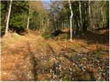 10
10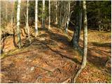 11
11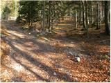 12
12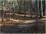 13
13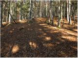 14
14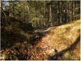 15
15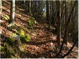 16
16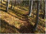 17
17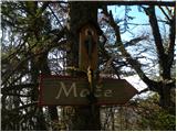 18
18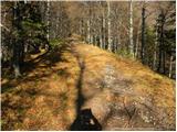 19
19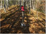 20
20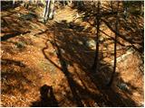 21
21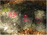 22
22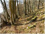 23
23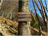 24
24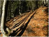 25
25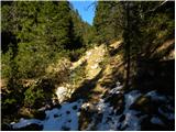 26
26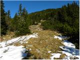 27
27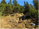 28
28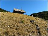 29
29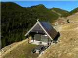 30
30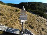 31
31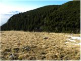 32
32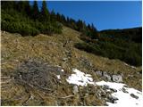 33
33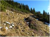 34
34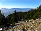 35
35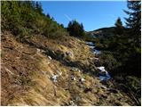 36
36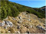 37
37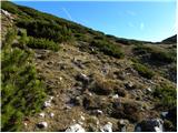 38
38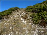 39
39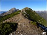 40
40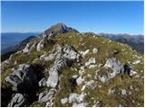 41
41 42
42
Discussion about the trip Mače - Srednji vrh (via Kozjek and Dolga njiva)
|
| jurc3. 03. 2008 |
Yesterday I did a circular tour. Started in Preddvor then to Sv. Jakoba, onwards to Potoško goro and Javorjev vrh. Followed crossing towards Cjanovci and ascent to it, finally via Srednji vrh ended the path in Mačah.
Path from Srednji vrh towards Mače is not trodden so sinking up to the butt
best, jure
|
|
|
|
| WLBozag4. 05. 2008 |
Today we treated ourselves to the beauties of Dolge njive and Srednji vrh from the direction of Mač. Unfortunately, it was still sinking up to the butt in places today. But fortunately there are also patches of bare ground in between, so it was manageable.
There is also a little snow in the gully before Dolge njive.
And I really must praise the bench and table before the weekend hut on Dolge njive. On the way back it provided a pleasant spot for rest and snack.
|
|
|
|
| daša25. 12. 2008 |
I used Christmas day to visit Srednji vrh from Mače. Snow starts a little below Dolge njive, the trail is made. On the way back, fog and snow caught me  , so I quickly returned to the valley. , so I quickly returned to the valley.
|
|
|
|
| zabica26. 07. 2010 |
The path from Srednji vrh to Dolge njive is very poorly marked. Markers??
|
|
|
|
| serajko26. 07. 2010 |
Zabica
Which path do you mean, the ridge one or back towards the hut. Towards the hut is problematic due to tall grass. I think it's not a problem to follow it as last year a new clearing of brushwood was made.
lp
|
|
|
|
| zabica27. 07. 2010 |
Hi Serajko
We had a problem descending from Srednji vrh to Dolge Njive. We came from Mali Grintovec to Srednji vrh and wanted to descend to the hut. If you go from the hut to the summit, it's probably no problem to go back down, but since we didn't know and from above it's hard to see down, we couldn't find it, so we went back towards Mali Grintovec and then turned left onto a path that brought us to Dolgo Njivo. I know grass is a problem (and there was even a dead sheep on the path ) so maybe they could put up a sign on a stake to make it more visible.
LP
|
|
|
|
| grega_p2. 10. 2010 |
Today there was no sign anywhere prohibiting driving to the cable car, and full of cars around. Has the regime changed or is it because of off-season?
Went to Srednji vrh via Dolga njiva and the path is indeed a bit poorly marked, but even if we go a bit left or right on the ridge, we quickly find our way (except in fog). Down via Cjanovca to Hudičev boršt on pathless steep grass. Careful when wet!
Recommend in autumn days, on inversion days - today it was heavenly warm and scenic up there.
p.s. if you're more of an evening-night type - watch out, hunters have their area here for deer culling.
|
|
|
|
| tomko23. 03. 2011 |
On a beautiful day, I decided to visit Sr. vrh a bit differently.
First, I headed to Kališče, then continued to Bašeljski vrh. Then I continued to M. Grintovec and on to Sr. vrh. I descended to "fabolova hiša" on the long meadows, then down to the path coming from Hudičkov boršt and then back to Kališče. Excellent tour. Still plenty of snow, but it held until 12 o'clock and nothing collapsed. On shady spots, small crampons wouldn't be superfluous either.
|
|
|
|
| ločanka6. 05. 2017 |
It's been a long time since anything was written here. The time is a bit exaggerated, I took 2.50 hours and I'm not among the fast hikers. The path from the hut on Dolga Njiva is well traceable, maybe some markings are even more than years ago. Then I went to Mali Grintovec and down via Kališče partly on marked trail, partly off-trail under Lanež back to the parking.
This trail isn't crowded, expect peace and solitude.
On Srednji vrh I signed after three days without entries.
And this: I broke the ice, first time alone on tour.
|
|
|
|
| dRM19. 04. 2018 |
Path super, towards the summit still quite a lot of snow, but early enough it's still frozen, so it doesn't sink in.
Click to view video
|
|
|
|
| alyas21. 01. 2019 |
On the described path on Saturday and Sunday, a good track was made to the top of Srednji vrh. In the forest below pl. Dolgo njivo there is just under half a meter of snow, above it a bit more. The snow cover there is relatively stable, walking towards Cjanovci is even safer.
In the morning the snow was still dry and uncompacted, in the afternoon it transformed a bit in sunny areas and settled, but still sinks to the ground or base.
Tramping such snow significantly extends the walking time on the path.
|
|
|
|
| tango15. 03. 2019 |
Today my wife and I took the makeup exam, we didn't fail and instead of Mali Grintovec we nicely went to Dolga njiva, Srednji vrh and then also to nearby Cjanovca. Weather decent, slightly poorer visibility, here and there a stronger gust of south wind. Otherwise good conditions, from Dolga njiva onwards good snow cover, and no stones yet
|
|
|
To post a comment you must log in:
If you do not yet have a username, you must first
register.