Makekova Kočna - Veliki vrh
Starting point: Makekova Kočna (945 m)
| Latitude/Longitude: | 46,38570°N 14,50430°E |
| |
Walking time: 2 h 15 min
Difficulty: difficult marked way
Elevation gain: 797 m
Elevation difference along the route: 797 m
Map: Kamniške in Savinjske Alpe 1:50.000
Recommended equipment (summer):
Recommended equipment (winter): ice axe, crampons
Views: 32.727
 | 4 people like this post |
Access to starting point:
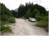
First, we drive to Preddvor or to the settlement Tupaliče (to here from the Gorenjska highway or Kranj), then we continue driving in the direction of Jezersko. When we get to Zgornje Jezersko, on the part where the road flattens, we leave the main road and continue driving right in the direction of the ecological tourist farm Makek, Češka koča, Veliki vrh and waterfall Čedca (we leave the main road before the Petrol gas station). Immediately after the turn-off from the main road we first descend a little and then we follow the road in the direction of farm Makek. Further, the road starts ascending, and we drive along it to a smaller crossroads, where to the left the road continues towards farm Makek, and straight ahead continues the road which leads further past the turn-off of the path to waterfall Čedca and past the turn-off of the path to Veliki vrh. We park in an appropriate place near the crossroads, in such a way that we do not hinder frequent forestry works.
Route description:
From the parking lot, we continue on the right road which slightly ascends through the forest. After a good 10 minutes of walking, we get to the sharp right turn, from which a marked path branches off to the left towards the waterfall Čedca. We continue on the road which for some time still ascends, then higher it brings us to the spot where we notice the mountain signpost for Veliki vrh. Here we continue left upwards on the often muddy cart track, which higher changes into a footpath which ascends mostly through the forest (because of the larger number of tractor tracks the orientation is somewhat harder). The steepness then eases and the path brings us to a clearing along which the path gently ascends. The path then turns slightly left into the forest and reaches a lonely cottage which is located in the middle of the forest.
Ahead we carefully follow the blazes, because with numerous paths around the cottage we can quickly go astray. A little above the cottage the path steeply ascends, then turns to the right and higher brings us to the avalanche-prone gully (in winter time danger of snow avalanches). The path ahead relatively steeply ascends along and beside the gully. Eventually the path brings us to the ridge, where for a short time a nice view opens up (viewpoint). On the ridge the path turns left and returns to the forest.
The last part of the path towards the summit awaits us. This part is somewhat exposed in places, but in the dry not too dangerous (in the wet great danger of slipping). A little below the summit the path leaves the forest for the slopes overgrown with brushwood, which we then follow to the summit.

Photos:
 1
1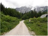 2
2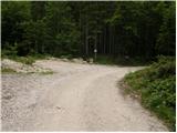 3
3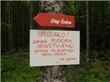 4
4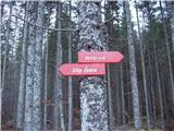 5
5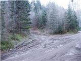 6
6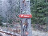 7
7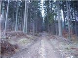 8
8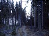 9
9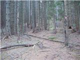 10
10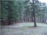 11
11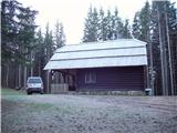 12
12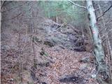 13
13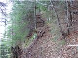 14
14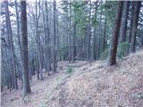 15
15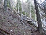 16
16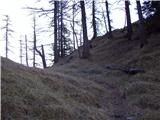 17
17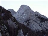 18
18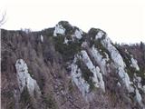 19
19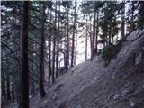 20
20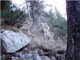 21
21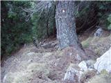 22
22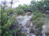 23
23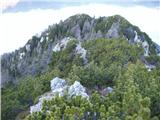 24
24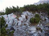 25
25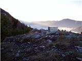 26
26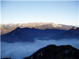 27
27
Discussion about the trip Makekova Kočna - Veliki vrh
|
| Gost24. 06. 2007 |
Brane V. A bit strenuous, but rewarded by wonderful views from the summit.
|
|
|
|
| klavdy610. 01. 2009 |
extremely beautiful view, slippery when wet
|
|
|
|
| klavdipo13. 06. 2009 |
Is there a stamp of Jezerska planinska pot at the top?
|
|
|
|
| velkavrh14. 06. 2009 |
I was here two years ago. At that time there was the stamp of the Jezerska mountain trail. Nice training for more demanding hikes. Recommended!
|
|
|
|
| klavdipo14. 06. 2009 |
I was there today! Wonderful weather provided exceptional views! 
LP
|
|
|
|
| Sam.volk9. 06. 2010 |
Today I was up there. Nice mountain tour that rewards you with a wonderful view. The path is well marked. So I recommend it. Lp Franc
|
|
|
|
| Sam.volk9. 06. 2010 |
Today I was up there. Nice mountain tour that rewards you with a wonderful view. The path is well marked. So I recommend it. Lp Franc
|
|
|
|
| abes30. 03. 2011 |
On Saturday I plan to go to Veliki vrh, has anyone been up there recently, conditions on the path?
|
|
|
|
| tonek71. 04. 2011 |
from the saddle upwards in the rather steep slopes there are still individual icy patches that you can avoid, more concentration is needed for the descent because some ice is hidden under leaves, but temperatures are pleasant and it gets better every day  my advice: don't rush in the morning, and the sun will help, since the tour isn't for a whole day of walking either Good luck my advice: don't rush in the morning, and the sun will help, since the tour isn't for a whole day of walking either Good luck
|
|
|
|
| abes4. 04. 2011 |
Thanks for the info. I was up there, nice tour, quite steep, views fantastic. lp
|
|
|
|
| robter8. 06. 2011 |
I have a question.
Here it says Veliki vrh, 1742m. When checking on Geopedia.si, I find Veliki vrh 1696 m.
I'm not saying data usually differ by +-5m, but here a whole 50 m.
Does anyone know where this difference comes from ??
|
|
|
|
| jaz8. 06. 2011 |
In KSA guidebook 1742m, on maps 1696m. Regards!
|
|
|
|
| Jože.9. 06. 2011 |
The 1696m summit is just a kind of fore-summit, but there is no marked path leading to it, which goes right below it to the main summit 1742m.
|
|
|
|
| drobiž15. 08. 2011 |
Today I visited Veliki vrh with my three little dogs. The path ascends quite steeply. On the path I met only two female hikers, so I fully enjoyed the peace and beautiful views.
|
|
|
|
| Lunca19. 04. 2012 |
I visited this summit yesterday. I described the conditions under current conditions, here I just mention that the tour should not be taken lightly, but the summit rewards us with wonderful views!
|
|
|
|
| Sim798. 08. 2012 |
This morning I climbed this peak. The second half of the path is very steep and requires considerable fitness, and on the descent also quite some caution. The summit is very nice and offers a wonderful view of Kočna, peaks around Jezersko, Storžič, Košuta ... I didn't meet any other hikers.
|
|
|
|
| izidors21. 08. 2016 |
Yesterday the path was wet, so we turned back halfway up the hill. Still a positive experience, the return was not as difficult as we feared.
Good mental preparation for the next attempt. Personally harder path for me than to Česka Koča, even though it is classified as an easy marked path in terms of difficulty.
|
|
|
|
| matej_131112. 08. 2024 19:10:30 |
I just want to write that this path is quite far from an "easy" path. At several places, a rope or peg would be very welcome, which would qualify it at least as "moderately difficult".
So I definitely do not recommend hiking here to complete beginners or those afraid of steep slopes. There are no precipices, but it is very steep and quite dangerous for slipping.
The description of the starting point could also be written better, as one doesn't know whether to park at the junction for the farm, or at the junction for Čedca waterfall (which no longer exists and there's no sign for it anymore) or at the junction for Veliki vrh. Based on the altitude of the starting point given above, I conclude it's at the junction for the farm.
Otherwise, very nicely marked path and great view from the summit!
|
|
|
|
| lina1220. 04. 2026 11:29:49 |
On Saturday I (almost) visited Veliki vrh. Above 1650 m there are still quite a few snowfields, which are a bit tricky due to the steep terrain and I preferred not to continue the path, not even with small crampons. Otherwise, the path is normally passable, at some points you have to use your hands, but nothing special - I would rate the path at most moderately difficult. It is well marked, and I didn't meet anyone on the entire path
|
|
|
To post a comment you must log in:
If you do not yet have a username, you must first
register.