Starting point: Mala Učka (985 m)
| Latitude/Longitude: | 45,27571°N 14,19674°E |
| |
Walking time: 20 min
Difficulty: easy marked way
Elevation gain: -16 m
Elevation difference along the route: 30 m
Map:
Recommended equipment (summer):
Recommended equipment (winter):
Views: 129
 | 1 person like this post |
Access to starting point:
Through the border crossing Jelšane or Pasjak we drive onto the highway towards Rijeka. We leave the highway at the Opatija junction and drive along the expressway towards Pula, which we leave at the Veprinac exit. We follow the steep road into the village, where we turn left. Along the ascending and winding road we drive over the Poklon pass and Peruč to the village Vela Učka, where at a small chapel we turn left onto a narrower road towards Mala Učka. The road initially ascends through a pine forest, then leads between meadows to Mala Učka. From the main road it is approximately 4 km to the starting point. We park at the mountain signposts for Učka or a little earlier along the road.
Route description:
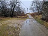
From the starting point we continue along the road towards Kremenjak, Sisola, Moščenička Draga and Brgud. Then the inscription on the power line pole and on the slope Maj and Balin additionally indicate to us that we are on the right path. Along the narrow road we descend slightly into the center of Mala Učka, where signposts direct us to the right. Left Perun and Moščenička draga. The road soon loses its asphalt surface and leads us across a meadow. After a short descent we are again at a junction, where the path to Šušnjevica branches off to the right. We continue straight along the cart track and in 2 minutes we are at the junction for Maj. We turn right onto a steep path that soon levels out. Then the path descends slightly through the forest to a small clearing. The path ascends again among smaller rocks and across a meadow to the edge, where the path turns left and we soon step onto Maj, from where some view opens up to us.
Description and photos refer to the situation in February 2026.

Photos:
 1
1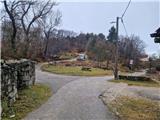 2
2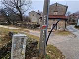 3
3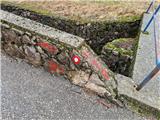 4
4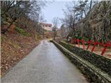 5
5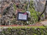 6
6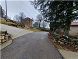 7
7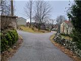 8
8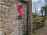 9
9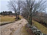 10
10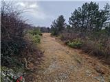 11
11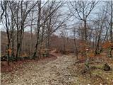 12
12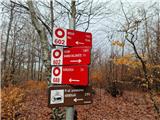 13
13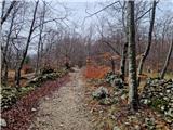 14
14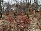 15
15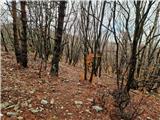 16
16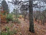 17
17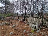 18
18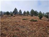 19
19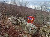 20
20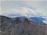 21
21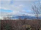 22
22
Discussion about the trip Mala Učka - Maj (Učka)
To post a comment you must log in:
If you do not yet have a username, you must first
register.