Starting point: Mala voda (420 m)
| Latitude/Longitude: | 46,04540°N 14,27090°E |
| |
Walking time: 1 h 15 min
Difficulty: easy unmarked way
Elevation gain: 368 m
Elevation difference along the route: 375 m
Map: Škofjeloško in Cerkljansko hribovje 1:50.000
Recommended equipment (summer):
Recommended equipment (winter):
Views: 4.849
 | 2 people like this post |
Access to starting point:
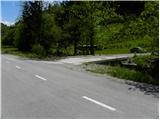
From Horjul or Dobrova we drive to Polhov Gradec, and then we continue driving towards Gorenja vas. Further, we drive through Briše and then along the river Mala voda. At the road sign between 4 and 3.5 km, we will notice on the left side a road which over a small bridge crosses the aforementioned stream. We head onto the mentioned road and then immediately behind the bridge we park in a suitable spot.
Route description:
From the bridge, we continue on a macadam road which gently ascends parallel with the stream. Ahead on the left side we bypass a residential house, and the road at the hayrack makes a left turn and then ascends diagonally across a panoramic grassy slope. The road higher passes into the forest, where it then moderately ascends to an unmarked crossroad. At the crossroad, we continue left, on the road which temporarily entirely flattens, and then gently ascends to the next crossroad. Here we continue right (left downwards to Koreno) and follow the moderately ascending road, from which a nice view opens up on Koreno, to the next crossroad by which we notice the first signposts and on a tree also a solitary blaze.
We continue the ascent in the direction of Samotorica (right farm Prevalca) on the road which in a moderate ascent brings us to a lonely farm by which there is a marked junction. We continue in the direction of Kožljek (left Koreno and Horjul) and continue the ascent on the road, which at the next crossroad gets an asphalt surface. At the crossroad, we continue left and continue the ascent on the asphalt road, on which in a few minutes of further walking we arrive at a smaller pass, by which we notice a chapel and next to it hiking signposts.
At the chapel, we leave the road and continue the ascent right (direction Kožljek) on a poorly visible path which moderately ascends across a panoramic grassy hay meadow. After a short ascent, we come to the edge of the forest, where signs for Kožljek direct us right into the dense forest. The path ahead steeply ascends through a belt of dense forest, then gradually flattens and brings us to a partly grassy ridge. We then follow this occasionally quite panoramic path all the way to the top of the 788 m high Kožljek.

Along the route: Grda Dolina (675m)
Photos:
 1
1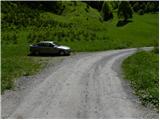 2
2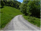 3
3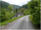 4
4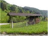 5
5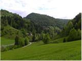 6
6 7
7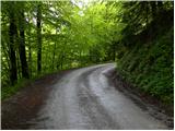 8
8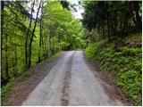 9
9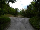 10
10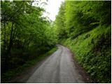 11
11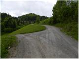 12
12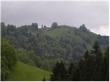 13
13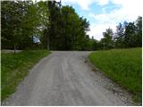 14
14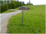 15
15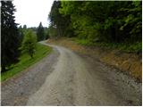 16
16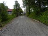 17
17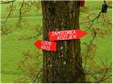 18
18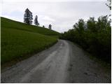 19
19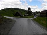 20
20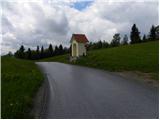 21
21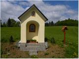 22
22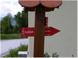 23
23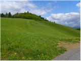 24
24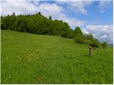 25
25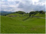 26
26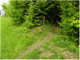 27
27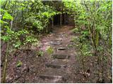 28
28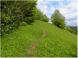 29
29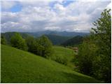 30
30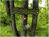 31
31 32
32
Discussion about the trip Mala voda - Kožljek
|
| Lisica5. 05. 2018 |
Very nice hike despite walking on the road, you hardly meet any cars. Since the day was nice, I continued to Koreno and made a circular route. Mostly unmarked but orientationally not demanding.
|
|
|
To post a comment you must log in:
If you do not yet have a username, you must first
register.