Malenski Vrh - Malenski vrh
Starting point: Malenski Vrh (692 m)
| Latitude/Longitude: | 46,13910°N 14,14930°E |
| |
Walking time: 1 h 5 min
Difficulty: easy marked way
Elevation gain: 359 m
Elevation difference along the route: 365 m
Map: Škofjeloško in Cerkljansko hribovje 1:50.000
Recommended equipment (summer):
Recommended equipment (winter): crampons
Views: 3.420
 | 1 person like this post |
Access to starting point:
We drive to Poljane nad Škofjo Loko, from where from a traffic-light crossroads we continue in the direction of the settlement Javorje. When we get to the settlement Volča, we go left (by the crossroads there are only signposts for Gora and hiking path Cvetje v jeseni), and then on a winding road we ascend to the crossroads before the village Malenski Vrh, where we park at the appropriate place. At the starting point, there is a marked junction of hiking paths.
Route description:
From the described starting point, we continue in the direction of Blegoš and the church of the Assumption of Mary on Gora. The road on which we walk quickly brings us to the village Malenski Vrh, where from the crossroad, behind a well-maintained chapel, we go right. There follows a diagonal ascent towards the right, during the ascent to the next houses beautiful views open up on the surrounding hills. At the mentioned houses, we go left upwards, the road after a shorter steep part flattens and a little further turns right, where at the older chapel we join the marked path which leads from the settlement Suša.
We continue on the road, which after the house with house number Jazbine 1 changes into a cart track, the path from which we clearly see the neighbouring Blegoš passes into the forest. There follows an ascent through the forest, at a slightly poorly marked junction we choose the left cart track. Higher we reach a larger meadow, from which a view opens up towards the church of the Assumption of Mary, the path gradually flattens. There follow a few minutes of walking, partly also through the forest, then we reach the mentioned church, from which a beautiful view opens up on the surroundings and nearby hills.
Left of the church and behind the parish house we notice mountain signposts for Blegoš and Žetina, which point slightly left, slightly right a marked path leads towards the saddle Hlevišče, we continue straight on an unmarked footpath which passes into the forest. There follow a few minutes of ascent through the forest, where along a worse footpath we reach a bench and a cairn on Malenski vrh.
Malenski Vrh - Gora 0:55, Gora - Malenski vrh 0:10.
Description and pictures refer to the condition in the year 2018 (December).

Photos:
 1
1 2
2 3
3 4
4 5
5 6
6 7
7 8
8 9
9 10
10 11
11 12
12 13
13 14
14 15
15 16
16 17
17 18
18 19
19 20
20 21
21 22
22 23
23 24
24 25
25 26
26 27
27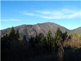 28
28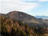 29
29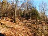 30
30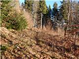 31
31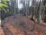 32
32 33
33
Discussion about the trip Malenski Vrh - Malenski vrh
To post a comment you must log in:
If you do not yet have a username, you must first
register.