Mallnitz - Hinterer Geißlkopf (via Feldseescharte)
Starting point: Mallnitz (1191 m)
| Latitude/Longitude: | 46,98182°N 13,17603°E |
| |
Route name: via Feldseescharte
Walking time: 6 h 50 min
Difficulty: difficult unmarked way
Elevation gain: 1697 m
Elevation difference along the route: 1780 m
Map:
Recommended equipment (summer):
Recommended equipment (winter):
Views: 286
 | 1 person like this post |
Access to starting point:
Arriving by train in Mallnitz is one of the good options, as it allows crossing from the southern side of the Hohe Tauern to the northern side and then returning by train through the Tauern tunnel, which with 8371 m is the longest railway tunnel through the Hohe Tauern. Between Mallnitz and Bad Gastein through the tunnel also runs the car train. The nearest road connection is 178 kilometres long. Access by car is via the motorway to Spittal and the exit for Lienz. Then along the regional road past Lendorf, after which after a few kilometres turn right in the direction of Möllbrücke, Mühldorf and Obervellach. Soon after Obervellach turn right towards Mallnitz. In Mallnitz drive past the railway station (also car train to Bad Gastein through the 8371 m long Tauern tunnel).
Route description:
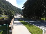
From the railway station 100 meters along the road towards Mallnitz. Before the Seebach stream, turn right and follow the signs for Via Alpina. The path runs along the stream to the first houses in Mallnitz.
Here turn left over the bridge, after the bridge right and then reach the main road, where there is a junction with many green signposts nearby. Turn onto the left road, where the signs for Jamnigalm and Hagener Hütte point. Then follow the road out of the town of Mallnitz to the last houses, where turn right and ascend to the more attractive footpath. Alternatively, the road can also be followed. The path first ascends and then runs about 50 meters above the road, which is rarely seen. The path has many benches and interesting information, stories and fairy tales, so it is very popular in summer for short walks with children. Along the path, always follow the signs for Jamnigalm, Hagener Hütte or Stockerhütte. At one point there is an unmarked fork and here continue left keeping in mind that the road will be crossed again later. The path is then gentle, at times even slightly losing height, until it reaches the road. Cross the road at the forest road, which then runs through the forest. Soon the path to Stockerhütte branches right, which is the last hut before the road barrier (toll 4 euros).
From here the path becomes steeper, but is still wide until the pasture fence. Always follow the signs for Jamnigalm or path number 110. Soon after the barrier the forest starts to thin and the path becomes more scenic and offers increasingly better views over the valley and the town of Mallnitz. After some steeper sections and crossing torrent beds, the path levels out and the rocks of the Jamnig pasture appear. The path leads to the road below the pasture, after which it is another 5 minutes' walk to the pasture.
At Jamnig pasture continue left. At the beginning the path crosses grassy slopes and ascends very gently in the direction westwards. The path then enters a steeper section, where entire slopes are covered with blueberries (therefore this area is popular with pickers). Occasionally a torrent spring is crossed, where it is good to have a long stride (some children may have difficulties here). The path becomes steepest in the last third, where it ascends the slopes towards the bivouac. The path then joins the Hagenerweg path, which leads to the Hagener hut. To the left, 5 minutes' walk away, is the Feldsee saddle (Feldseescharte) and the bivouac (Dr. Rudolf Weißgerber Biwak).
Turn right onto the path towards the Hagener hut. However, follow the path for only about one or two minutes. Approach the ridge behind two peaks a few tens of meters high that protrude from the ridge (i.e. between the bivouac and the entry gully for Vorderer Geißlkopf). The continuation looks more difficult from afar than it actually is. The approach to the ridge is unmarked and the path trace is initially less visible. On the ridge the direction to the fairly steep gully is logical. At the entry gully there is steep scree, which the path overcomes in zigzag in a few meter-long sections. In this section, lower-lying lakes of beautiful green colours steal the views. Then under the south wall of Vorderer Geißlkopf ascend a bit more on somewhat more tolerable scree terrain and finally cross the slope westwards. Along the path there are some meter-high rocky steps (and some small sinkhole). The terrain becomes firmer and less steep and soon the ridge between the mountains Vorderer and Hinterer Geißlkopf is reached.
From here just follow the ridge westwards to the summit of Hinterer Geißlkopf, from where there is a nice view of the adjacent summit Vorderer Geißlkopf and the lake and Feldseekopf to the south. In the distance to the west the Großglockner is also visible. Northwards about 1500 meters lower lies the valley that runs to Sportgastein.
Mallnitz – Jamnigalm (2h 30min); Jamnigalm - Bivak Dr. Rudolf Weißgerber / škrbina Feldsee (3 h 10 min); bivak – Hinterer Geißlkopf (1h 10 min).

Along the route: Seebach (1191m), Stockerhütte (1290m), Jamnigalm (1750m), Dr. Rudolf Weißgerber Biwak (bivouac) (2712m)
Photos:
 1
1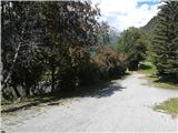 2
2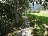 3
3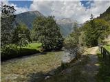 4
4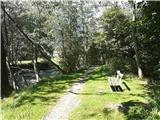 5
5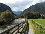 6
6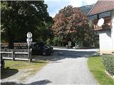 7
7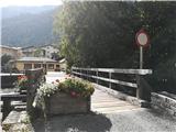 8
8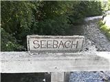 9
9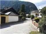 10
10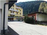 11
11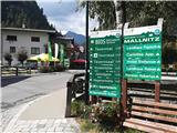 12
12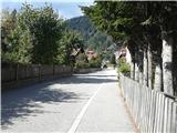 13
13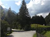 14
14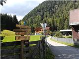 15
15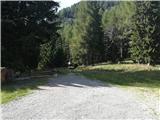 16
16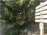 17
17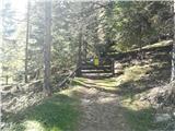 18
18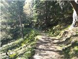 19
19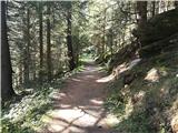 20
20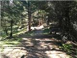 21
21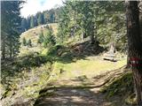 22
22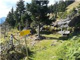 23
23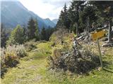 24
24 25
25 26
26 27
27 28
28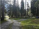 29
29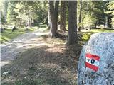 30
30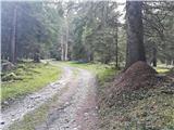 31
31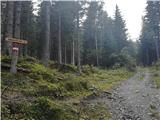 32
32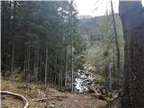 33
33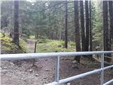 34
34 35
35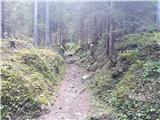 36
36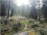 37
37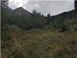 38
38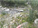 39
39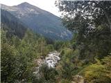 40
40 41
41 42
42 43
43 44
44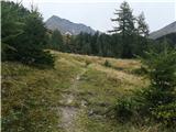 45
45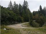 46
46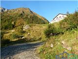 47
47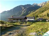 48
48 49
49 50
50 51
51 52
52 53
53 54
54 55
55 56
56 57
57 58
58 59
59 60
60 61
61 62
62 63
63 64
64 65
65 66
66 67
67 68
68 69
69 70
70 71
71 72
72 73
73 74
74 75
75 76
76 77
77 78
78 79
79 80
80 81
81 82
82 83
83 84
84 85
85 86
86 87
87 88
88 89
89 90
90 91
91 92
92 93
93 94
94 95
95 96
96 97
97 98
98 99
99 100
100 101
101 102
102 103
103 104
104 105
105 106
106 107
107 108
108 109
109 110
110 111
111 112
112 113
113 114
114 115
115 116
116 117
117 118
118 119
119 120
120 121
121 122
122 123
123 124
124 125
125 126
126 127
127 128
128 129
129 130
130 131
131 132
132 133
133 134
134 135
135 136
136 137
137 138
138 139
139 140
140 141
141 142
142 143
143 144
144 145
145 146
146 147
147 148
148 149
149 150
150 151
151
Discussion about the trip Mallnitz - Hinterer Geißlkopf (via Feldseescharte)
To post a comment you must log in:
If you do not yet have a username, you must first
register.