Mallnitz - Westerfrölkekogel
Starting point: Mallnitz (1191 m)
| Latitude/Longitude: | 46,98182°N 13,17603°E |
| |
Walking time: 6 h
Difficulty: difficult pathless terrain
Elevation gain: 1536 m
Elevation difference along the route: 1590 m
Map:
Recommended equipment (summer):
Recommended equipment (winter): ice axe, crampons
Views: 496
 | 1 person like this post |
Access to starting point:
Arriving by train in Mallnitz is one of the good options, as it allows crossing from the southern side of the Hohe Tauern to the northern side and then returning by train through the Tauern Tunnel, which with 8371 m is the longest railway tunnel through the Hohe Tauern. Between Mallnitz and Bad Gastein through the tunnel also runs the car train. The nearest road connection is 178 kilometres long.
Access by car is via the motorway to Spittal and the exit for Lienz. Then along the regional road past Lendorf, after which after a few kilometres turn right in the direction of Möllbrücke, Mühldorf and Obervellach. Soon after the town of Obervellach turn right towards Mallnitz. In Mallnitz drive past the railway station (also car train to Bad Gastein through the 8371 m long Tauern Tunnel).
Route description:
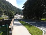
From the railway station 100 metres along the road towards Mallnitz. Before the stream Seebach turn right and follow the signs for Via Alpina. The path runs along the stream to the first houses in Mallnitz. Here turn left over the bridge, after the bridge right to the main road, where there is a junction with many green signposts. Follow the left road with signs for Jamnigalm and Hagener Hütte.
Follow the road out of the town of Mallnitz to the last houses, where turn right and ascend to the more attractive footpath. Alternatively, follow the road. The path first ascends and then runs about 50 metres above the road, which is rarely seen. The path has many benches and interesting information, stories and fairy tales, so it is very popular in summer for short walks with children. Always follow the signs for Jamnigalm, Hagener Hütte or Stockerhütte. At one point there is an unmarked fork, continue left thinking that the road will be crossed again later. The path is then level, at times even slightly losing height until reaching the road. Cross the road on the track, which then runs through the forest. Soon a path to Stockerhütte branches right (last hut before the road barrier, toll 4 euros). From here the path becomes steeper, but remains wide until the pasture fence. Always follow the signs for Jamnigalm or path number 110. Soon after the barrier the forest starts to thin and the path becomes more scenic, offering increasingly better views over the valley and the town of Mallnitz. After some steeper sections and crossing torrent beds the path levels out and the slopes of the Jamnig pasture appear. The path leads to the road under the pasture, after which it is 5 minutes' walk to the pasture.
The forest ends with the pasture. To the destination walk along the wide path, which ascends gently and occasionally in hairpin bends. On the left are clearly visible the peaks Feldseekopf and Vorderer Geißlkopf, on the right rises the slope of the mountain Greilkopf. The path forks only five minutes before the hut, where it is necessary to turn left.
From the hut the path descends to the signposts, next to which there is a bell, and continues westwards. The path gently leads to the ground-level spring and then begins to ascend. About 150 metres of elevation gain later the path reaches the saddle, from where the 2727 m high Westerfrölkekogel rises to the north. The path is somewhat crumbly just below the saddle and requires careful steps.
From the saddle onwards the hiker faces a pathless ridge, which is very crumbly for the Hohe Tauern. It is necessary to be somewhat careful when placing steps, as layers of rock peel off the crags. The direction is always logical, somewhere in the middle of the ridge hold somewhat more to the left and ascend a shorter and smaller gully back onto the ridge and to the narrow but scenic summit.
From the summit the three-thousander Schareck and the almost three-thousander Vorderer Geißlkopf are clearly visible. A very nice view is also offered on the Sportgastein valley and Nassfeldalm. The nearby hut Hagener Hütte is also visible.
Mallnitz - Jamnig pasture (2 h 30 min); Jamnig pasture - Hagener Hütte (2 h 30 min); Hagener Hütte – Westerfrölkekogel (1 h).

Photos:
 1
1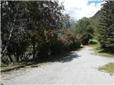 2
2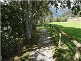 3
3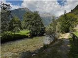 4
4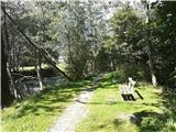 5
5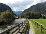 6
6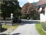 7
7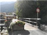 8
8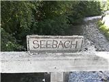 9
9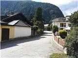 10
10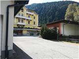 11
11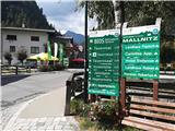 12
12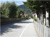 13
13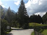 14
14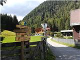 15
15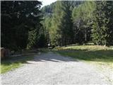 16
16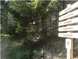 17
17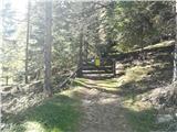 18
18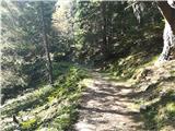 19
19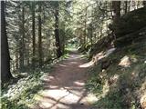 20
20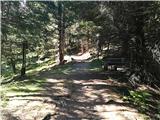 21
21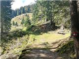 22
22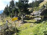 23
23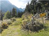 24
24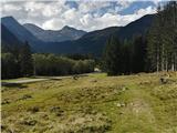 25
25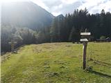 26
26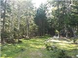 27
27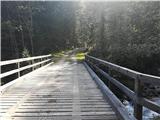 28
28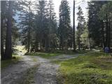 29
29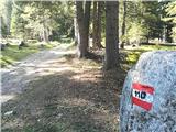 30
30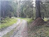 31
31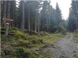 32
32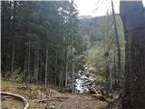 33
33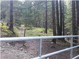 34
34 35
35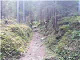 36
36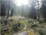 37
37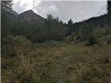 38
38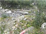 39
39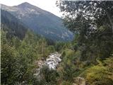 40
40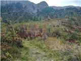 41
41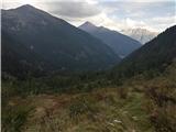 42
42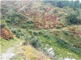 43
43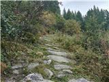 44
44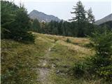 45
45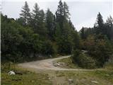 46
46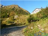 47
47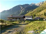 48
48 49
49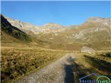 50
50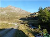 51
51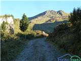 52
52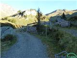 53
53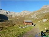 54
54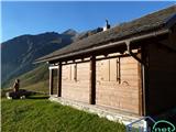 55
55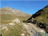 56
56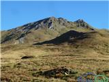 57
57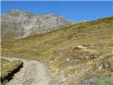 58
58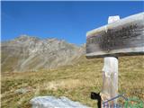 59
59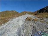 60
60 61
61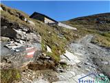 62
62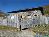 63
63 64
64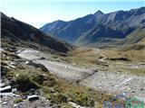 65
65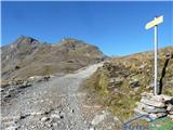 66
66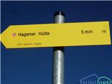 67
67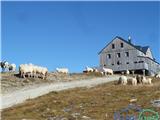 68
68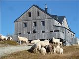 69
69 70
70 71
71 72
72 73
73 74
74 75
75 76
76 77
77 78
78 79
79 80
80 81
81 82
82 83
83 84
84 85
85 86
86 87
87 88
88 89
89 90
90 91
91 92
92 93
93 94
94 95
95 96
96 97
97 98
98 99
99 100
100 101
101 102
102 103
103 104
104 105
105 106
106
Discussion about the trip Mallnitz - Westerfrölkekogel
To post a comment you must log in:
If you do not yet have a username, you must first
register.