Maria Waldrast - Serles (western approach from Maria Waldrast)
Starting point: Maria Waldrast (1638 m)
| Latitude/Longitude: | 47,13159°N 11,40445°E |
| |
Route name: western approach from Maria Waldrast
Walking time: 3 h 30 min
Difficulty: partly demanding marked way
Elevation gain: 1079 m
Elevation difference along the route: 1079 m
Map: Innsbruck und Umgebung, 31/5 1:50.000; Outdooractive Stubai Wanderkarte
Recommended equipment (summer): helmet
Recommended equipment (winter): ice axe, crampons
Views: 459
 | 1 person like this post |
Access to starting point:
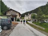
From Ljubljana, we drive on the highway past Salzburg in the direction towards München. At the multi-level interchange Dreieck Inntal we turn onto the road A93 in the direction of Innsbruck/Kufstein/Brenner. Upon returning to Austria we continue to the junction with the exit Innsbruck-Mitte. Here we don't turn towards Innsbruck, but we continue on the highway A13 in the direction towards the Brenner Pass. We continue on the highway all the way to the town of Matrei am Brenner, where we take exit 19-Matrei. Then we head onto the road B182 and follow it to the village of Mützens, where with the help of reliable signs we turn onto the ever narrower road, which after crossing the barrier (toll is 6 euros for a passenger car) in a few kilometers brings us to the parking lot near the inn and the monastery church.
Alternatively, driving through northern Italy is an option: in this case from central Slovenia on the highway A2 we drive to one of the border crossings with Austria and continue the journey to Lienz. Here we continue on road 100 and past the border crossing Prato alla Drava we drive into Italy. In Italy we follow road SS49 all the way to the junction with highway A22 in the direction towards the Brenner Pass. After the pass we continue in the direction towards Innsbruck to exit 19-Matrei at the town of Matrei am Brenner. From there we continue on the route described above.
Route description:
From the parking lot at Maria Waldrast, the highest-lying pilgrimage station in Austria, following the signs for Serles we set out on the path which immediately behind the church turns left into the forest. Through grazing areas we continue on a narrow path which soon crosses the scree gully in the eastern wall of Serles. Further on, an excellently marked path leads us through increasingly sparse high-alpine forest, which higher up is replaced by dwarf pines, and twice more we cross the outlets of steep gullies that descend from the rocky slopes above us. After a good hour of walking from the starting point, we reach open grassy slopes in the heart of the Serles group, and a beautiful view also opens up to the southern part of the range, where Lämpermahdspitze and Peilspitze predominate. We follow the path, which zigzags across the moderately steep slope, all the way to the pass Serlesjöchl, where the path from Marie Waldrast joins the longer alternative approach path from Kampl in the Stubai Valley.
On the saddle the continuation of the path reveals itself; we head right towards the northern Serles and in a few minutes we reach the first protections on the path. With the help of a metal ladder and steel cables we climb over the rocky edge (partly demanding), after which we continue on the path which in zigzags crosses the moderately steep slopes of Serles. Not long after the first steel cables we cross the last secured section on the path, after that we follow a moderately steep but undemanding path along the summit slope of the mountain for a long time. A little below the summit ridge the path turns more sharply to the right towards the west and reliably leads us over the rocky step onto the extensive summit plateau of Serles. From here only a short walk separates us from the highest point with the large cross and exceptional view.
It is worth mentioning that high mountain paths in Tyrol are marked with blue (easy), red (moderately demanding) and black (demanding/very demanding) signs. Although the described path to Serles is marked with black circles and on it we encounter a short easy climbing section, I rate it as comparable to Slovenian partly demanding paths without obviously exposed spots and greater technical demands.

Along the route: Serlesjöchl (2384m)
Photos:
 1
1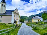 2
2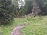 3
3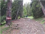 4
4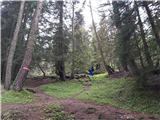 5
5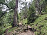 6
6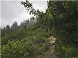 7
7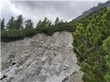 8
8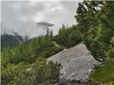 9
9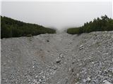 10
10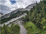 11
11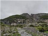 12
12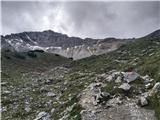 13
13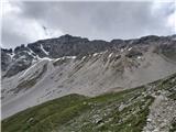 14
14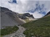 15
15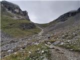 16
16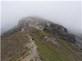 17
17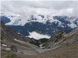 18
18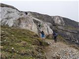 19
19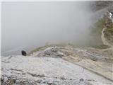 20
20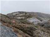 21
21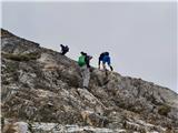 22
22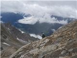 23
23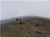 24
24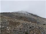 25
25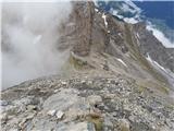 26
26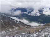 27
27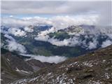 28
28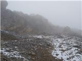 29
29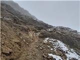 30
30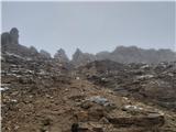 31
31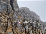 32
32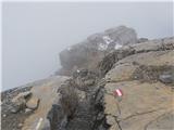 33
33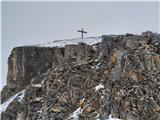 34
34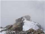 35
35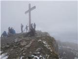 36
36
Discussion about the trip Maria Waldrast - Serles (western approach from Maria Waldrast)
To post a comment you must log in:
If you do not yet have a username, you must first
register.