Martinčev Rovt - Rosenbachsattel/Rožca
Starting point: Martinčev Rovt (1150 m)
| Latitude/Longitude: | 46,47180°N 14,02940°E |
| |
Walking time: 1 h 15 min
Difficulty: easy unmarked way
Elevation gain: 437 m
Elevation difference along the route: 437 m
Map: Karavanke - osrednji del 1:50.000
Recommended equipment (summer):
Recommended equipment (winter): ice axe, crampons
Views: 7.092
 | 3 people like this post |
Access to starting point:
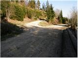
From the Ljubljana–Jesenice motorway, take the Lipce exit (Hrušica also possible) and follow the road ahead towards Jesenice, where signs for Planina pod Golico direct us onto an ascending road (the turn-off is marked and located at the health centre in Jesenice). After the initial steeper ascent, the road brings us to a junction, where we turn left over the bridge towards Plavški Rovt. The steep road brings us to the village, and we follow it further to the spot where the asphalt ends. Soon after the village, the road descends slightly and brings us to a junction, where we take the left upper road. The road then brings us to a smaller hamlet, where we continue straight on the right side of the houses. We follow the road ahead to the next junction, where we park nearby (a larger parking lot is a few dozen meters back in the direction of travel).
Route description:
At the junction, we take the left upper road, which ascends moderately. The road then goes past the barrier and soon afterwards brings us to a meadow on the edge of which there is a pleasant spring. The road then enters the forest and gradually turns into a cart track, which ascends more steeply. The cart track brings us out of the forest onto Jeseniška planina, where a nice view opens up onto the slopes of Belščica and parts of the Julian Alps.
From the shepherd's hut on the planina, we continue up the meadow (slightly left) along an initially poorly visible path. A little higher, we will notice a path which we then ascend. Here and there we can spot some blazes, which are mostly already faded. After 20 minutes of ascent over the meadow, the path turns left into a short stretch of forest. The path then crosses the slopes of Klek through the forest towards the west. When we step out of the forest, we cross a somewhat awkward but not dangerous (when dry) passage through the gully. Further on, there are several paths that bring us to the hunting hut on Rožca in a few minutes.
Starting point - Jeseniška planina 45 minutes, Jeseniška planina - Rožca 30 minutes.

Photos:
 1
1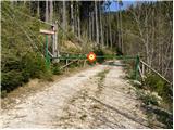 2
2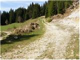 3
3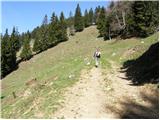 4
4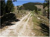 5
5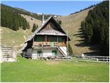 6
6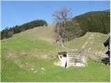 7
7 8
8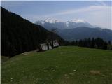 9
9 10
10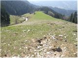 11
11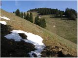 12
12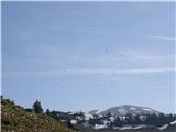 13
13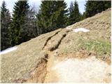 14
14 15
15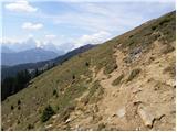 16
16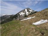 17
17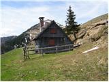 18
18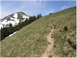 19
19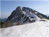 20
20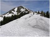 21
21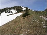 22
22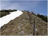 23
23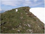 24
24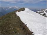 25
25 26
26
Discussion about the trip Martinčev Rovt - Rosenbachsattel/Rožca
To post a comment you must log in:
If you do not yet have a username, you must first
register.