Starting point: Martinj vrh (1030 m)
| Latitude/Longitude: | 46,17650°N 14,12890°E |
| |
Walking time: 1 h 40 min
Difficulty: partly demanding marked way
Elevation gain: 532 m
Elevation difference along the route: 575 m
Map: Škofjeloško in Cerkljansko hribovje 1:50.000
Recommended equipment (summer):
Recommended equipment (winter): ice axe, crampons
Views: 40.661
 | 3 people like this post |
Access to starting point:
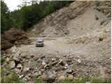
From Škofja Loka we drive towards Železniki and further towards Zali Log. Soon after Železniki, we will notice signs for the village Martinj vrh, which direct us left onto an ascending road that begins to ascend beside the stream Zadnja Smoleva. After a short ascent, we come to an intersection, where we continue right on the road, which in a few hairpin turns steeply ascends, then brings us to the next intersection. We continue left (right Javh and Pučar) on the road which past individual farms brings us to the next intersection, where we continue sharply right in the direction of the farms Bendišč and Čemšišar. Further, we drive past the mentioned farms and the road quickly brings us to a larger quarry, where it ends. We can park already somewhat lower on one of the parking areas beside the road.
Route description:
At the end of the road, we will notice an initially gently marked path (the mentioned path is not drawn on maps), which crosses relatively steep slopes of Romovca. Already after a few steps of walking we encounter the first steel cable, with the help of which we cross a steep slope that is dangerous for slipping when wet. Somewhat after the steel cable the path turns to the left and steeply ascends for a short time. Further, the steepness eases, the path turns to the right, where after a few additional steps it brings us to the second steel cable, with the help of which in a traverse ascent we climb over a very steep slope. The path then flattens again and brings us to an old military bunker, which is located above a smaller precipice.
We bypass the bunker on the left side, then the path descends along an exposed ledge (great risk of slipping). Behind the ledge the path widens, and after a few minutes of additional walking it brings us to a large parking lot on Črni Kal.
From the parking lot we head onto the road, above which is written "from here on we walk on foot". Right at the mentioned sign, the signs for Blegoš direct us right onto a wide footpath, which already after a few meters crosses a forest road that leads towards the hut on Blegoš.
We continue on the footpath, which starts to ascend steeply through the forest. Higher the still steep path brings us onto the vegetated northeastern ridge of Blegoš, along which we then ascend for quite some time. The path further leads us past an old military bunker, above which we soon come to a mini vantage point, from which a beautiful view opens onto the nearby Ratitovec.
At the vantage point the steepness eases, and the path after 5 minutes of additional walking brings us out of the forest onto an indistinct little saddle between Špik (1538 m) on the left and Blegoš on the right. Here the path turns slightly to the right and after a few additional steps brings us onto the panoramic summit ridge. There follows only a short walk past old military trenches to the top of Blegoš, which we reach after some ten steps of additional walking.

Along the route: Črni Kal (1103m)
Photos:
 1
1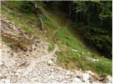 2
2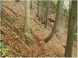 3
3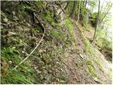 4
4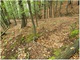 5
5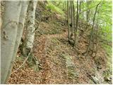 6
6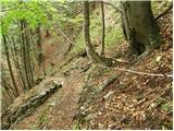 7
7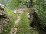 8
8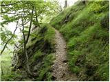 9
9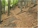 10
10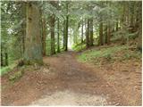 11
11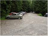 12
12 13
13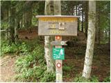 14
14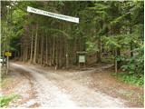 15
15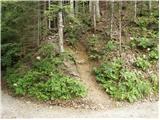 16
16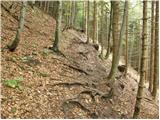 17
17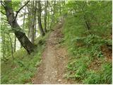 18
18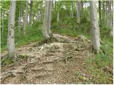 19
19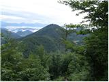 20
20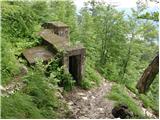 21
21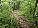 22
22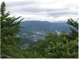 23
23 24
24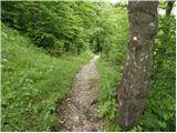 25
25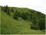 26
26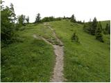 27
27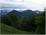 28
28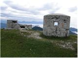 29
29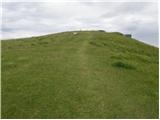 30
30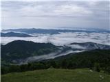 31
31 32
32
Discussion about the trip Martinj vrh - Blegoš
|
| georgia10. 04. 2021 18:57:47 |
We have been going to Blegoš only via this path for some time, for a bit more ascent and adrenaline and less driving. We haven't met anyone on the section to Črni Kal, so it's solitary and ends too quickly at the crowded parking lot, but we are already well warmed up for the continued ascent along the ridge path.  Definitely be careful in wet and snowy conditions! Definitely be careful in wet and snowy conditions!
|
|
|
|
| Doohan4. 05. 2022 15:19:44 |
After two years again on this path to Blegoš. The fixed cables that help when crossing Romovec are not in the best condition. Not that it's very dangerous, but careful steps are needed. Ascent along the Blegoš ridge - poetry.
|
|
|
To post a comment you must log in:
If you do not yet have a username, you must first
register.