Starting point: Masna Luka (1200 m)
| Latitude/Longitude: | 43,63132°N 17,54613°E |
| |
Walking time: 4 h 30 min
Difficulty: easy marked way
Elevation gain: 1028 m
Elevation difference along the route: 1100 m
Map:
Recommended equipment (summer):
Recommended equipment (winter): ice axe, crampons
Views: 255
 | 1 person like this post |
Access to starting point:
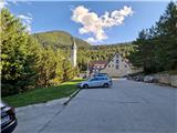
a) Drive to Posušje (to here from Imotski via the border crossing Vinjani Gornji - Osoje), then continue driving towards Jablanica. The road ascends transversely onto the plateau. Drive through Vrpolje, after it the road ascends to a larger valley with the larger Blidinje Lake. Drive along the mentioned lake and soon after it notice signs for Masna Luka, where turn right. Follow the signs for Masna Luka and drive past the larger mountain hut Masna Luka, a little after it arrive at the larger parking lot in front of the Franciscan hut and the church of Sveti Ilija.
b) Drive to Tomislavgrad and continue driving towards Blidinje. The road leads through the valley and then ascends and descends all the way to Blidinje Lake. Drive along the mentioned lake for a short time and soon after it notice signs for Masna Luka, where turn right. Follow the signs for Masna Luka and drive past the larger mountain hut Masna Luka, a little after it arrive at the larger parking lot in front of the Franciscan hut and the church of Sveti Ilija.
c) From Sarajevo drive via Konjic along the Neretva to Jablanica, where in the town center turn left towards Posušje. The road ascends to a larger valley. When arriving at the junction for the tourist settlement Risovac, be attentive, as we will soon turn left towards Masna Luka. Follow the signs for Masna Luka and drive past the larger mountain hut Masna Luka, a little after it arrive at the larger parking lot in front of the Franciscan hut and the church of Sveti Ilija.
Route description:
At the parking lot, head towards the larger building, where a path branches off to the right leading to Pločno. A little further left is the direct path to Veliki Vilinac. Initially there are some steps, followed by a short ascent to a logging trail that turns left. Walk above the mentioned Franciscan hut and enter the forest. The logging trail turns into a path that begins to ascend. After about 20 minutes of ascent, the path levels out and begins to gently descend to a poorer cart track. Continue left. The cart track leads from the Masna Luka Mountain Hut towards Blidinje Lake. The road descends quite steeply in places, when it levels out, signs direct us slightly left onto the path. The sign "Pločno 4h" additionally directs us to the path, which initially leads past larger screes. The path leads through the forest and ascends, sometimes more gently and sometimes more steeply. After about 45 minutes of ascent, the forest begins to thin gradually, replaced by lower shrubbery and dwarf pine. The serpentine path leads below the walls of Čužićev Kuk. The path then turns left and there is a memorial plaque along the path. Here beautiful views open up to the neighboring Vran Planina. The path still ascends through the dwarf pine. When we arrive over a small edge, the path begins to descend into a small cirque, after which the path becomes somewhat more scree-covered. After a short ascent, the path descends again and the direct path from the starting point joins us almost imperceptibly from the left. Continue along the right side of a smaller valley. On the left we see Juneći Kuk. The path brings us to a larger pass between Juneći Kuk and an unnamed peak located below the cliffs of Pločno. Then about half an hour of up and down walking through the valley awaits us, then we arrive at a junction where the path to Pločno branches right, straight ahead to Veliki Vilinac. Head right. The path is initially level and leads through dwarf pine, then steeply ascends to a smaller ridge. The path crosses below it for a while and temporarily returns to the ridge. Further on the path is level, with a short descent in between, then mostly ascends through dwarf pine all the way to the scree under Pločno. The path over the scree is well laid out in serpentines and after about half an hour of scenic ascent we arrive over the edge to the plateau-like world of Pločno. Continue right along the grassy slope to the yellow logbook box, which is empty. Here we step onto the gravel road that takes us past the telecommunications facility to the concrete pillar at the highest point of the summit, where a splendid view opens in all directions.
Description and photos refer to the state in August 2025.

Photos:
 1
1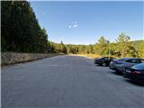 2
2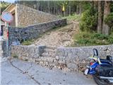 3
3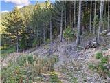 4
4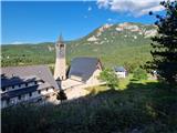 5
5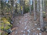 6
6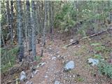 7
7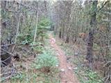 8
8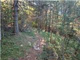 9
9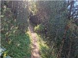 10
10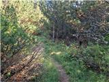 11
11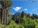 12
12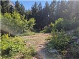 13
13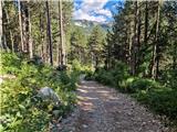 14
14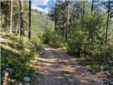 15
15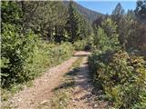 16
16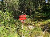 17
17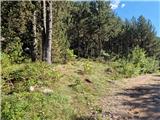 18
18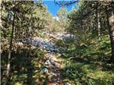 19
19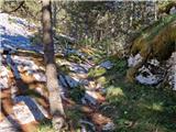 20
20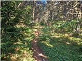 21
21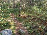 22
22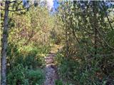 23
23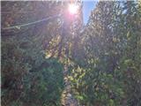 24
24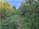 25
25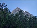 26
26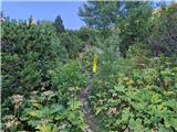 27
27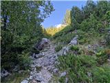 28
28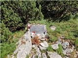 29
29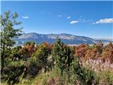 30
30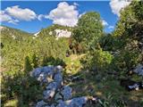 31
31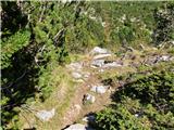 32
32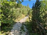 33
33 34
34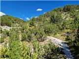 35
35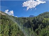 36
36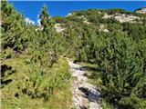 37
37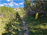 38
38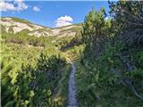 39
39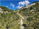 40
40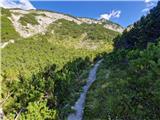 41
41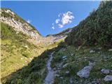 42
42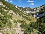 43
43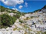 44
44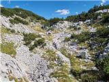 45
45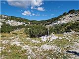 46
46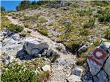 47
47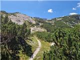 48
48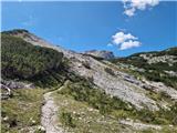 49
49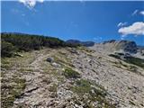 50
50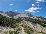 51
51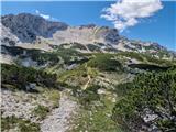 52
52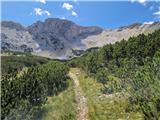 53
53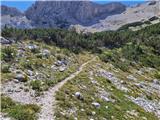 54
54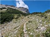 55
55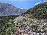 56
56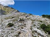 57
57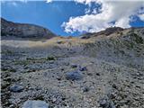 58
58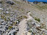 59
59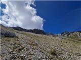 60
60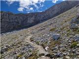 61
61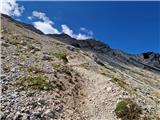 62
62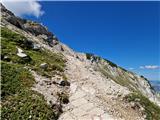 63
63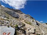 64
64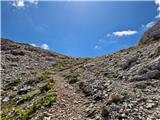 65
65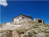 66
66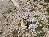 67
67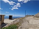 68
68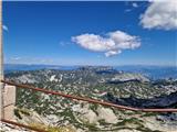 69
69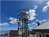 70
70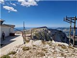 71
71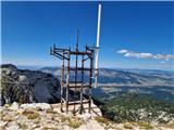 72
72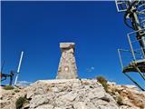 73
73
Discussion about the trip Masna Luka - Pločno
To post a comment you must log in:
If you do not yet have a username, you must first
register.