Starting point: Matizovec (915 m)
| Latitude/Longitude: | 46,41450°N 14,30000°E |
| |
Walking time: 3 h 5 min
Difficulty: partly demanding marked way
Elevation gain: 1121 m
Elevation difference along the route: 1210 m
Map: Karavanke - osrednji del 1:50.000
Recommended equipment (summer):
Recommended equipment (winter): ice axe, crampons
Views: 10.911
 | 2 people like this post |
Access to starting point:
From the Ljubljana - Jesenice highway, we take the Ljubelj exit and follow the road ahead towards the border crossing. We leave the main road at the spot where the signs for »camp and Podljubelj« direct us to the right. When we leave the main road, we will already after a few meters come to a crossroad, where we continue left in the direction of »Kofce«. Further, we drive through the village on a slightly ascending road and then turn right in the direction of »Matizovec and Kofce«. We then follow this occasionally somewhat narrower road, which is asphalted in the lower part, to a larger marked parking lot, about 150 elevation meters below the farm Matizovec.
Route description:
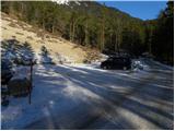
From the large free parking lot we continue on a macadam road, on which in approximately 20 minutes we arrive at the farm Matizovec.
From Matizovec we continue on the right marked road, which through a meadow quickly brings us to a smaller crossroad. We again continue on the right upper road, which then quickly changes into an often quite muddy cart track. After a few minutes' walk we leave the cart track and head onto a footpath, which starts to ascend more steeply through the forest. The marked path then crosses a few cart tracks and higher brings us to a somewhat larger clearing, where we continue slightly right into the forest. The path ahead ascends diagonally, higher turns left and brings us out of the forest, where we join the macadam road from Jelendol. We continue left upwards and after a few minutes of additional walking the path brings us to the mountain hut Dom na Kofcah.
From the mountain hut we continue in the direction of Veliki vrh and Kladivo on an initially somewhat poorly visible path, which starts ascending across a panoramic meadow. After 15 minutes of walking from the Dom na Kofcah hut we reach a nice viewpoint at the cross.
The path then descends slightly and in a few minutes brings us to the steeper slopes of Košuta. The path then ascends through a belt of dwarf pines, bringing us to a junction. We continue right (straight Veliki vrh) on the path to which an unmarked but signposted path from the mountain pasture Šija joins after just a few meters. We continue left upwards on the path, which ascends steeply and quickly brings us to an exposed passage. Without fixed safety gear we cross a short but crumbly and slightly exposed ledge, after which we enter a belt of dwarf pines. The path ahead ascends through a short belt of dwarf pines, then continues along the side ridge of Košuta. The increasingly panoramic and quite steep path higher up joins the ridge path.
We continue right in the direction of Kladivo (left Veliki vrh, straight upwards Kofce gora 10 steps) on the path which starts to descend slightly along the edge of the ridge. The very panoramic ridge path, which runs on and along the main ridge, is ahead slightly exposed in a few places, but the passages do not cause problems when dry.
A little further ahead the path approaches the indistinct summit (Malo Kladivo), to which a short steep ascent brings us.
Starting point - Matizovec 20 minutes, Matizovec - Kofce 1:15, Kofce - Kofce gora 1:00, Kofce gora - Malo Kladivo 30 minutes.

Photos:
 1
1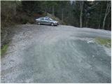 2
2 3
3 4
4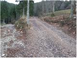 5
5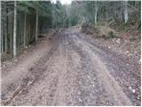 6
6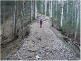 7
7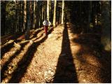 8
8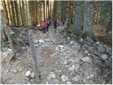 9
9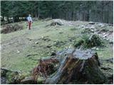 10
10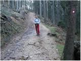 11
11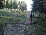 12
12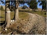 13
13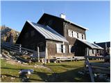 14
14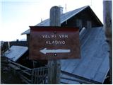 15
15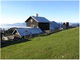 16
16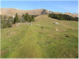 17
17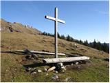 18
18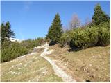 19
19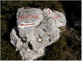 20
20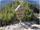 21
21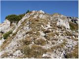 22
22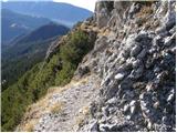 23
23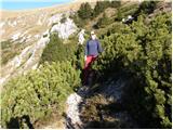 24
24 25
25 26
26 27
27 28
28 29
29 30
30 31
31 32
32 33
33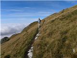 34
34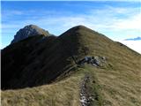 35
35 36
36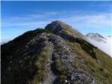 37
37 38
38 39
39 40
40 41
41 42
42 43
43 44
44 45
45 46
46
Discussion about the trip Matizovec - Malo Kladivo
To post a comment you must log in:
If you do not yet have a username, you must first
register.