Matkov kot - Veliki vrh above Matkov kot
Starting point: Matkov kot (850 m)
| Latitude/Longitude: | 46,41940°N 14,62780°E |
| |
Walking time: 2 h
Difficulty: very difficult pathless terrain
Elevation gain: 689 m
Elevation difference along the route: 689 m
Map: Kamniško Savinjske Alpe 1:50 000
Recommended equipment (summer): helmet
Recommended equipment (winter): helmet, ice axe, crampons
Views: 6.726
 | 4 people like this post |
Access to starting point:
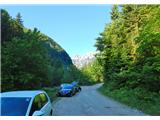
We drive to Luče (to here from Mozirje or over the mountain pass Volovljek (Kranjski Rak)) and continue towards Logarska dolina. Soon after the village of Solčava we come to an intersection, where the road to Logarska dolina branches off to the left, and we continue straight for approximately 1 km towards Pavličevo sedlo and then turn left over the bridge towards Matkov kot. We park at an appropriate place.
Route description:
From the parking lot we start along the road towards Matkov kot, sticking to the lower road where there is a gate. The road leads us along the edge of a meadow, crosses scree and leads onto a meadow. Then it crosses a wide scree again, we step back onto the road, which after some time brings us to the scree at the hut in the center of Matkov kot. Here a view opens up to the peaks that surround Matkov kot.
We cross the scree in the direction of the hunting hut (bajta). Behind the hut on the right, we look for the wide forest road that is cut into the slope. The road ascends, occasionally very steeply; we walk along it keeping straight ahead. It takes us very high, almost to the saddle. When the road ends (cairn) we turn right upwards. There is no trodden path; we keep to the minor ridge. Rocks protrude from the ridge, telling us we are on the right track. Higher up we reach a saddle at 1400 m, where we turn left (east direction). Further on, the terrain becomes rocky and grassy, and the steepness increases. We keep to the direction along the ridge, where a pathlet appears along with hunting markers (blue line). The pathlet bypasses the first rise in the ridge on the north side and takes us to the next saddle just below the slopes of Veliki vrh. Here we tackle the steep slope again, seeking the easiest passages. Soon we are in front of dense dwarf pine thicket, where the path is visible. The steepness increases further; for the ascent we use the dwarf pines. When we overcome this steepness we find ourselves beside a vertical wall; on the left there is a steep grassy chute diagonally upwards for about 10 m. We climb it (few holds and very exposed) to the forepeak, which is covered in dwarf pines. We descend from it towards the east, aided again by the dwarf pines. After a few minutes of further ascent we reach Veliki vrh 1539 m.

Photos:
 1
1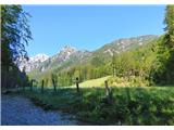 2
2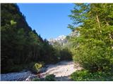 3
3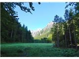 4
4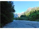 5
5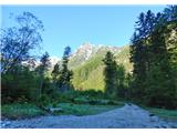 6
6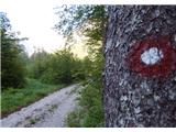 7
7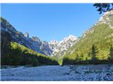 8
8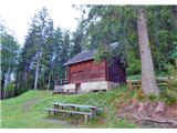 9
9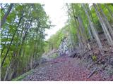 10
10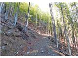 11
11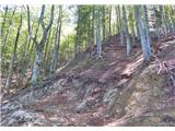 12
12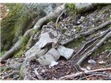 13
13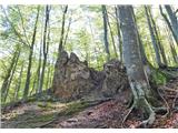 14
14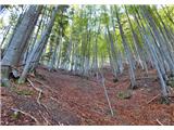 15
15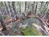 16
16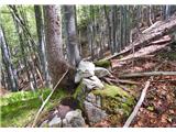 17
17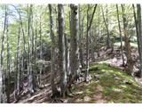 18
18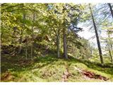 19
19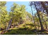 20
20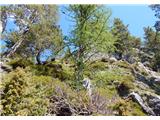 21
21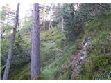 22
22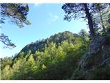 23
23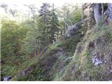 24
24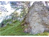 25
25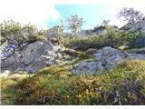 26
26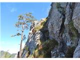 27
27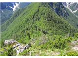 28
28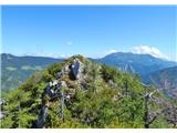 29
29
Discussion about the trip Matkov kot - Veliki vrh above Matkov kot
|
| dprapr1. 07. 2014 |
Nicely described!
It doesn't have "big" in the name without reason, as it has everything they have...
|
|
|
|
| pohodnik381. 07. 2014 |
Thanks, but good thing the admin added "above Matkov kot", I started thinking then when I had already submitted the description because there are many Veliki vrh.
Best! Tone
|
|
|
|
| garmont12. 11. 2025 16:55:14 |
From the saddle onwards, the “path” is marked with red-white ribbons showing the easiest passages.
|
|
|
To post a comment you must log in:
If you do not yet have a username, you must first
register.