Matrafüred - Kékestető (zelena pot)
Starting point: Matrafüred (350 m)
| Latitude/Longitude: | 47,83050°N 19,96730°E |
| |
Route name: zelena pot
Walking time: 2 h 15 min
Difficulty: easy marked way
Elevation gain: 664 m
Elevation difference along the route: 675 m
Map:
Recommended equipment (summer):
Recommended equipment (winter):
Views: 1.386
 | 3 people like this post |
Access to starting point:
From Budapest, we drive east on the motorway towards the town of Nyiregyhaza. After approximately 90 kilometres, we leave the motorway at the Gyöngyös/Matrafüred exit. We continue to the town of Gyöngyös, then at the marked intersection continue north towards Matrafüred. When we arrive in the mentioned place, we turn left into the first street (Beke ut), where we park.
Route description:
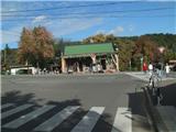
The trail starts at the main intersection in Matrafüred, where there is also the sports climbing base (Hegyes sportok bazisa) and the bus station (Palyaudvar). We descend downhill and at the electricity pole we notice the first markings. The trail leading us to our goal is marked with a green line.
The path enters the forest and after a few meters we go right over a small bridge across the Somor stream (straight ahead the blue cross and blue triangle trails continue). Our path turns slightly south, then after the rest area it begins to steeply ascend on rocky terrain through thinned forest. When we reach the forest entrance, the path levels out and transitions to a wider cart track, along which we arrive at a wider forest road, which we first just cross, then walk along it for some time, until we reach the Csepegő spring. Here we will cross the Csurgo stream and then turn north (straight ahead red trail across Peresberca).
Our path initially ascends quickly, then the forest thins and on the right there will be a long belt of low and dense forest. After some walking we are back in the forest, where we go along the Csurgo stream (there is also a cairn along the path marking the Beka kut spring), when we cross it the path begins to ascend more steeply. Further on we will cross a wider forest cart track, then our path turns west.
At this point where the path turns west, a steep headwall and scree of white rocks can be seen through the forest, which is interesting.
After the bend we reach the source of the Csurgo stream (named after Lajos Kossuth), then we will ascend very steeply up the slope. After the initial steep section the path turns north again, where we cross another cart track. The steepness then eases, and the path brings us to a junction where the green cross trail joins (this leads from the summit of Negyeshatar). Now we are at the Valyus kut spring, ahead is also the Vadasz Kunyho shelter (hunter's hut).
From here the path is less steep, characteristically crossing the forest cart track four times further on. Higher up the path passes under the indistinct cliffs of the Pezső kő summit, the second highest peak in Hungary. Here is also the Pezső kut spring, which we can easily overlook.
From the spring the path finally levels out and in a few minutes of further walking brings us to a junction where the red trail joins, which branched off at the Csepegő spring.
After the junction the path leaves the wider cart track and goes left onto a narrower trail (to the right along the path we will notice a guesthouse). The narrower trail then brings us into a belt of spruce forest and finally to the asphalt path along the sanatorium fence.
When we reach the junction we cross the road and through the forest reach it again. At the next junction we go in the direction of the sanatorium, but only for a minute and then left onto stairs that bring us to the fence of the TV tower. Here the blue trail from Matrafüred also joins us. Another minute of walking follows and we are at the sculpture on the highest peak of Hungary.

Photos:
 1
1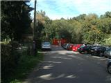 2
2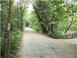 3
3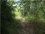 4
4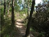 5
5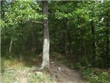 6
6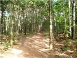 7
7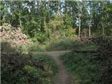 8
8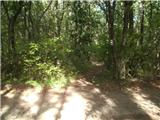 9
9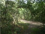 10
10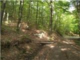 11
11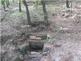 12
12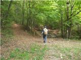 13
13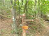 14
14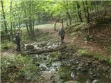 15
15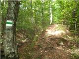 16
16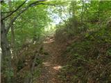 17
17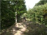 18
18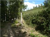 19
19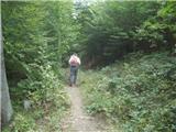 20
20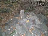 21
21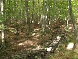 22
22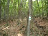 23
23 24
24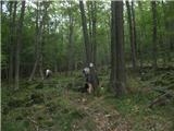 25
25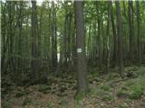 26
26 27
27 28
28 29
29 30
30 31
31 32
32 33
33 34
34 35
35 36
36 37
37 38
38 39
39 40
40 41
41 42
42 43
43 44
44 45
45 46
46 47
47 48
48 49
49 50
50 51
51 52
52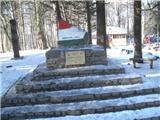 53
53
Discussion about the trip Matrafüred - Kékestető (zelena pot)
To post a comment you must log in:
If you do not yet have a username, you must first
register.