Starting point: Medjugorje (190 m)
Walking time: 1 h
Difficulty: easy marked way
Elevation gain: 258 m
Elevation difference along the route: 266 m
Map:
Recommended equipment (summer):
Recommended equipment (winter):
Views: 22.001
 | 5 people like this post |
Access to starting point:
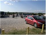
From Mostar, we drive towards Čitluk. Just a little after Čitluk, the road to Medjugorje branches off to the left. We follow this road, which quickly brings us to the pilgrimage site, to the large marked parking lot near the church.
From the Croatian side: Between Šibenik and Dubrovnik, in the town of Vrgorac, we notice the signs for Medjugorje. We follow these signs to the mentioned place (the intersections are well marked).
Route description:
From the parking lot at the church, we continue towards the large statue of Jesus Christ and then past the cemetery to the road, where we continue right slightly uphill. After a few minutes of walking, we reach a crossroads, where we continue right towards Križevac. From the road, which continues to ascend, the start of the path to the mentioned mountain soon branches off to the left. We follow this path, which is quite steep and along which the Way of the Cross runs, all the way to the summit, where a large cross stands.
Photos:
 1
1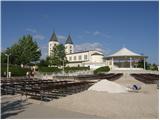 2
2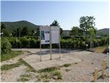 3
3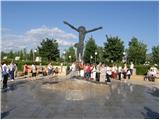 4
4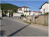 5
5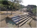 6
6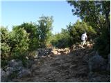 7
7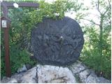 8
8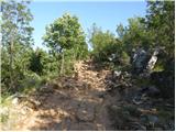 9
9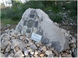 10
10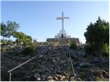 11
11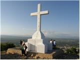 12
12
Discussion about the trip Medjugorje - Križevac
|
| VanSims19. 08. 2012 |
The path from the start of the ascent (picture 6) is not easy at all and I would classify it as partially demanding. The path goes over rocks, not a made hiking path or just vegetation removed. Need to watch your step very carefully.
Mountaineering boots highly recommended, although there were people in dress shoes and sneakers and of course some in flip-flops, sandals,... even barefoot (probably penance or similar).
In hot summer months (for local climate e.g. at least from early June to end of September) also have plenty of water and head cover against the sun.
WARNING! If you park right before the start of the ascent (picture 6) there is a sign no parking for 600 m, traffic wardens issue tickets! Nearby parking costs 1KM per hour.
|
|
|
|
| VanSims19. 08. 2012 |
Oh yes and poles of course, mandatory!
|
|
|
|
| Chirrilona20. 08. 2012 |
The path is not easy at all, I agree with the previous one. In addition to the path to the summit being over rocks and really big ones at that, which are very slippery on top of everything. Down seemed even harder to me than up, as it's very slippery, on some sections it was best to just sit on the rock to get down. Some more illustrative picture of these rocks wouldn't be superfluous.
|
|
|
|
| Chirrilona20. 08. 2012 |
I would share my pictures of this rocky terrain with you if I knew where to send them. 
|
|
|
To post a comment you must log in:
If you do not yet have a username, you must first
register.