Medvedova konta - Brda (west path)
Starting point: Medvedova konta (1410 m)
| Latitude/Longitude: | 46,37480°N 13,94090°E |
| |
Route name: west path
Walking time: 2 h
Difficulty: easy marked way
Elevation gain: 598 m
Elevation difference along the route: 588 m
Map: TNP 1:50.000
Recommended equipment (summer):
Recommended equipment (winter): ice axe, crampons
Views: 34.494
 | 1 person like this post |
Access to starting point:
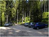
From the Ljubljana - Jesenice highway, take the Lesce exit and follow the road towards Bled; there, at the traffic-light intersection, signs for Pokljuka direct us to the right. Follow this road, which in the lower part runs through some villages and later starts to ascend more steeply, to Mrzli Studenec (mountain pasture located just over 50 m behind the intersection where the road to Bohinj branches off to the left downwards). In the middle of the mentioned mountain pasture, a road branches off to the right from the main road to Medvedova konta, Pri Rupah and mountain pasture Javornik. Here, turn right and follow the road to the next intersection, where continue right in the direction of Medvedova konta (straight to mountain pasture Javornik). The road ahead, after a short ascent, descends and brings us to the next intersection, where we continue left in the direction of Blejska koča mountain hut. Then follow this road to the parking lot in front of the barrier.
Route description:
From the parking lot, continue along the rough road closed by a gate, which quickly turns into a cart track. Soon, a path from mountain pasture Javornik joins the moderately steep cart track. Continue the ascent along the very wide cart track, which in a gentle ascent brings us to the grazing area of mountain pasture Lipanca in a few minutes. Here the path turns right and leads us in a moderate ascent along the right lower edge of the mentioned mountain pasture. This is followed by crossing a grassy slope, and the path that brings us back into the forest makes a sharp right turn at the NOB monument, after which we reach the shepherd and mountain hut on mountain pasture Lipanca.
From the mountain pasture, continue right along an initially poorly visible and even more poorly marked path, which after a short ascent brings us to the upper edge of the mountain pasture, where there is also a smaller junction. Continue slightly left in the direction of Lipanski vrh, Brda and Debela peč along the path that bypasses a larger sinkhole on the right side. A little further on, a path to Lipanski vrh branches off from the "main" path. Continue slightly right in the direction of Debela peč along the path, which gradually begins to ascend more and more steeply. After passing this somewhat steeper section of the path, we reach the next junction, where we continue left in the direction of Brda (straight to Debela peč). The path ahead ascends moderately through increasingly sparse forest and brings us on grassy slopes to a junction, where the path from Krma joins us.
Continue right in the direction of Brda and Debela peč, but only to the next junction. Here, head left upwards in the direction of Brda and follow the path along the summit panoramic slope to the top, which we reach without major difficulties.
Starting point - Lipanca 45 minutes, Lipanca - Brda 1:15.

Photos:
 1
1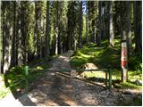 2
2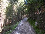 3
3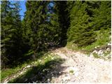 4
4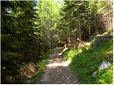 5
5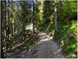 6
6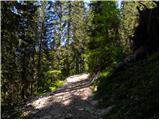 7
7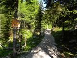 8
8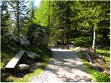 9
9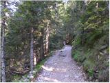 10
10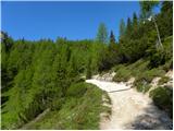 11
11 12
12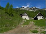 13
13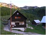 14
14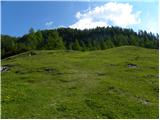 15
15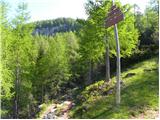 16
16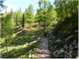 17
17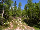 18
18 19
19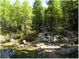 20
20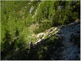 21
21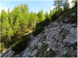 22
22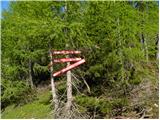 23
23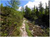 24
24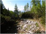 25
25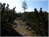 26
26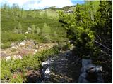 27
27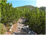 28
28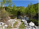 29
29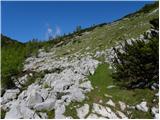 30
30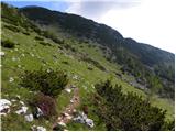 31
31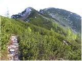 32
32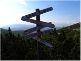 33
33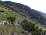 34
34 35
35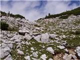 36
36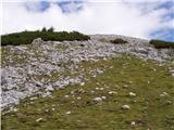 37
37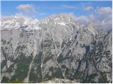 38
38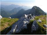 39
39 40
40
Discussion about the trip Medvedova konta - Brda (west path)
|
| nisa25. 01. 2011 |
I would like information about the conditions on the road Pokljuka - Medvedova konta.
Regards!
|
|
|
|
| Murglovc25. 01. 2011 |
Last week it wasn't passable, but you can drive by car to the monument Pri Rupah.
|
|
|
|
| minca2326. 01. 2011 |
Hi! Last Tuesday, Jan 18, I went to Debelo peč, and the road to Medvedova konta was quite passable.
Good luck to whoever goes.
|
|
|
|
| andrejjerina26. 01. 2011 |
On Saturday the road wasn't plowed towards Medvedova konta. As Murglovc already wrote to you, the road is nicely passable to the monument pri Rupah and that in both directions (read circular)! LP Andrej
|
|
|
|
| minca2326. 01. 2011 |
Oh, mistake, I turned right at the junction to hotel Šport past planina Javornik, there it was possible to drive.
|
|
|
|
| nisa28. 01. 2011 |
Thanks for the answers. On Saturday I'm going, even if the path is a bit longer. I hope the weather will be nice.
Regards!
|
|
|
|
| Marco-Slo7. 02. 2011 |
Has anyone been in this area these days?
How is the road to Medvedova konta?
Thanks for answers.
|
|
|
|
| AT10. 02. 2012 |
normally passable, was there yesterday 
|
|
|
To post a comment you must log in:
If you do not yet have a username, you must first
register.