Medvedova konta - Debela peč
Starting point: Medvedova konta (1410 m)
| Latitude/Longitude: | 46,37480°N 13,94090°E |
| |
Walking time: 2 h 15 min
Difficulty: easy marked way
Elevation gain: 604 m
Elevation difference along the route: 604 m
Map: Triglav 1:25.000
Recommended equipment (summer):
Recommended equipment (winter): ice axe, crampons
Views: 268.742
 | 16 people like this post |
Access to starting point:
From the Ljubljana-Jesenice highway, take the Lesce exit and follow the road towards Bled; there at the traffic-light crossroads, signs for Pokljuka direct us to the right. We follow this road, which in the lower part runs through a few villages and later starts to ascend more steeply, to Mrzli Studenec (mountain pasture, which is located a good 50 meters behind the crossroad where the road to Bohinj branches off left downwards). In the middle of the mentioned mountain pasture, from the main road a road branches off to the right which leads to Medvedova konta, Pri Rupah and mountain pasture Zajavornik. Here we turn right and follow the road to the next crossroad, where we continue right in the direction of Medvedova konta (straight to mountain pasture Zajavornik). The road ahead after a short ascent descends and brings us to the next crossroads, where we continue left in the direction of the mountain hut Blejska koča. We follow this road to the parking lot in front of the gate; further driving is forbidden.
In winter, the road to the described starting point is usually not passable.
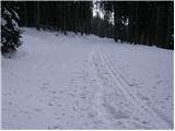
Route description:
From the parking lot we continue on the rough road closed by the gate, which quickly changes into a cart track. To the moderately steep cart track soon joins the path from mountain pasture Zajavornik and monument Pri Rupah. We continue the ascent on the very wide cart track, which in a gentle ascent in a few minutes brings us to the grazing area of mountain pasture Lipanca. Here the path turns right and in a moderate ascent leads along the right lower edge of the mentioned mountain pasture. Follows crossing of a grassy slope and the path, which brings us back into the forest, makes at the memorial plaque NOB a sharp right turn, after which we come to the shepherd and mountain hut on mountain pasture Lipanca.
From the mountain pasture we continue right on an initially poorly visible and poorly marked path, which after a short ascent brings us to the upper edge of the mountain pasture, where there is also a smaller junction. We continue slightly left in the direction of "Lipanski vrh, Brda and Debela peč" on the path which on the right side bypasses a larger sinkhole. A little further, from the "main" path branches off the path towards Lipanski vrh.
We continue slightly right in the direction of Debela peč on the path which gradually starts to ascend steeper and steeper. When we pass this somewhat steeper part of the path we come to the next junction, where we continue straight in the direction of Debela peč (left Lipanska vrata and Brda). We continue on the level path, from which already after a few more steps to the right branches off the path to mountain pasture Klek. The well-marked path then on the left side bypasses the interesting peak named Spodnja Brda (1844 m) and thereafter starts to ascend steeper on ever less vegetated slopes. When we reach the broad ridge the steepness eases and the path turns right, where it bypasses the dwarf pine-covered Okroglež. Follows a 10-minute crossing towards the east, which ends at the foot of the summit of Debela peč. Here the path ascends steeply and brings us after another 10 minutes to the panoramic peak.
Starting point - Blejska koča 45 minutes, Blejska koča - Debela peč 1:30.

Photos:
 1
1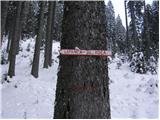 2
2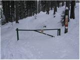 3
3 4
4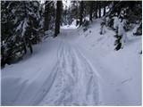 5
5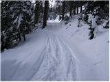 6
6 7
7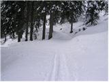 8
8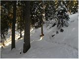 9
9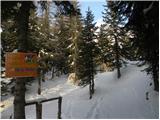 10
10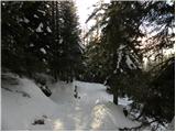 11
11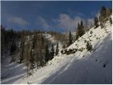 12
12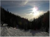 13
13 14
14 15
15 16
16 17
17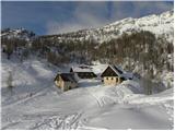 18
18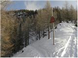 19
19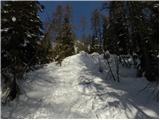 20
20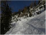 21
21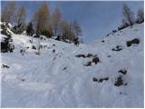 22
22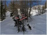 23
23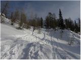 24
24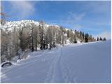 25
25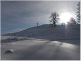 26
26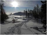 27
27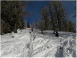 28
28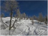 29
29 30
30 31
31 32
32 33
33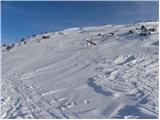 34
34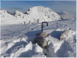 35
35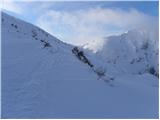 36
36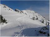 37
37 38
38 39
39 40
40 41
41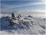 42
42 43
43
Discussion about the trip Medvedova konta - Debela peč
Show older messages
|
| Gost17. 08. 2006 |
A very easy tour, which is really worth visiting because of the view we have at the top of Debela peč.
Alenka
|
|
|
|
| Gost17. 08. 2006 |
Even more beautiful is the tour that connects all the peaks: from Debela peč to Brdo, then to Lipanski vrh, from there to Mrežce and descent to the hut on Lipanca. In all seasons, it's very, very beautiful here. The tour is really not strenuous, but you can recharge your batteries for the whole week.
|
|
|
|
| ljubica17. 08. 2006 |
Wonderful tour also in winter under favorable snow conditions (firm track). Lj.
|
|
|
|
| mkonci20. 08. 2006 |
Debela peč, very easy path, super view in nice weather. I was up there yesterday 19.8.06 we went from Medvedova konta to Lipanca (1633m). From there to Debela peč (2014m) then to Brda (2009m) further to Lipanski vrh (1975m) then also to Mrežce (1965m) and Vrh Razora (1893m, you can't get right to the top overgrown) and finally to Debeli vrh (1962m), we returned to Lipanca. The path is not demanding except at 2 places where there is a little steel cable and I think 2 pitons. We walked altogether 6 hours, 20 min. It was really nice.
|
|
|
|
| Gost30. 08. 2006 |
In Medvedova konta you can find some boletus.... Nice excursion ,,which we will repeat in autumn when the larches are golden.
|
|
|
|
| Gost30. 05. 2007 |
What are the conditions like on Debela peč???
|
|
|
|
| Gost31. 05. 2007 |
From Pokljuka via Blejska koča it was dry on Saturday, 26 May.
|
|
|
|
| johnybravoslo8. 08. 2007 |
On 05.08.2007 it was a perfectly beautiful day. Temperature up to 25 Celsius.
View of Triglav magnificent.
From the parking lot via Blejska koča approx. 2 hours of slow walking. Midway encounter with an adder (75 cm, black as coal).
|
|
|
|
| Gost8. 08. 2007 |
But if that adder was black as coal and without the "pattern" i.e. characteristic zigzag, then it wasn't an adder.
|
|
|
|
| Gost12. 08. 2007 |
that's a good one!? Fear has big eyes!? Best! Guest
|
|
|
|
| johnybravoslo29. 08. 2007 |
Guest...good expert on snakes.
If you've ever seen the aforementioned snake above, the zigzag pattern is not visible from all perspectives.
Take a good look at it once.
Then be smart on forums....and don't be "guest", at least give your name.
If you can't do that, let me know....
LP
|
|
|
|
| kvak31. 08. 2007 |
How some people get excited quickly and become a bit rude when you mildly oppose them. You saw what you saw! But capital letters your "gad" still doesn't deserve, especially since you use lowercase for our dad.
|
|
|
|
| sector17. 03. 2008 |
Currently conditions for Debela peč are unsuitable (too much snow). LP
|
|
|
|
| počasni27. 08. 2008 |
Was up there on 21.8. Really nice trip!
For slower ones: 45min from konta to koča is spot on, but for the section from koča to the summit better take a half hour reserve.
|
|
|
|
| GITA10. 10. 2008 |
First Guest or someone else, can you give me information if a circular path is possible, approximately how much time per section:
- from the top of Debela peč to Brda
- from Brda to Lipanski vrh
- from Lipanski vrh to Mrežce
We would go with children sometime, so I can assess if we can afford the whole loop or shorten from Debela peč directly via Lipanska vrata back to Lipanco.
And one more question: on my map, the marked path over Lipanski vrh is not drawn. Is the path well visible and possible junctions marked? Thanks.
|
|
|
|
| Brane7110. 10. 2008 |
The path from Debela peč to Mrežce takes one and a half to at most two hours. The path is well visible but there is one very steep section between Lipanski vrh and Mrežce, if I'm not mistaken, but secured with wire ropes. It's a very nice hiking tour. Good luck!
|
|
|
|
| GITA10. 10. 2008 |
Many many thanks! 
|
|
|
|
| dj1223. 05. 2009 |
LP- has anyone perhaps been to Debela peč from Pokljuka these days!? Is there still snow on the path?
Thanks for any information
|
|
|
|
| Simon2822. 07. 2009 |
Today I was up there....unforgettable...weather gorgeous..everything ok...then did a circular route back via Mrežče - really recommend it.
LP
|
|
|
|
| laraa9. 11. 2009 |
I have one question? What about the path if continuing from Debela peč over Okroglež to Brda and from there back to Lipanca?
Realization probably only next year, but anyway...
Thanks, LP!
|
|
|
|
| viharnik9. 11. 2009 |
The trail in question, you've probably already traversed it in one direction if coming from Lipance, unless you start from pl. Klek? From Brd 2009m, the descent to the trampled transversal or main ridge is just over five minutes on easy terrain in summer. In winter, there can be cornices there.
|
|
|
|
| laraa10. 11. 2009 |
Viharnik, thanks for the reply! I haven't walked this trail from Lipance yet. Since it's not long, it seems a shame not to connect Brd as well. LP
|
|
|
|
| michael6610. 11. 2009 |
Some photos from this trail this March.
|
|
|
|
| michael6610. 11. 2009 |
Sorry, pictures cannot be uploaded here.
|
|
|
|
| pasavec18. 11. 2009 |
Hello! Has anyone been to Debela peč from Blejska koča in recent days? I'm interested in snow conditions... Thanks!
|
|
|
|
| spelii18. 11. 2009 |
I was at Debela peč from Blejska koča on Sunday, the path is trodden. There was about half a meter of snow, given the high temperatures these days I think there's much less now. Have a nice hike
|
|
|
|
| kris30. 04. 2010 |
Has anyone been to Debela peč recently, I'd go tomorrow but wonder how much snow is left?
|
|
|
|
| el rocco2. 08. 2010 |
Yesterday I was at the summit, and I must say I recommend this trip to everyone. The route is not demanding, the views from the top phenomenal. The only black spot is the summit stamp which does not deserve the name stamp  but just a smudge. Regardless that I got a new one later at Blejska koča, I call on the responsible persons to do something about it. but just a smudge. Regardless that I got a new one later at Blejska koča, I call on the responsible persons to do something about it.
|
|
|
|
| laraa23. 08. 2010 |
Yesterday I went up Debela peč via this route. Path super, lots of people, view wonderful. I also climbed to Brda and then back to Lipance. Unforgettable!
|
|
|
|
| petrah77729. 08. 2010 |
today I was with my dear one at Debela peč, really nice path. The weather also served well, windy at the summit but still sunny...then to Brda, Lipanski vrh, Mrežce and back towards Blejska koča
|
|
|
|
| storž9. 11. 2010 |
On Saturday 6.11. I was at the top, more than 40 of us were sunbathing up there, conditions ideal. Hut open, very friendly, unique experience, view from the top like few others. Only at the parking lot unfriendly and haughty "locals" from Bled who don't like Dolenjci, but no problem up there, I avoided them in the hut, they didn't go up the hill anyway, because the goal was free beer in the hut. Shame such people don't read these lines.
|
|
|
|
| majazmaja10. 11. 2010 |
Storž, if you show up here in the next few days, please write if the trail, which is probably quite snowy these days, is suitable for small children (5 and 7 years old) used to hiking and about how many cm of snow is on the trail? Best regards
|
|
|
|
| stefanb10. 11. 2010 |
Just for information.
As far as I know, the Bled hut should be closed this and next week.
For reliable information, you can call 051/ 621 021, 051/ 633-769.
|
|
|
|
| storž10. 11. 2010 |
Yes, on Saturday there was little snow, none at the top, but after these precipitations I think there will be enough. In Klinar's book it says that the summit is accessible all year round even for families with children, so no problem, the question is only trampling the snow. Access by car will also be more difficult. Overall easier than to Viševnik, and the friendly hut is open all year. Highly recommended. Best regards.
|
|
|
|
| Parkeljc14. 01. 2011 |
Yesterday we took it towards Debela peč, to Okroglež without major issues, except for at least half a meter of new snow in places, no path even for orientation (from Blejska koča).. From Okroglež we descended about 150 m, then you have to cross a quite dangerous scree slope, but we decided to turn back as there was too much new snow and it was too dangerous. The snow transformed very quickly, a little after noon it was already quite heavy, but not yet wet. At the top of Okroglež calm..., to Mrežc trodden (visible path).
|
|
|
|
| Domn10. 08. 2011 |
Is there a mountain hut right on the top of Debela peči where you can eat something or do you have to go to Lipance or somewhere else? I can't find it on the hut list.
|
|
|
|
| kr neki10. 08. 2011 |
On the top of Debela peči there is no hut. There is a summit book and stamp. You can eat at Lipanci or elsewhere.
|
|
|
|
| Kokta12. 11. 2011 |
Nice tour, sunny weather but cold wind was a bit annoying. Just FYI for those who haven't been there yet..From Mrzlega studenca to Medvedova konta it's about 7 km of macadam road. Otherwise I recommend the visit.
|
|
|
|
| Nuši20. 11. 2011 |
Beautiful tour. Fog in the valley all the way to Gorje, then it cleared up. Beautiful weather, beautiful views. Quite a few people on the path. Of course, everyone who could "escaped" from the fog to the sun.
|
|
|
|
| Alni21. 08. 2012 |
Nice tour, nice views especially on Triglav On Sunday the weather was wonderful.
We took 3 hours 45 min together with stops for both directions.
|
|
|
|
| Sašo119. 08. 2013 |
Very nice hike, especially the views from Debela peč. Recommended! You won't regret it.
|
|
|
|
| simdey24. 01. 2015 |
Was anyone here this weekend? What are the snow conditions?
|
|
|
|
| srfar17. 02. 2015 |
Oh!
Has anyone gone this way recently?
I'm interested in how far you can get by car.
Best regards.
|
|
|
|
| mrak.miša@gmail.com18. 02. 2015 |
Yesterday I was at D.peč from pl. Zajavornik...from Medvedova konta there are only footprints of two hikers, no trodden path, so I assume the road isn't plowed either. That's it, if it's of any help
|
|
|
|
| Nastja8930. 10. 2015 |
Hello,
has anyone been to Debela peč in the last few days? How is the snow? Thanks for help
|
|
|
|
| PFranci30. 10. 2015 |
Check current conditions under title: Viševnik, MDV, VDV, Ablanca and you'll see what the conditions are like above Pokljuka. No snow.
|
|
|
|
| lepenatka31. 10. 2015 |
No snow, today it was real summer weather
|
|
|
|
| hribolazka9112. 11. 2015 |
just back from Debela peč really nice hike, dry, perfect weather for a short-sleeved shirt and windbreaker at the top from Blejska koča to the summit took us 1 hour and 5 min with stops
highly recommend!
|
|
|
|
| fpetel128. 05. 2016 |
Hello!
Is there still any snow on this trail?
Thanks for the help.
|
|
|
|
| Mitke28. 05. 2016 |
There's still quite a bit of snow (I'd say up to half a meter or even more) in shady spots... Yesterday saw a snow "patch" already at about 1200 m asl on Pokljuka.
|
|
|
|
| borisf14. 06. 2016 |
Hi.
This weekend, on Saturday 18.6 we'd head to Debela peč. A little hillwalker - 7 years - will be with us, and I'm interested in the snow conditions? Thanks for the info
|
|
|
|
| matzaj18. 06. 2016 |
I'm also interested in the same, if anyone has any information.
Regards
|
|
|
|
| Becar23. 07. 2016 |
This year I did the mentioned path for the first time. I would warn that when accessing Medvedova konta, you need to follow the note to turn right after the junction for Bohinj. Namely, at the mentioned junction there is no sign for Mrzli Studenec or Medvedova konta, which I was looking for the most. The sign is only for Lipanco and Blejska koča. However, there are THREE junctions to Rudno polje with signs for Blejska koča! Because I didn't read the access carefully enough, I drove not only past Medvedova konta, but also past Lisičja, Zajčja and some other konta, finally found the goal
|
|
|
|
| ločanka28. 12. 2016 |
Has anyone driven to Medvedova konta recently? Is the road icy?
Thanks in advance.
|
|
|
|
| @rekar28. 12. 2016 |
You can drive without worry, the road is dry.
|
|
|
|
| citam28. 12. 2016 |
The road is icy. Quite a bit in some places. Careful.
|
|
|
|
| ločanka29. 12. 2016 |
What kind of jokes. @rekar, I'd rather believe you
|
|
|
|
| mjan12. 03. 2017 |
The road to Medvedova konta was very icy today, so visitors turned back en masse. If you don't have a car with chains or all-wheel drive, it's not safe.
|
|
|
|
| trdi21. 08. 2017 |
It should be noted that the actual junction from the main road on Pokljuka is 100 m after the intersection where the road to Bohinj branches off to the left downhill (which is well signposted), as there is another junction before this intersection that also eventually leads to the starting point, but you get lost on various forest branches. So, when you turn right at the correct junction onto the gravel road, you drive 2.5 km, then turn right again, then after 0.9 km right again, then after 0.8 km left, then after 0.9 km left once more, and then keep straight for 1.3 km to reach Medvedova konta.
|
|
|
|
| Enka21. 08. 2017 |
The description to the starting point is perfectly fine. Without any doubt (and without a meter ) it leads you to Medvedova konta. ) it leads you to Medvedova konta.
|
|
|
|
| Katja5614. 09. 2017 |
Yesterday I was up there for the first time. Wonderful view. The middle section was a bit slippery due to melting snow but we still got there safely.
|
|
|
|
| J.P.13. 01. 2018 |
Today we were at the top. Due to snowy conditions, we left the car at the first right turnoff towards Lipanco. The path then lengthens by less than an hour. Winter gear needed, otherwise the tour is even nicer now than in summer :-) Regards
|
|
|
|
| KJ15. 01. 2018 |
The road (on Saturday) is normally drivable to the parking lot at Medvedova konta..
|
|
|
|
| skala12318. 01. 2018 |
The road to Medvedova konta is not passable, checked today.
|
|
|
|
| masker10. 08. 2018 |
Yesterday I made the ascent to Debela peč with friends. It was really great. In beautiful clear weather we enjoyed a wonderful view from the top to Triglav and the other Julian and Karawank peaks. The south wind that blew hard ensured it wasn't too hot. I also headed to Brda and Lipanski vrh. On the descent from this peak via the via ferrata, it would be advisable to install a cable in the lower section, right before the exit, for about two and a half meters (or three), which provides a sense of security. Otherwise all good. Nice hiking greeting!
|
|
|
|
| POLJANC10. 08. 2018 |
Too bad you didn't extend further to Mrežce. Then to Blejska koča. Super tour. Nice hiking greeting and safe steps.
|
|
|
|
| Zdenkob15. 10. 2018 |
On Saturday I did a circular tour from Blejska koča to Debela peč, then back via Brda, Lipanski vrh and Mrežice. Nice weather, nice views and easy path (except for two short sections secured with cables). I would just note that the gravel road from the main road to the starting point is very potholed in places. Log trucks obviously do their damage.
|
|
|
|
| AronBreitenberger21. 12. 2018 |
I'm wondering if the path from Lipanci is trodden to Debela peč. Lp
|
|
|
|
| miri21. 12. 2018 |
If your namesake got you, he would run right over the top of any possible snow. He was a teacher and knows Slovenian.
|
|
|
|
| khribi6. 03. 2019 |
What are the current conditions?
|
|
|
|
| boogle16. 05. 2019 |
Does anyone know the current conditions? If the weather holds, I'd go up on Saturday or Sunday.
|
|
|
|
| zvezdica_zaspanka8. 10. 2019 |
Ugh, the road by car to Medvedova konta is a potholed lottery. Signs are there or not, in the end I didn't even know where I parked. Only when I got home did I realize that it was probably Medvedova konta - let me emphasize that I followed the instructions for the starting point Strmec
Otherwise, a beautiful, pleasant and not strenuous path and wonderful view from the top.
|
|
|
|
| MajaT4. 07. 2020 |
Has anyone perhaps been recently to this starting point (Medvedova konta) by car? I have a quite low car and would like to check if it's feasible or if it's better to take some other starting point?
Thanks for any info
|
|
|
|
| tinky4. 07. 2020 |
Check the current conditions Debela peč!
|
|
|
|
| primozg5. 07. 2020 |
MajaT - if you go from Rudno polje you'll have only about half an hour more walking, to the starting point you arrive via asphalt road.
|
|
|
|
| Andrey Ts19. 05. 2021 12:51:27 |
Has anyone been to Debela peč recently? I'm planning to go on Friday and I'm wondering how much snow there is?
|
|
|
|
| rbubnjar17. 04. 2022 12:18:22 |
Beyond Blejska koča there is a huge amount of snow. Not recommended, as your leg sinks up to the waist at every step. Better to wait a month or two for the snow to melt.
|
|
|
|
| azzey20. 05. 2022 11:43:41 |
Has anyone been on this trail recently? How is the snow situation?
|
|
|
|
| Evjuna20. 05. 2022 16:55:34 |
On 15.5. there might have been a patch somewhere.
|
|
|
|
| orchigu5. 07. 2022 21:08:58 |
This is really an excellent hike. The caretaker at the hut (don't know if new this year?) is a real legend. The path at this time is like a walk through a botanical garden. Excellent and undemanding tour, if that's not enough for someone, you can then hop to e.g. Lipanski vrh. For cars, as you ask - I think you can get almost there with any. This year and last I drove here with an old Polo and a CLC Mercedes, no panic with either. Polo is a tractor anyway but you can make it even with low clearance. A few potholes on the road, but not huge and most can be avoided. The trip is really 1A, I recommend to everyone. 2.15h is in my opinion (I generally walk at the pace as marked) a very touristy variant - but in the mountains we don't need to rush
|
|
|
|
| Napolhribovc31. 10. 2022 20:58:35 |
Hello. If anyone is online, I'd appreciate some tips on how to get to Medvedova konta from the Bled side (road to Pokljuka), where to turn. The car will make it, but I have no idea where to go. I'd like to take my son up, and this path seems perfect. Thanks in advance!
|
|
|
|
| Enka31. 10. 2022 21:59:26 |
Access to the starting point is described above. The description is good, I found it without problems.
|
|
|
|
| Napolhribovc31. 10. 2022 23:32:15 |
Yes, I believe so. Well, I'll try tomorrow and hope it works. I don't know where Medvedova konta is now, but Google Maps shows the location 'Lipance, Blejska koča' and the parking in front of it, which I think is the spot I'm looking for. I think there won't be problems with that and it will go smoothly. Otherwise, I'll write more tomorrow evening. Thanks!
|
|
|
|
| Napolhribovc1. 11. 2022 15:55:18 |
Here, it was great. Divine day, Medvedova konta located, parking space too, bottom line - divine. Blejska koča, Debela peč, Brdo and back to the car. Just the right number of people, excursion maximally successful. I would post a picture, but I don't know how / don't know how to upload. Otherwise, you've probably all seen it first-hand anyway, so you're not missing much
|
|
|
|
| bos1. 11. 2022 19:29:23 |
You can upload pictures under current conditions, where you find the appropriate topic.
|
|
|
|
| Potisk24. 07. 2023 18:25:14 |
Today from Medvedova konta to the summit... finding the starting point is really no problem, but after storms the macadam is quite damaged. You can get there by car, but more in first and second gear and with a lot of sympathy for the undercarriage. Otherwise a wonderful trip.
|
|
|
|
| dussan27. 09. 2023 22:06:53 |
Today I drove to Medvedova konta without problems, the road is exemplarily maintained.
|
|
|
|
| LuncaPetra26. 12. 2023 14:46:42 |
Plowed to the parking lot, with very little ice, winter tires are sufficient. On the way to the summit very little snow, but icy in the morning hours and crampons are recommended. The summit is completely bare.
|
|
|
|
| GregaČ2. 11. 2024 16:20:46 |
Went on 1.11.2024 to Debela peč from Medvedova konta. We went slowly 3h up and then easier 2h down. Started at 11:00 and back at 16:30. Weather was exceptionally nice autumn, sunny and warm. When at Mrzli Studenec you turn down from asphalt right towards Blejska koča (direction sign), the macadam starts, which was in quite good condition. Obviously they repaired the potholes, so there weren't many. Then there's a fork about in the middle, well marked to the right for Medvedove konte. Parking at the end where the road ends is not big, so if crowded, park a bit earlier along the road. Today there were many people but we still found a spot. The path is very pleasant, ascending gradually, so before you reach the steeper part, you're already warmed up. Blejska koča was unfortunately closed! In the second half of the path, beautiful view opens to Krma, Rjavina, Triglav, Veliki Draški vrh, so it's really a pleasure to walk. At the top of Debela peč there's also signal (A1 and Telemach) so you can make a call home in peace that you arrived safely Regarding the stamp, it's fixed (you just press the booklet against it) so it's essential to have ink and pad with you. Registration book is also available. Highly recommend
|
|
|
To post a comment you must log in:
If you do not yet have a username, you must first
register.