Medvedova konta - Debela peč (via Kotel)
Starting point: Medvedova konta (1410 m)
| Latitude/Longitude: | 46,37480°N 13,94090°E |
| |
Route name: via Kotel
Walking time: 2 h 25 min
Difficulty: easy pathless terrain, easy marked way
Elevation gain: 604 m
Elevation difference along the route: 675 m
Map: TNP 1:50.000
Recommended equipment (summer):
Recommended equipment (winter): ice axe, crampons
Views: 9.173
 | 1 person like this post |
Access to starting point:
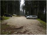
From the Ljubljana - Jesenice highway, we take the Lesce exit and follow the road in the direction of Bled; there, at the traffic-light crossroads, signs for Pokljuka direct us to the right. We follow this road, which in the lower part runs through a few villages and later starts to ascend more steeply, to Mrzli Studenec (mountain pasture, which is located good 50 meters behind the crossroad, where the road to Bohinj branches off left downwards). In the middle of the mentioned mountain pasture, from the main road a road branches off to the right which leads to Medvedova konta, Pri Rupah and mountain pasture Zajavornik. Here we turn right and follow the road to the next crossroad, where we continue right in the direction of Medvedova konta (straight to mountain pasture Zajavornik). The road ahead after a short ascent descends and brings us to the next crossing, where we continue left in the direction of the mountain hut Blejska koča. We follow this road to the parking lot in front of a gate, further driving is forbidden.
In winter time, the road to the described starting point usually is not accessible.
Route description:
From the parking lot, we continue on a wide cart track in the direction of the mountain hut Blejska koča na Lipanci. On the wide cart track, over which there is a gate, we walk to the first left turn. At the mentioned turn we leave the cart track and continue straight through the forest, where we follow a fainter trail, on which in less than 5 minutes we arrive at the end of the nearby forest road. We reach the road at the turning area, which is very similar to some sort of roundabout. We head into the circle in the clockwise direction, but we walk along the road to the nearby cart track which branches off to the left from the road (the cart track is located a few meters before we step out of the circle). We head onto the mentioned cart track, which continues along the left side of the nearby Kotel (Kotel is a larger, mostly unvegetated sinkhole in the middle of the forests, in which cold air lingers). The cart track, which barely noticeably descends, soon ends, and we continue in approximately the same direction.
Further on, we walk on pathless terrain, only occasionally can we follow remnants of old cart tracks and trails.
From the place where the cart track ends, we first descend slightly along the lower edge of the slope (slope on the left side, to the right the terrain is less steep), then we continuously ascend gently to moderately through a series of indistinct valleys, which are located along the lower edge of the already mentioned slopes. Higher up the "path" becomes temporarily somewhat steeper, then it quickly levels out on the meadows of Prevala, where we reach the marked path Planina Klek - Debela peč, or Planina Klek - mountain hut Blejska koča na Lipanci.
We reach the marked path right at the marked junction, and we continue straight in the direction of Debela peč (left Lipanca, right Planina Klek). Ahead the path begins to ascend moderately through increasingly sparse (mostly) larch forest. A little further on we enter a smaller valley, along which we ascend to the place where the signs for Debela peč direct us sharply to the left. The path ahead enters a belt of dwarf pines, through which we climb below the ridge of Klečica (the actual peak of Klečica is located further to the right). Only a few 10 m before the mentioned ridge, the marked path turns left and begins to descend transversely towards the southwest. During the descent, a wonderful view of Debela peč opens up to us several times. The path ahead crosses the dwarf pine-covered slopes for some time more, then turns right and begins to ascend very steeply. After a short ascent we reach the ridge again, from which a nice view opens towards Radovna.
On the ridge the path turns left and withdraws from it into the dwarf pines, through which the path continues to ascend very steeply. Higher up the path levels out and brings us to a panoramic and at some points also precipitous ridge (the path runs somewhat below the ridge, so there is no major danger of slipping). The path ahead descends slightly, then brings us to the upper edge of a gully in the shape of the letter V. We continue on the marked path, which leads us further along the ridge of Debela peč; this brings us to the panoramic summit after less than 5 minutes of further walking.

Photos:
 1
1 2
2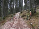 3
3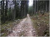 4
4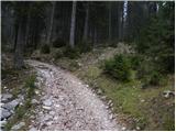 5
5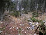 6
6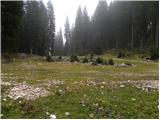 7
7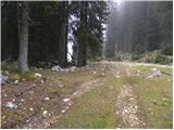 8
8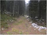 9
9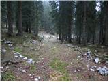 10
10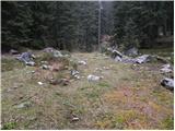 11
11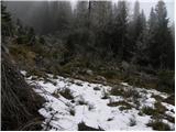 12
12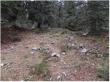 13
13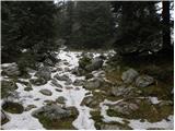 14
14 15
15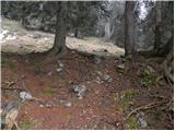 16
16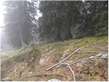 17
17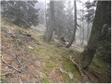 18
18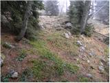 19
19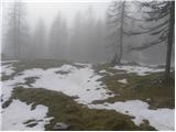 20
20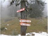 21
21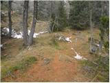 22
22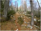 23
23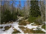 24
24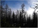 25
25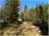 26
26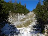 27
27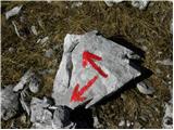 28
28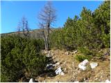 29
29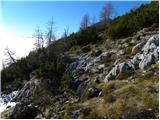 30
30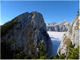 31
31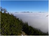 32
32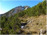 33
33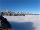 34
34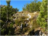 35
35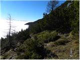 36
36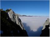 37
37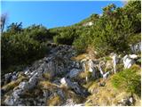 38
38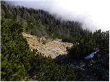 39
39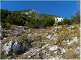 40
40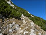 41
41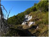 42
42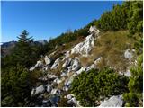 43
43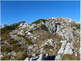 44
44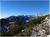 45
45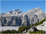 46
46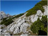 47
47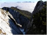 48
48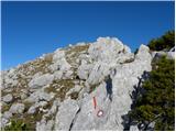 49
49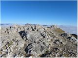 50
50 51
51
Discussion about the trip Medvedova konta - Debela peč (via Kotel)
To post a comment you must log in:
If you do not yet have a username, you must first
register.