Medvodje - Medvodnica (via Košutnik)
Starting point: Medvodje (854 m)
| Latitude/Longitude: | 46,40760°N 14,39150°E |
| |
Route name: via Košutnik
Walking time: 1 h 25 min
Difficulty: easy unmarked way
Elevation gain: 348 m
Elevation difference along the route: 350 m
Map: Karavanke - osrednji del 1:50.000
Recommended equipment (summer):
Recommended equipment (winter): ice axe, crampons
Views: 477
 | 1 person like this post |
Access to starting point:
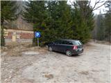
From the highway Ljubljana - Jesenice we go to the exit Podnart (Ljubelj), and then we continue driving on the fast road towards Ljubelj and Tržič. When the fast road ends, we will notice a gas station on the right side, in front of which we turn right downwards towards Tržič. Further, we drive through Tržič, while we follow the narrower road towards Dovžanova soteska and then through the villages Dolina and Jelendol to Medvodje, where we park on a marked parking lot by the nearby crossroad.
Route description:
From the parking lot, we continue on the left road in the direction of Košutnikov turn, Dolge njive and Košutnika (right Stegovniški slap). We first walk on a marked road, by which the blazes are rare, all the time ascending along the stream Košutnik. When the macadam road turns sharply right and crosses the stream, we leave the marked path, which continues along the stream, and continue walking on the road. There follows a diagonal ascent towards the right, when the road turns left and passes onto the ridge of Črna peč, we leave it and continue right on a cart track, which first lightly descends, then starts to ascend more steeply on the slopes of Medvodnica, at the junctions we continue straight and follow the wider cart track. When higher the wider cart track turns right upwards, we continue straight on the older cart track, along which in a few minutes we ascend to the saddle between Črna peč on the left and Medvodnica on the right.
On the saddle, where we step onto the road, we continue right on the cart track (along the road which we reach we can descend to the starting point, the roads left and right soon end), which starts ascending right of the ridge of Medvodnica.
There follows a moderate ascent on the cart track, from which a little further a nice view opens towards Košuta, a little higher we reach the ridge of Medvodnica, where the cart track narrows somewhat. There follows a few more minutes of walking to the end of the cart track, from there in a few steps we ascend to the indistinct summit of Medvodnica.
The description refers to the condition in April 2020, the pictures are from March and April 2020.

Photos:
 1
1 2
2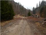 3
3 4
4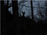 5
5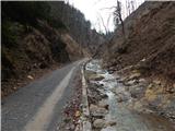 6
6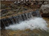 7
7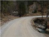 8
8 9
9 10
10 11
11 12
12 13
13 14
14 15
15 16
16 17
17 18
18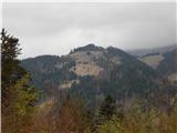 19
19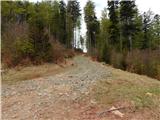 20
20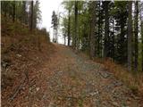 21
21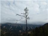 22
22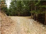 23
23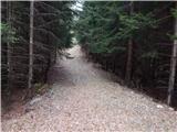 24
24 25
25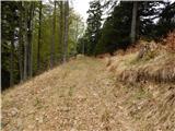 26
26 27
27 28
28
Discussion about the trip Medvodje - Medvodnica (via Košutnik)
To post a comment you must log in:
If you do not yet have a username, you must first
register.