Medvodje - Stegovnik (via Stegovniški slap)
Starting point: Medvodje (854 m)
| Latitude/Longitude: | 46,40760°N 14,39150°E |
| |
Route name: via Stegovniški slap
Walking time: 3 h 10 min
Difficulty: easy unmarked way, partly demanding marked way
Elevation gain: 838 m
Elevation difference along the route: 838 m
Map: Karavanke - osrednji del 1:50.000
Recommended equipment (summer): helmet
Recommended equipment (winter): helmet, ice axe, crampons
Views: 13.312
 | 1 person like this post |
Access to starting point:
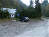
From the highway Ljubljana - Jesenice we go to the exit Podnart (Ljubelj), and then we continue driving on the fast road towards Ljubelj and Tržič. When the fast road ends, we will notice a gas station on the right side, in front of which we turn right downwards towards Tržič. Further, we drive through Tržič, and we follow the narrower road towards the gorge Dovžanova soteska and then through the villages Dolina and Jelendol to the hamlet Medvodje, where we park on a marked parking lot by the nearby crossroad.
Route description:
From the parking lot, we continue on the right road in the direction of Stegovnik and Stegovniški slap (left road leads towards the mountain pasture Dolga njiva), and it quickly brings us to the next crossroad. Here as well, we continue right (left road continues by the river Tržiška Bistrica) in the direction of Stegovniški slap. Further, the road leads us past the football field, after which the road gradually passes directly next to the stream Stegovnik. For some time we are ascending by the stream, on which we can observe small pools and cascades, and then on the left side we already notice the waterfall, to which a shorter footpath leads, and it branches off from the road to the left.
From the waterfall, we return to the road, and then we ascend along it to its end or the spot where it changes into a cart track. The cart track quickly splits into two parts, and we choose the right less distinct one. The right cart track, along which we continue the path, brings us only a few 10 steps ahead to the next junction. The right cart track continues towards the stream Stegovnik and ends higher by the riverbed, and we choose the left one, which gradually passes into a wider but poorly beaten footpath. Further, the path leads us through a belt of forest, after which we arrive at an overgrown clearing. Along the overgrown footpath we continue across the clearing, and on the other side of it we arrive at the stream Stegovnik. Here on the left side, only a few meters away we notice the hunting cottage Mantova, which is located at 1010 meters above sea level.
Before the hunting cottage or when we are parallel with it we continue right across the nearby stream and then on the other side we look for a poorly beaten footpath, which starts to ascend through the forest. The very poorly beaten and on some spots almost unnoticeable footpath gradually withdraws somewhat to the right from the bed of the main stream Stegovnik, but still holds approximately the same direction. In the upper part of the ascent through the forest the footpath completely disappears, and we only a little higher reach the forest road, which we follow to the right to the nearby crossroad.
At the mentioned crossroad, we continue left and continue the ascent along the moderately steep road, from which a nice view of Stegovnik opens up temporarily. Higher, we cross two more streams, and then we arrive at the next crossroad, where we continue along the right road. A little further we arrive at the widening of the road or some kind of turning area. Here we leave the road and continue the path left along an initially quite wide cart track, which continues through the forest for some time. Further, the forest thins out or completely breaks off at some spots, and the cart track leads us past a few smaller junctions. In all cases we continue along the "main" cart track, and along it with occasional views we walk to its end. When the cart track ends we continue right through easier pathless terrain. In less than 5 minutes of ascent through pathless terrain we reach the marked path mountain pasture Javornik - Stegovnik.
We follow the mentioned marked path to the left, and it quickly brings us to a junction, where the path from the Jezersko side joins us from the right (path from Dol and eastern path from Dom pod Storžičem). Only a little after the junction the slope becomes quite steep, and the path brings us to the first steel cable, with the help of which we enter the window in Stegovnik. In the middle of the window a passage opens to the left towards the second window, to which we descend along a shorter ladder, and from there we continue right through a smaller window, after which we step onto the other side of the ridge.
On the other side of the window, with the help of a shorter steel cable we descend to the slope, along which we then ascend relatively steeply. Further the steep path leads us under the cliffs (danger of falling rocks), and then we gradually arrive at the main ridge of Stegovnik. Here the path turns to the left and ascends to the southwestern secondary peak amid ever better views, from which a short indistinct descent follows along a locally narrow ridge. We continue along the very panoramic and on some spots precipitous ridge, along which in a few minutes of gentle ascent we arrive at the 1692 meters high summit.

Photos:
 1
1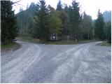 2
2 3
3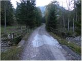 4
4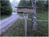 5
5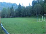 6
6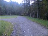 7
7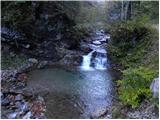 8
8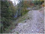 9
9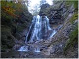 10
10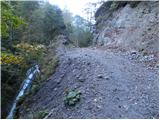 11
11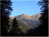 12
12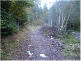 13
13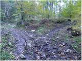 14
14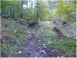 15
15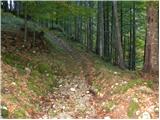 16
16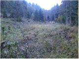 17
17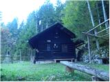 18
18 19
19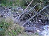 20
20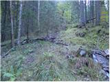 21
21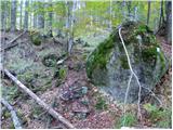 22
22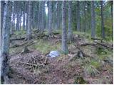 23
23 24
24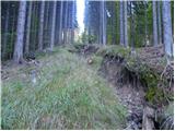 25
25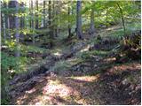 26
26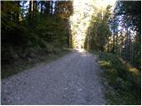 27
27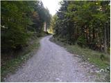 28
28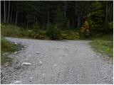 29
29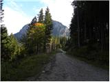 30
30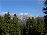 31
31 32
32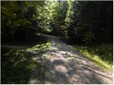 33
33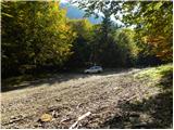 34
34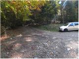 35
35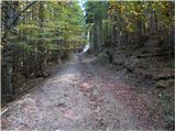 36
36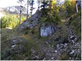 37
37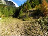 38
38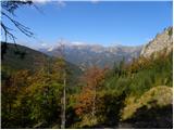 39
39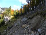 40
40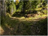 41
41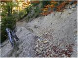 42
42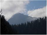 43
43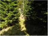 44
44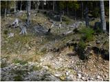 45
45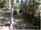 46
46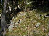 47
47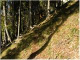 48
48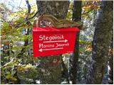 49
49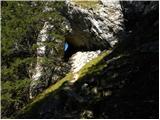 50
50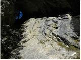 51
51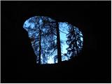 52
52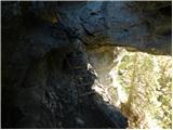 53
53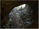 54
54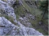 55
55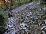 56
56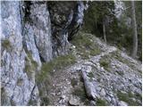 57
57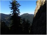 58
58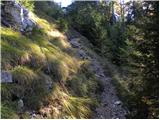 59
59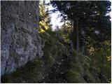 60
60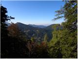 61
61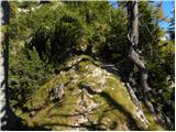 62
62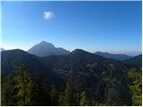 63
63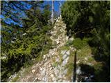 64
64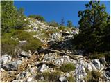 65
65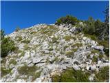 66
66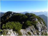 67
67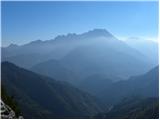 68
68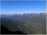 69
69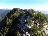 70
70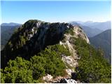 71
71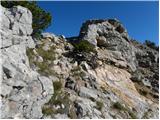 72
72 73
73 74
74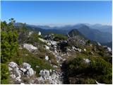 75
75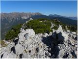 76
76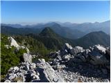 77
77
Discussion about the trip Medvodje - Stegovnik (via Stegovniški slap)
|
| laik25. 07. 2013 |
this one seems very interesting to me......is it suitable for a beginner...? thanks for the advice
|
|
|
|
| scorpio18. 04. 2014 |
Yesterday on this path. Varied and obstacle-filled. For easier orientation: when you cross the stream below the hunting hut, stick to the bed of the smaller stream, as the ice can quickly sweep a person away. This way you will reach the road (approx. 20 min) far enough to the left, where you then continue right. If the road does not soon turn sharply left and uphill, you are on its left section, so you need to turn back.
|
|
|
|
| andi227. 05. 2014 |
Today I went up this path to Stegovnik, back via the ridge, Lojtra and descent to the road and down the valley by road. Enjoyed many unmarked paths, escaped from the summit ahead of the thunderstorm, lightning and storm that nicely washed me during the descent, lots of good The path is probably not for beginners, on the way up I missed the way twice due to changes after the ice storm, it's also at least very demanding in terms of fitness, orientation moderately difficult. Possibly two additions (where I had trouble myself) - the upper path from the lookout forks many times and ascends very steeply in switchbacks. You know you're right when you reach picture 42at 38 go right, at 41 go left, although the main path seems maybe different. And for the lower part - after the ice storm everything is broken, along the left side of the stream we go over obstacles all the way to the remnant of the end of the forestry road (triangular shape of the cross a little before picture 14) above it as in the picture briefly right and then immediately left. Safe steps and lots of enjoyment in the mountains. The path is probably not for beginners, on the way up I missed the way twice due to changes after the ice storm, it's also at least very demanding in terms of fitness, orientation moderately difficult. Possibly two additions (where I had trouble myself) - the upper path from the lookout forks many times and ascends very steeply in switchbacks. You know you're right when you reach picture 42at 38 go right, at 41 go left, although the main path seems maybe different. And for the lower part - after the ice storm everything is broken, along the left side of the stream we go over obstacles all the way to the remnant of the end of the forestry road (triangular shape of the cross a little before picture 14) above it as in the picture briefly right and then immediately left. Safe steps and lots of enjoyment in the mountains.
|
|
|
|
| Batistuta25. 06. 2021 17:53:39 |
Today I walked this trail uphill. I would describe it as moderately difficult pathless terrain, definitely for those with a desire to explore.
To the Mantova hunting hut, I followed the trail as described here. Right after the hut, after about 100 meters, I completely lost the trail. I went left and right, but couldn't find it. It's clear that everyone goes their own way here, as there are several trodden paths through the grass. I oriented myself by always going uphill between two streams, which got me to the gravel road. The next section to the 'turning point' went smoothly again. After the turning point, I continued on the track that turned into a path, which suddenly vanished on a small clearing. This time I continued steeply uphill through very demanding terrain and first crossed another wide, grass-overgrown track/abandoned forestry lane. I crossed it and continued steeply up the hill. Finally, I reached the marked trail leading from the Javornik pasture. This last ascent was through tall grass, dense spruce thickets, and steep slopes, partly unpleasant.
I can't imagine how to find the exit from the trail if going downhill. Downhill I went via Fevča, a very easy trail on gravel roads.
|
|
|
To post a comment you must log in:
If you do not yet have a username, you must first
register.