Mekinje nad Stično - Lavričeva koča on Gradišče
Starting point: Mekinje nad Stično (463 m)
| Latitude/Longitude: | 45,96300°N 14,81830°E |
| |
Walking time: 10 min
Difficulty: easy marked way
Elevation gain: 47 m
Elevation difference along the route: 47 m
Map:
Recommended equipment (summer):
Recommended equipment (winter):
Views: 20.854
 | 2 people like this post |
Access to starting point:
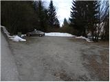
From the Ljubljana - Novo Mesto highway, we take the Ivančna Gorica exit, then follow the road in the direction of Stična. In Stična, at the intersection opposite the monastery, we continue slightly right and then drive in the direction of Pristava nad Stično. In the settlement Mekinje, we will notice signs for Lavričeva koča, which direct us to the right onto a somewhat narrower road. The road first ascends a little, then descends and brings us to a smaller intersection, where we continue right and then after a few meters park on the marked and nicely maintained parking lot.
Route description:
From the parking lot, we continue on the asphalt road in the direction of Lavričeva koča. The road, which immediately starts moderately ascending through a belt of forest, quickly brings us to the upper slope of Gradišče, from which a nice view opens up. Here the road turns to the left and after some ten steps of additional walking brings us to the summit of Gradišče. The mountain hut Lavričeva koča is situated only a few meters below the summit, in the middle of which stands the church of St. Miklavž.
Photos:
 1
1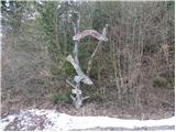 2
2 3
3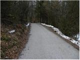 4
4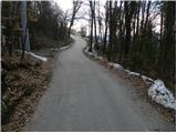 5
5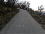 6
6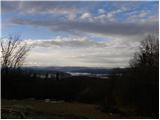 7
7 8
8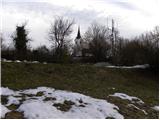 9
9 10
10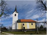 11
11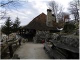 12
12
Discussion about the trip Mekinje nad Stično - Lavričeva koča on Gradišče
|
| Kokta17. 12. 2011 |
Highly recommend a visit.....the hut is really cozy 
|
|
|
|
| slavkoo15. 08. 2014 |
The hut is really something special...worth a visit, they also boast excellent grilled dishes and trout. On foot from Stična (parking at the bus station) along the forest road about 30 min., or further along the ascending road to the village of Mekinje, where there's a turn-off to the right and another 15 min. walk.
|
|
|
|
| Lori8. 08. 2015 |
Visited Lavričeva koča and it's really praiseworthy. Started from Vir village along forest paths, markings OK, hut really nicely renovated. There's also a very nicely arranged playground for children, several wooden sculptures, in short, there's something to see. Nice view of Ivančna Gorica.
Let me say it's much nicer than in the pictures here, because it's renovated. Worth a visit. :-)
|
|
|
|
| pbastic111. 11. 2018 |
VISITOR, you won't regret it, come!
|
|
|
To post a comment you must log in:
If you do not yet have a username, you must first
register.