Starting point: Mesnice (806 m)
| Latitude/Longitude: | 45,90660°N 14,43110°E |
| |
Walking time: 55 min
Difficulty: easy marked way
Elevation gain: 158 m
Elevation difference along the route: 158 m
Map: Ljubljana - okolica 1:50.000
Recommended equipment (summer):
Recommended equipment (winter):
Views: 3.183
 | 2 people like this post |
Access to starting point:
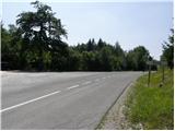
A) From the highway Ljubljana - Koper, we take the exit Brezovica, then continue driving in the direction of Podpeči (to Podpeči we can also come from Črna vas or Ig). In Podpeči, we continue in the direction of Borovnica, Krim and Rakitna, and continue driving for a short time along the edge of the Ljubljana Moor, then the signs for Rakitna direct us to the left onto a steep ascending road. The road then leads us through Preserje, where it also starts to descend. After a short descent, we continue left in the direction of Krim and Rakitna, and we follow the mostly ascending road to the crossroads, where the road towards Krim branches off to the left. At the crossroads, there is enough space where we can park.
B) First, we drive to Cerknica, then continue driving in the direction of Begunje; when we arrive in Begunje, we follow the signs for Rakitna. From Rakitna, we continue on the main road towards the settlement Preserje to the crossroads, where the road towards Krim branches off to the right. At the crossroads, there is enough space where we can park.
Route description:
From the starting point, we continue on a macadam road in the direction of Krim, to where it is 8 km by signs. The road from bushes quickly passes into the forest and ascends relatively gently, first on the slopes of the peak Reber (923 m), then also on the slopes of Županov vrh (999 m). After approximately half an hour of walking, we arrive at a longer left turn, where almost unnoticeably we cross the upper part of the forested Lepa dolina. From the mentioned turn along the road, beside which from the starting point we noticed only some old, partly already faded blazes, we arrive at a marked junction, where signs for Rakitna direct us to the right (straight ahead on the road to Krim) onto an ascending footpath that continues through the forest. After a short ascent, we step onto a rutted cart track and follow it to the right. Further on, a bit more caution is needed since it can quickly happen that a motocross rider comes towards us. There follow some smaller junctions, and we always follow the marked path towards Rakitna, but we walk along it only to the marked junction on the saddle between Rotovc (964 m) on the left and Županov vrh (999 m) on the right.
From the junction on the saddle, which is at 930 m, we continue left in the direction of the peak Rotovc. The path ahead leads us along the edge of the forest, from where occasionally a nice view opens towards Rakitna, Novaška gora, the ridge Avšnik and part of the Notranjsko hribovje. A moderately steep path, along which we also notice some boards of the educational path, brings us in 5 minutes of walking from the junction on the saddle to the summit, which has a small bench and a logbook box.

Photos:
 1
1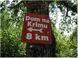 2
2 3
3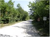 4
4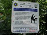 5
5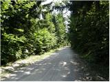 6
6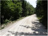 7
7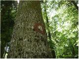 8
8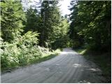 9
9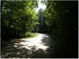 10
10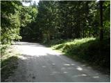 11
11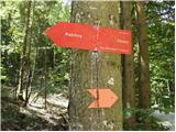 12
12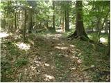 13
13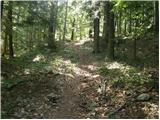 14
14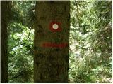 15
15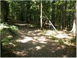 16
16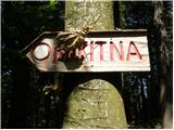 17
17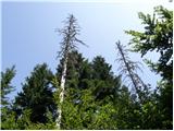 18
18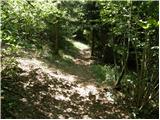 19
19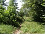 20
20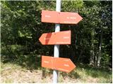 21
21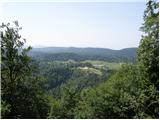 22
22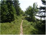 23
23 24
24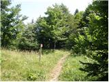 25
25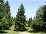 26
26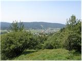 27
27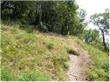 28
28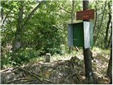 29
29
Discussion about the trip Mesnice - Rotovc
To post a comment you must log in:
If you do not yet have a username, you must first
register.