Starting point: Mišače (441 m)
| Latitude/Longitude: | 46,31494°N 14,21294°E |
| |
Walking time: 40 min
Difficulty: easy unmarked way
Elevation gain: 64 m
Elevation difference along the route: 115 m
Map: Karavanke - osrednji del 1:50.000
Recommended equipment (summer):
Recommended equipment (winter):
Views: 310
 | 1 person like this post |
Access to starting point:
From the road Podbrezje - Brezje, in the settlement Posavec we turn left (from the direction Brezje right) in the direction of the settlement Otoče. In Otoče we continue straight towards the settlement Mišače, where in the middle of the settlement at the chapel the described path begins. At the starting point there are no appropriate parking spots, therefore we can park a little earlier at an appropriate place by the road. This extends the path by 5 to 10 minutes.
Route description:
From the crossroad in the middle of the village Mišače we continue in the direction of Kropa and Srednja Dobrava and we start ascending on an asphalt road. Soon we notice a cross on the right, after which we go right into the forest on a footpath which moderately ascends and after a few minutes returns to the road. On the road towards Srednja Dobrava we walk a few more steps, and then we go right on a side road which brings us to the nearby house, and before the house and after the hayrack we go left on a cart track. The cart track ascends diagonally and soon becomes overgrown and flattens. There follows some traversing, and when we get closer to a meadow we go right, at first a little downwards, where in a smaller valley we cross an older cart track. We continue a short time longer on the path, and then we join another cart track. We continue right, where the cart track changes into a footpath, and when we temporarily leave the forest the footpath on the meadow somewhat disappears. On the other side of the meadow the footpath reappears and joins a wider path from Zgornja Dobrava.
Here too we continue right, and a gentle path brings us to a marked junction, where we continue in the direction of Zjavka (slightly right Ojstra peč 1 minute).
From the cart track on which we continue only a few steps further to the right a wider path branches off (path which leads further towards Pusti grad, Fux footbridge - path which bypasses Zjavka), and we continue on the cart track which continues with some shorter ascents and descents. After a few minutes the cart track splits, and we once again continue on the left cart track. The cart track a little further temporarily descends, and then ascends to panoramic Zjavka.
Description and pictures refer to the condition in September 2020 and March 2017.

Along the route: Ojstra peč (516m)
Photos:
 1
1 2
2 3
3 4
4 5
5 6
6 7
7 8
8 9
9 10
10 11
11 12
12 13
13 14
14 15
15 16
16 17
17 18
18 19
19 20
20 21
21 22
22 23
23 24
24 25
25 26
26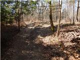 27
27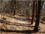 28
28 29
29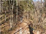 30
30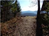 31
31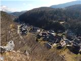 32
32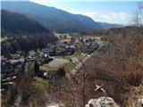 33
33
Discussion about the trip Mišače - Zjavka
To post a comment you must log in:
If you do not yet have a username, you must first
register.