Mojstrana - Risnati rob (Polevec)
Starting point: Mojstrana (670 m)
| Latitude/Longitude: | 46,45560°N 13,93570°E |
| |
Walking time: 2 h
Difficulty: easy pathless terrain
Elevation gain: 768 m
Elevation difference along the route: 768 m
Map: Kranjska Gora 1:30.000
Recommended equipment (summer):
Recommended equipment (winter): ice axe, crampons
Views: 1.120
 | 5 people like this post |
Access to starting point:
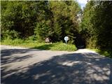
From the road Jesenice - Kranjska Gora we drive to Mojstrana, and then we follow the signs for Krma and Radovna. When Mojstrana ends, soon a macadam road branches off to the right towards the gorge Mlačca, and we park a little further at the tennis court.
We can also park lower in Mojstrana on a parking lot by the ski slope or somewhere else in an appropriate place, which makes our path a bit longer.
Route description:
From the starting point, we walk to the main road, and then we continue the ascent on the asphalt road. Soon after the sign, which marks the beginning of Triglav National Park, the red mountain signposts direct us left onto a cart track in the direction of Jerebikovec. The cart track, on which we continue, quickly changes into a steep footpath that leads us along an indistinct valley to a viewpoint with a bench, where an unmarked and even steeper small path joins from the left, leading across the slope Na tnalu.
From the bench, from which a beautiful view opens up in the direction of Kepa and its neighboring peaks, we continue on the marked path, which then steeply ascends the northwestern slopes of Mežakla. Higher up, the slope beside the path also becomes quite steep, so especially when wet there is a risk of slipping in a few places. We ascend steeply to an elevation of approximately 1300 meters, then the path flattens and brings us to the edge of the Mežakla plateau, where at the NOB monument we leave the marked path.
Behind the monument we go right off-path, where we quickly reach the ridge of Velika stena. Along the ridge we first ascend steeply, higher it flattens and we continue for a while along an older cart track. We continue to follow the ridge, where from occasional shoulders a nice view opens up on the Julian Alps. Risnati rob or Polevec we reach after a few minutes of further walking, and we recognize it by the marked stone.
Description and pictures refer to the condition in July 2020.

Photos:
 1
1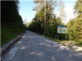 2
2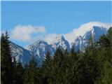 3
3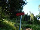 4
4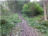 5
5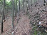 6
6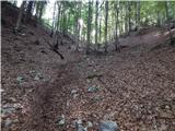 7
7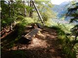 8
8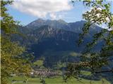 9
9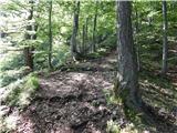 10
10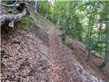 11
11 12
12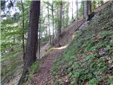 13
13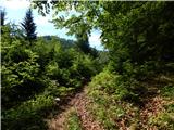 14
14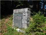 15
15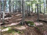 16
16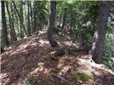 17
17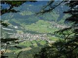 18
18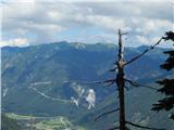 19
19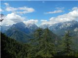 20
20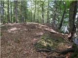 21
21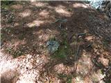 22
22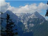 23
23
Discussion about the trip Mojstrana - Risnati rob (Polevec)
|
| Jusk30. 07. 2020 |
Interesting, need to check it Thanks for the description Best regards Thanks for the description Best regards
|
|
|
To post a comment you must log in:
If you do not yet have a username, you must first
register.