Molnarjev breg - Kamniški vrh (via planina Osredek)
Starting point: Molnarjev breg (1200 m)
| Latitude/Longitude: | 46,28030°N 14,53590°E |
| |
Route name: via planina Osredek
Walking time: 1 h 30 min
Difficulty: easy marked way
Elevation gain: 59 m
Elevation difference along the route: 240 m
Map: Kamniške in Savinjske Alpe 1:50.000
Recommended equipment (summer):
Recommended equipment (winter): ice axe, crampons
Views: 18.520
 | 2 people like this post |
Access to starting point:
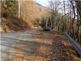
A) From the Ljubljana–Jesenice highway, take the Vodice exit, then continue driving to the first traffic-light intersection in Vodice, where continue left towards Cerklje na Gorenjskem and Brnik. When you arrive at the main roundabout in Spodnji Brnik, continue driving towards Cerklje and Krvavec ski slope. At the end of the settlement Cerklje na Gorenjskem, leave the main road which continues towards Velesovo and Visoko, and continue slightly right onto the road towards the Krvavec ski slope. Further on, arrive at the village Grad, where signs for the settlement Ambrož pod Krvavcem direct you right onto a steep asphalt road (straight: bottom station of the cable car to Krvavec and Štefanja Gora). When the steepness on the steep road decreases somewhat, you will arrive at an intersection, where continue left towards the settlement Ambrož pod Krvavcem (straight: settlements Ravne, Apno and Šenturška Gora). A little further, the road temporarily descends somewhat, then ascends through occasionally quite panoramic slopes. Higher up, arrive at Ambrož pod Krvavcem, where you bypass the church of St. Ambrož and tourist farm Pr Ambružarju on the left side. From the tourist farm onwards, the road enters the forest and relatively steeply ascends diagonally. When you arrive at the left hairpin bend, you are at the starting point, where park in a suitable place next to the smaller intersection.
B) From the Jesenice–Ljubljana highway, take the Kranj–east exit, then continue driving towards Brnik, Komenda and Mengeš. When you arrive at the main roundabout in Spodnji Brnik, continue driving towards Cerklje and Krvavec ski slope. At the end of the settlement Cerklje na Gorenjskem, leave the main road which continues towards Velesovo and Visoko, and continue slightly right onto the road towards the Krvavec ski slope. Further on, arrive at the village Grad, where signs for the settlement Ambrož pod Krvavcem direct you right onto a steep asphalt road (straight: bottom station of the cable car to Krvavec and Štefanja Gora). When the steepness on the steep road decreases somewhat, you will arrive at an intersection, where continue left towards the settlement Ambrož pod Krvavcem (straight: settlements Ravne, Apno and Šenturška Gora). A little further, the road temporarily descends somewhat, then ascends through occasionally quite panoramic slopes. Higher up, arrive at Ambrož pod Krvavcem, where you bypass the church of St. Ambrož and tourist farm Pr Ambružarju on the left side. From the tourist farm onwards, the road enters the forest and relatively steeply ascends diagonally. When you arrive at the left hairpin bend, you are at the starting point, where park in a suitable place next to the smaller intersection.
Route description:
From the starting point, head onto the forest road that crosses the slopes of Molnarjev breg. Ascend slightly along the road, then arrive at a smaller junction, where continue slightly left along the upper road (the lower road or cart track soon ends), beside which you also notice the blazes. There follow a few minutes of diagonal ascent along the road, from which we occasionally get some views. A little further, the road splits again, and once more choose the left upper road, from which just a few dozen steps further a steep cart track branches off to the left. Continue along the road to the right bend.
From the bend, continue straight onto the marked footpath, which continues diagonally through the forest. In the forest, quickly arrive at a marked junction, where continue right downwards towards mountain pasture Osredek and Kamniški vrh (the upper path leads to Kamniški vrh and bypasses mountain pasture Osredek; it is also possible to continue towards Kriška planina). There follows a somewhat steeper descent, then cross the road that was recently left and continue descending. Lower in the forest, the path turns left and levels out. There follow a few minutes of traversing, then arrive from the forest onto mountain pasture Osredek, where a few wooden huts stand.
From the huts on the mountain pasture, continue eastwards, soon arriving at the eastern edge of the mountain pasture, where from the right a marked path from the village Slevo and an unmarked path leading past the Korošaški slapovi join.
Continue into the forest and begin ascending across initially quite steep slopes. Higher, reach the ridge, where from the left the path bypassing mountain pasture Osredek joins.
Continue right (left: our starting point and Kriška planina) along the path running along the northern side of the ridge. After a short traverse, where the path approaches the ridge completely, an unmarked path to Planjava branches off slightly right; continue along the left, northern side of the ridge. There follows traversing the steeper northern slope of Planjava; then, once east of Planjava, return to the ridge. Upon reaching the ridge, descend slightly further east, then arrive at a marked junction, where join the visibly more trodden path from Stahovica and Županje Njive.
Here continue straight and begin steeply ascending the panoramic western ridge of Kamniški vrh. After approximately 10 minutes of ascent, reach Kamniški vrh; if continuing another minute, also arrive at the bivouac on Kamniški vrh.

Photos:
 1
1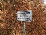 2
2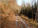 3
3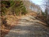 4
4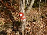 5
5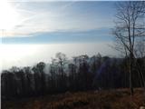 6
6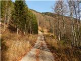 7
7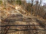 8
8 9
9 10
10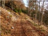 11
11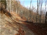 12
12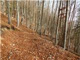 13
13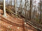 14
14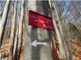 15
15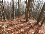 16
16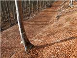 17
17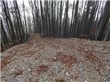 18
18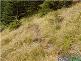 19
19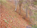 20
20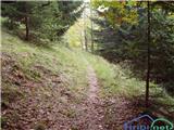 21
21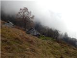 22
22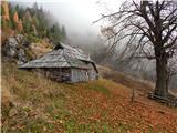 23
23 24
24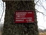 25
25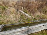 26
26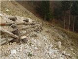 27
27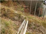 28
28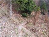 29
29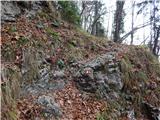 30
30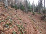 31
31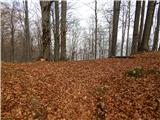 32
32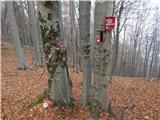 33
33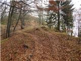 34
34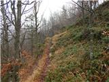 35
35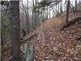 36
36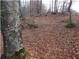 37
37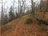 38
38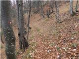 39
39 40
40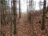 41
41 42
42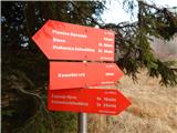 43
43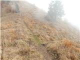 44
44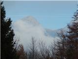 45
45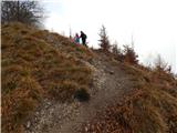 46
46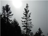 47
47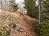 48
48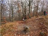 49
49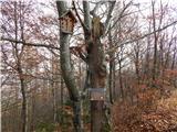 50
50 51
51
Discussion about the trip Molnarjev breg - Kamniški vrh (via planina Osredek)
|
| iUnknown28. 11. 2015 |
Just a note that the situation on how to get to planina Osredek is now a bit more complicated than before 2014, because due to clearing fallen trees from February 2014 they made a lot of new forest roads, on which tractors drive, so sometimes it's somewhat pointless to stick to the marked path, since there are fallen trees across it, while the new forest roads take you even more directly to the goal. Unfortunately I haven't checked all roads, otherwise I would have drawn them on the OpenStreetMap map.
|
|
|
|
| NinaSi13. 07. 2019 |
To Kamniški vrh via planina Osredek I went a few days ago. On some sections the trail is poorly marked (no markers or they are poorly visible), the part below the summit (before reaching the epic bench, which is also marked on Google maps), is completely unmarked. Otherwise, the trip was very nice and peaceful (the trail is little frequented, so I didn't meet any other hikers). Definitely recommend  , but of course be careful, GPS is also useful. , but of course be careful, GPS is also useful.
|
|
|
To post a comment you must log in:
If you do not yet have a username, you must first
register.