Starting point: Moravče (379 m)
| Latitude/Longitude: | 46,13570°N 14,74460°E |
| |
Walking time: 1 h 15 min
Difficulty: easy marked way
Elevation gain: 319 m
Elevation difference along the route: 330 m
Map: Ljubljana - okolica 1:50.000
Recommended equipment (summer):
Recommended equipment (winter): crampons
Views: 927
 | 5 people like this post |
Access to starting point:
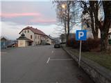
A) From the Ljubljana–Maribor highway, take the Krtina exit, then continue driving towards Moravče. In Moravče, continue right and park on the marked parking lot near the parish church.
B) From the Zasavje direction, first drive to Izlake, then continue driving towards Moravče. In Moravče, at the intersection near the church where the main road turns right, continue straight and park on the marked parking lot near the parish church.
Route description:
From the center of Moravče we continue along the main road which leads towards Izlake. Initially we walk on a sidewalk, somewhat beyond the Nissan Krulc company, we go slightly right onto the road in the direction of the settlements Ribče and Dešen and mountain hut Planinski dom Ušte - Žerenk. The path ahead starts ascending on a somewhat narrower asphalt road, from which a nice view opens towards Limbarska gora when looking back, and with good visibility the views reach to the highest peaks of the Kamnik-Savinja Alps. Soon after Moravče ends, we arrive at hamlet Podbrdo, where we leave the asphalt road and continue left in the direction of the mountain hut and sv. Miklavž.
Behind the houses, which we bypass on the left side, the path goes into the forest and starts ascending somewhat more, quite quickly also splitting.
We choose the left path (right sv. Miklavž), which ascends transversely towards the left, higher widening into a newer cart track. We ascend the mentioned cart track for a few minutes, then again on a mountain path, which higher crosses the macadam road, some ten steps higher reaching the asphalt road, which we follow to the left. We walk along the road to a smaller saddle, where the marked path towards the mountain hut Planinski dom Ušte - Žerenk turns left through a meadow, while we continue right on a cart track, which through the meadow quickly enters the forest. There follow a few minutes of light to moderate ascent through the forest and we arrive at the top of Gorišca, where a transmission tower stands.
Description and pictures refer to the condition in the year 2018 (December).

Photos:
 1
1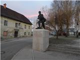 2
2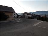 3
3 4
4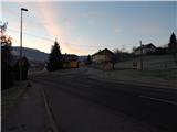 5
5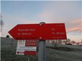 6
6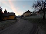 7
7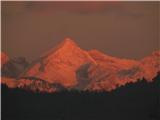 8
8 9
9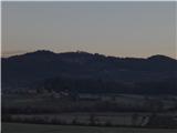 10
10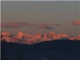 11
11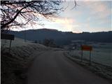 12
12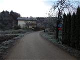 13
13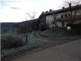 14
14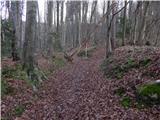 15
15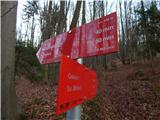 16
16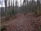 17
17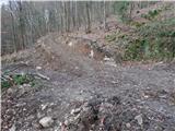 18
18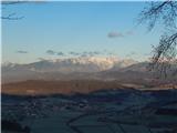 19
19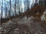 20
20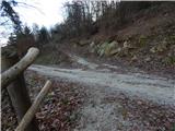 21
21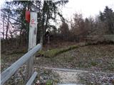 22
22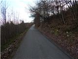 23
23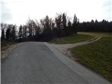 24
24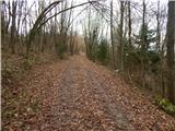 25
25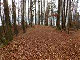 26
26 27
27
Discussion about the trip Moravče - Gorišca
|
| romankolar4. 09. 2022 09:47:59 |
Current status: after the steep ascent the "gravel" path from picture 21 is now asphalted, it misled us yesterday with my girlfriend... At this point you have to cross the asphalted road and higher up at the second road turn left.
There are very few markers on the path, especially at junctions, you have to rely on the ground and continue where it looks trodden. The sign for Sv. Miklavž/Mountain hut at the beginning of the path in the forest (picture 16) has also miraculously disappeared  . .
|
|
|
To post a comment you must log in:
If you do not yet have a username, you must first
register.