Starting point: Moravče (379 m)
| Latitude/Longitude: | 46,13540°N 14,74350°E |
| |
Walking time: 20 min
Difficulty: easy unmarked way
Elevation gain: 9 m
Elevation difference along the route: 35 m
Map: Ljubljana - okolica 1:50.000
Recommended equipment (summer):
Recommended equipment (winter):
Views: 1.640
 | 3 people like this post |
Access to starting point:
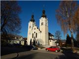
A) From the Ljubljana–Maribor highway take the Krtina exit, then continue driving in the direction of Moravče. In Moravče, behind the church, we turn right and then park on the parking lot near the church.
B) From the Zasavje direction we first drive to Izlake, from there we continue driving towards Moravče. In Moravče, at the crossroads near the church, we continue straight and then park on the parking lot near the church.
Route description:
From the church, we return to the main road, then at the crossroads we continue right onto the road along which there are signs for the cycling path L042. The path ahead leads us past a few more houses, then the asphalt ends and the road descends into a smaller valley where we cross the stream Rudniška Rača. Behind the nearby wooden cross we arrive at a smaller crossroads, where we continue straight on the steeper road, which ascends through a belt of forest. When the forest on the left side ends, the road flattens, and only about a minute's walk separates us from the small church of Our Lady of Sorrows, which is located on the Hribce hill.
The description and pictures refer to the condition in 2015 (November).
Photos:
 1
1 2
2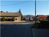 3
3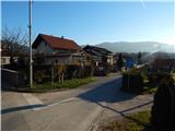 4
4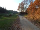 5
5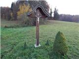 6
6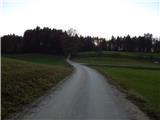 7
7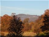 8
8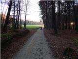 9
9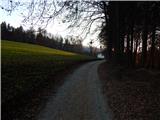 10
10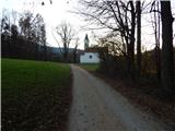 11
11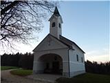 12
12 13
13
Discussion about the trip Moravče - Hribce
To post a comment you must log in:
If you do not yet have a username, you must first
register.