Most Boka - Boka waterfall (to viewpoint)
Starting point: Most Boka (400 m)
| Latitude/Longitude: | 46,31830°N 13,49480°E |
| |
Route name: to viewpoint
Walking time: 40 min
Difficulty: easy marked way
Elevation gain: 280 m
Elevation difference along the route: 300 m
Map: Julijske Alpe - zahodni del 1:50.000
Recommended equipment (summer):
Recommended equipment (winter): ice axe, crampons
Views: 47.926
 | 2 people like this post |
Access to starting point:
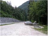
From Bovec, we drive towards Kobarid or vice versa. Before the Boka Bridge (from the direction of Kobarid, after the bridge), there is a parking lot where we park.
Route description:
From the starting point, we first walk to the bridge, from which a nice view opens up on the Boka waterfall. We continue to the other side of the bridge, and from there right on a wide path in the direction of Boka. We follow the wide path only a few steps, and then signs for the Boka vantage point direct us to the left on a gradually steeper footpath. The path first ascends through the forest, and after approximately 20 minutes brings us to the edge of a panoramic and in parts precipitous ridge. We continue the ascent mostly along the left side of the ridge quite steeply upwards. Higher, the path withdraws from the ridge to the left and continues through a thin forest. A few minutes higher the path again approaches the ridge and brings us to a junction, where we continue right in the direction of the Boka viewpoint. From the junction in a few steps we reach the mentioned viewpoint, from which a nice view opens up on the Boka waterfall.
Photos:
 1
1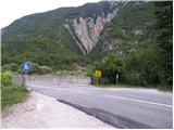 2
2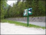 3
3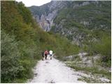 4
4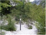 5
5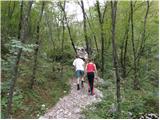 6
6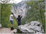 7
7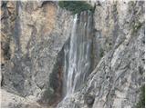 8
8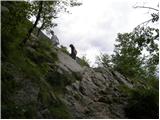 9
9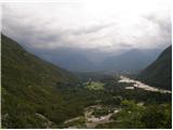 10
10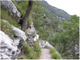 11
11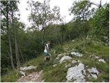 12
12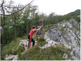 13
13 14
14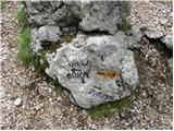 15
15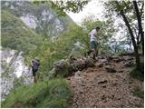 16
16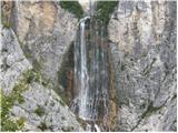 17
17
Discussion about the trip Most Boka - Boka waterfall (to viewpoint)
|
| VanSims10. 05. 2010 |
You have to watch not to miss that stone 'View Boka - Parking' otherwise the path continues up (who knows where). You have to look right below from the moment the path starts along the ridge.
|
|
|
|
| ljubitelj gora23. 02. 2014 |
Visited Slap Boka up to that viewpoint, picture 15 is also the end of the viewpoint, further on the trail probably already leads to Pl. Baban, where there are various options. Before visiting the waterfall I was on Matajur and Kolovrat.
|
|
|
|
| Stane76. 04. 2016 |
The path continues to a small abandoned alpine pasture, where it turns right and leads exactly above the Boka Waterfall and nowhere else. About half an hour and a bit more demanding than to the viewpoint.
|
|
|
To post a comment you must log in:
If you do not yet have a username, you must first
register.