Motvarjevci - Gravel pit Kobilje
Starting point: Motvarjevci (202 m)
| Latitude/Longitude: | 46,70764°N 16,34620°E |
| |
Walking time: 30 min
Difficulty: easy marked way
Elevation gain: -7 m
Elevation difference along the route: 3 m
Map: Pomurje 1:40.000
Recommended equipment (summer):
Recommended equipment (winter):
Views: 94
 | 1 person like this post |
Access to starting point:
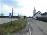
a) We drive to Bogojina, where from the roundabout we turn onto the road towards Bukovnica and Motvarjevci, following the mentioned directions also at subsequent intersections. When we arrive in Bukovnica we first go right, then left towards Motvarjevci. Upon arriving in Motvarjevci we turn left and park at one of the parking areas in the settlement, preferably at the marked parking lot between the Reformed Christian Church of Slovenia and the Sports Association Motvarjevci.
b) From Prosenjakovci we drive towards Kobilje, or vice versa, but only to the settlement of Motvarjevci, where the described path begins next to the Reformed Christian Church of Slovenia, and there we also park at the marked parking lot.
Route description:
From the starting point we first continue along the main road towards Kobilje, after the bus stop we arrive at a marked intersection, from which we head straight onto the side road, along which there are signs for the hiking trail to Kobilje, Alvarium and Voglerjeva koča (left main road towards Kobilje, right road signs for Bukovniško jezero and Bukovnica, i.e. the road by which we arrived at the starting point according to description a).
We continue past a few houses and the Alvarium museum, then arrive at an intersection where the path to Voglerjeva koča branches off to the right.
We continue straight towards Kobilje, where the path is still accompanied by occasional yellow-white markers. Before the last houses in the settlement of Motvarjevci we cross Kobiljski potok, then mainly through fields we continue all the way to Gramoznica Kobilje, which we notice on the left side of the path.
Description and photos refer to the status in February 2026.

Along the route: Alvarium / Alvárium (202m)
Photos:
 1
1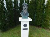 2
2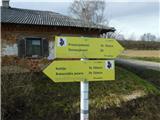 3
3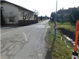 4
4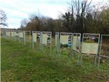 5
5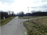 6
6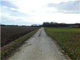 7
7 8
8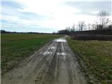 9
9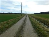 10
10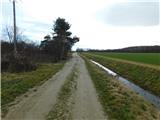 11
11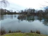 12
12
Discussion about the trip Motvarjevci - Gravel pit Kobilje
To post a comment you must log in:
If you do not yet have a username, you must first
register.